Andhra Pradesh, Beyond the Coast
Eastern Ghats, temple towns, working ports, rice deltas and the dry landscapes of Rayalaseema.
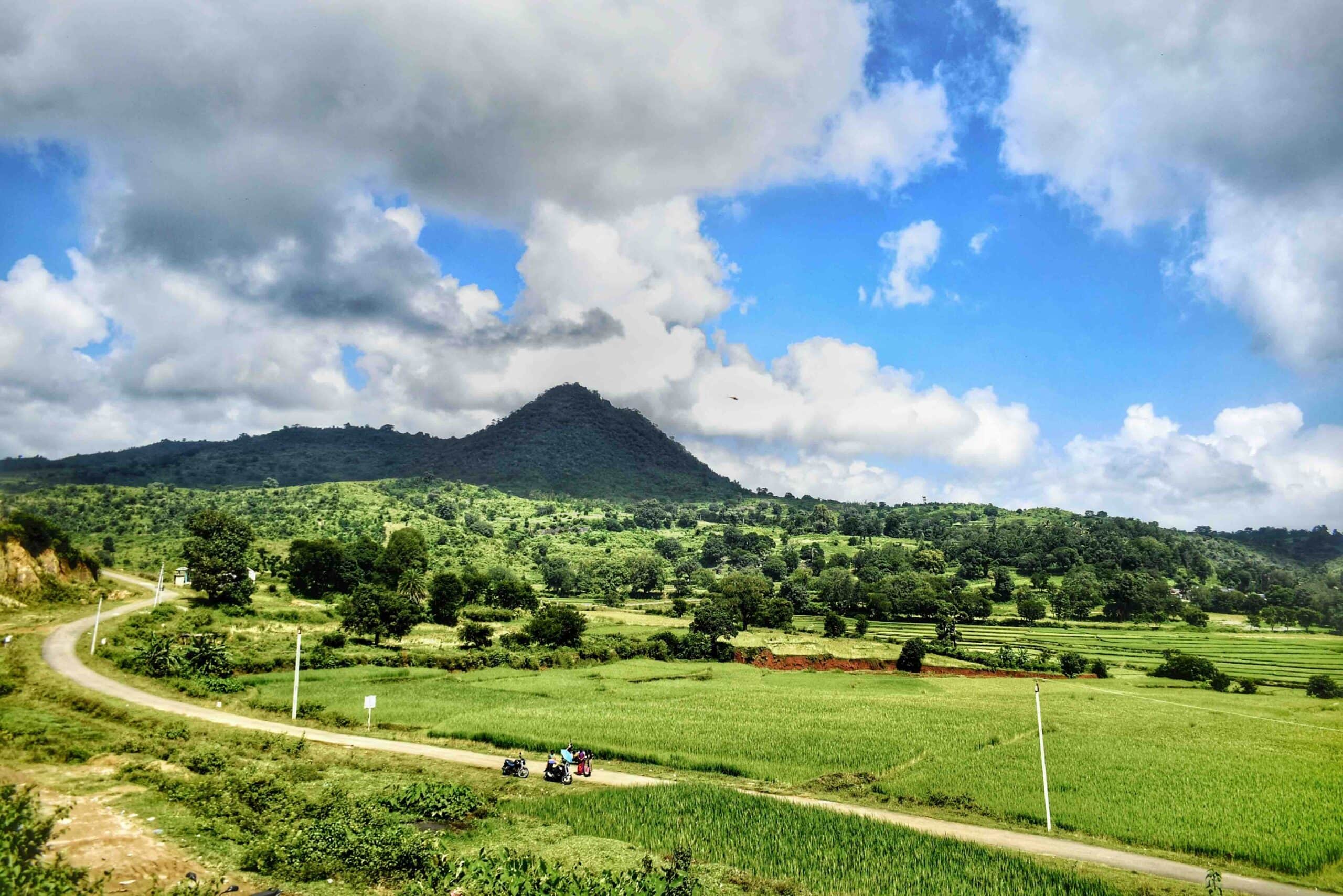

Andhra Pradesh is easy to reduce to a handful of famous names: Tirupati, Visakhapatnam, perhaps the Krishna and Godavari rivers. But this long state on India’s eastern coast is far more varied than that shortlist suggests.
In the northeast, the Eastern Ghats rise above coffee-growing hills and forest communities. Farther south, the Godavari spreads across an extraordinary delta of rice fields, canals and coconut groves. Port cities, fishing harbours, industrial corridors and market towns share the coast. Inland, Rayalaseema has its own geography of rocky hills, dryland farms, pilgrimage towns and historic forts.
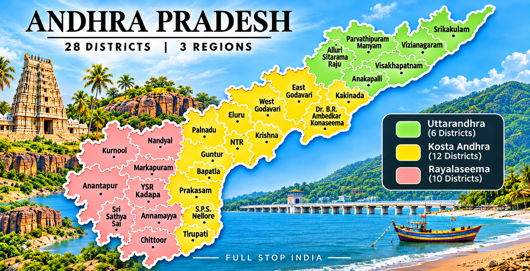
Across its 28 districts, three broad regions provide a useful way to understand those differences: Uttaraandhra in the north, Kostaandhra along the coast and its interior, and Rayalaseema in the southwest. Each district has its own story beyond the usual sightseeing stops.
History & identity
A state with several landscapes and histories
Telugu language and culture connect much of Andhra Pradesh, but the state’s coastal and inland regions have distinct histories and economies. The Satavahanas, Eastern Chalukyas, Vijayanagara rulers and later regional powers all left traces in architecture, literature and local traditions. The modern state took its present form after Telangana became a separate state in 2014.
Vijayawada and the Amaravati capital region, Visakhapatnam’s port economy and Tirupati’s pilgrimage network each represent a different center of activity. No single city tells the whole story.
The districts
Three regions. Twenty-eight districts.
Andhra Pradesh is traditionally understood through Uttaraandhra (North Andhra), Kostaandhra (Coastal Andhra) and Rayalaseema. We follow that north-to-south regional framework below, with individual district portraits exploring the places, industries, farming and communities that give each area its identity.
Region 01 / Uttaraandhra · North Andhra
Where the Eastern Ghats meet the Bay of Bengal
North Andhra runs from the forested uplands of the Eastern Ghats to the northern shoreline. Coffee-growing hill communities, rice-growing plains, fishing harbours, temple towns and the working port of Visakhapatnam give Uttaraandhra a character distinct from the rest of the state.
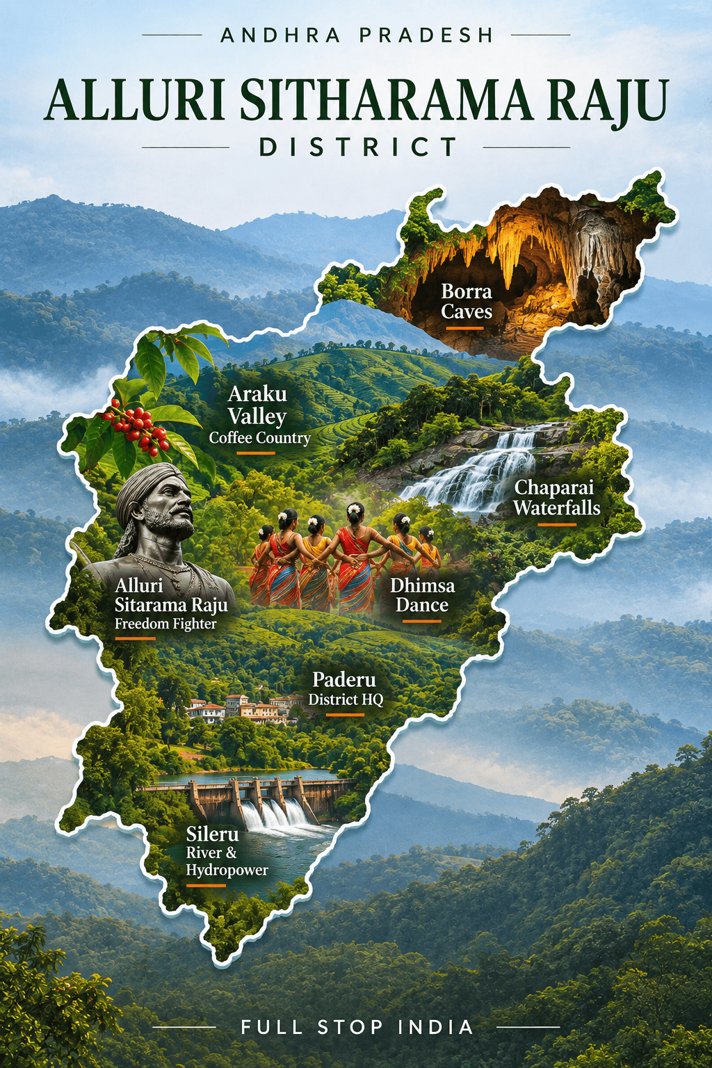
01 / Alluri Sitharama Raju District
Forested highlands and coffee country
The Eastern Ghats give this district a character quite unlike Andhra Pradesh’s coastal plains. Around Araku and Paderu, coffee grows on cool slopes, and weekly markets bring together farmers and forest communities whose livelihoods depend on the hills. Tribal cultures, languages and food traditions are central to the region, not decorative additions to a scenic landscape.
Coffee cultivation, pepper, horticulture and small-scale trade coexist with difficult questions about roads, land and access to services. The winding railway toward Araku is among the region’s memorable journeys, although the district’s remote interior takes considerably longer to explore. The Sileru hydroelectric system adds another dimension to the working landscape. Administrative boundaries changed in late 2025, when the Rampachodavaram and Chinturu areas were separated into Polavaram district.
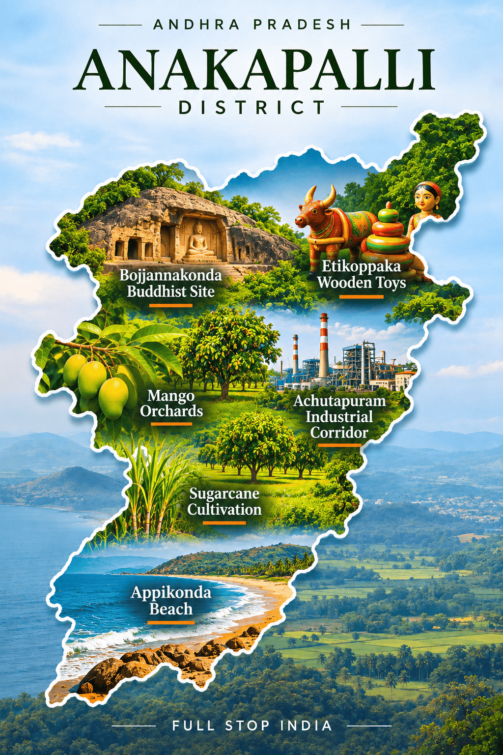
02 / Anakapalli District
Jaggery markets and a changing industrial coast
Anakapalli’s identity has long been tied to sugarcane. Its jaggery trade connects farms, processing yards and wholesale buyers in a district where agriculture remains visible even as industry advances along the coast. The Nookambika temple draws local devotees, while fishing settlements near Pudimadaka follow the rhythms of the Bay of Bengal. Around Atchutapuram, industrial parks and manufacturing have brought a different pace of development, along with employment and pressure on surrounding villages.
Inland, the land rises toward the Eastern Ghats and the cooler Lambasingi area. Visakhapatnam’s airport and major railway stations are the most practical gateways for many visitors.
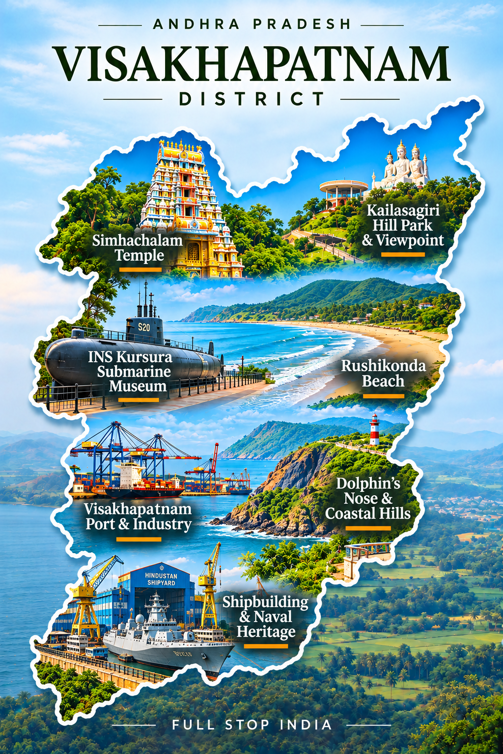
03 / Visakhapatnam District
A port city between hills and the sea
Visakhapatnam is not simply a beach city. It is one of India’s great working maritime centers, where commercial shipping, naval installations, shipbuilding and steel production have helped shape the urban skyline. Hills descend toward the Bay of Bengal, and the contrast between waterfront promenades and industrial docks is part of the city’s identity.
Simhachalam’s temple draws worshippers into a much older landscape, while universities, hospitals and technology businesses serve a growing metropolitan population. Fishing communities, seafood markets and busy residential neighborhoods keep the city grounded in everyday coastal life. Major gateway: Visakhapatnam Airport (VTZ) offers scheduled domestic flights, while Visakhapatnam Junction (VSKP) is a major railway station with long-distance connections.
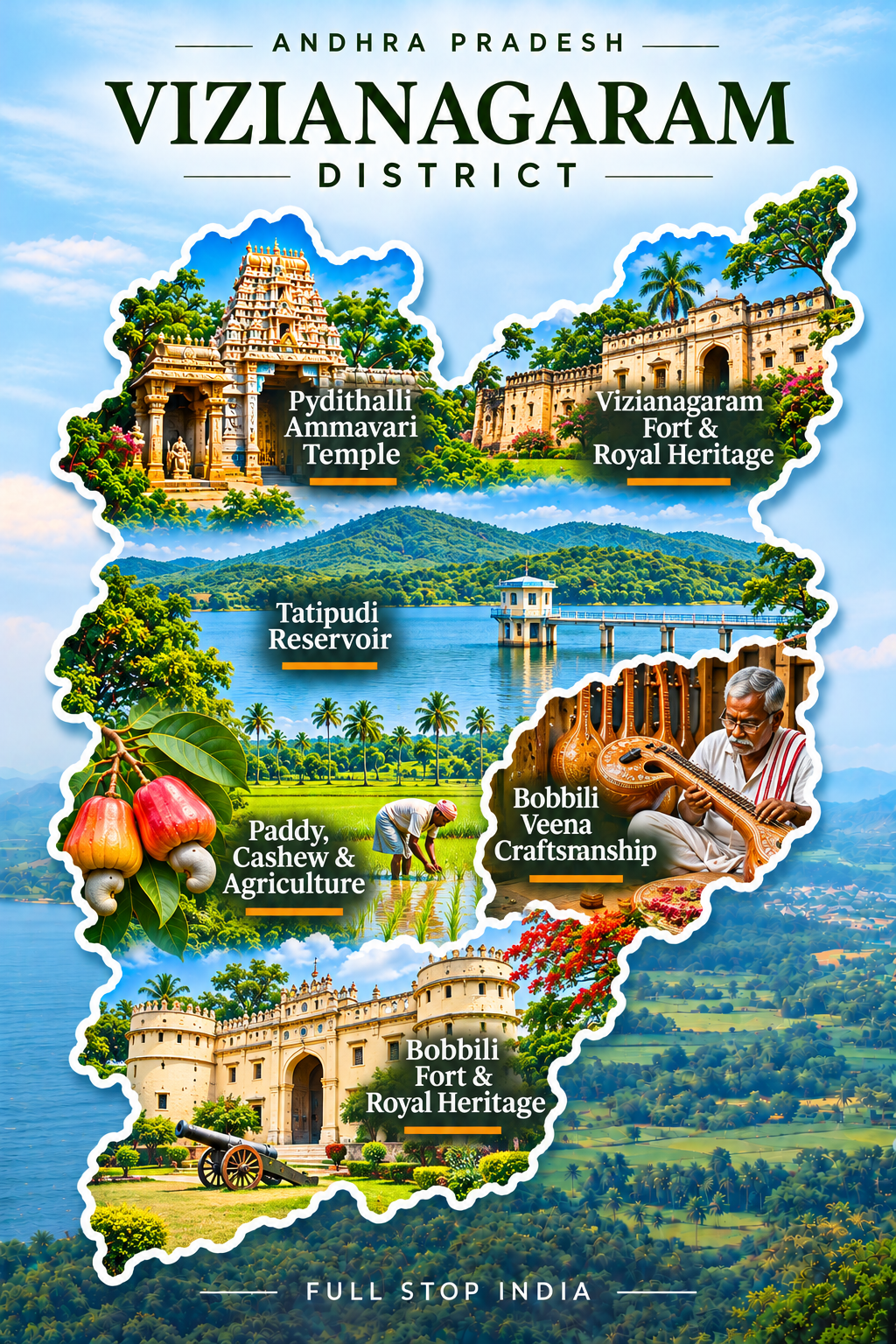
04 / Vizianagaram District
Royal heritage, music and market towns
Vizianagaram carries traces of princely patronage in its buildings, institutions and cultural memory. The town’s history is intertwined with music and education, and Bobbili is particularly associated with the making of veenas and a distinctive musical heritage. Beyond the urban centers, paddy cultivation, horticulture and local trading networks support a largely agricultural district.
The district sits between the coast and the northern uplands, making it a transition between different landscapes and livelihoods. Rail gateway: Vizianagaram Junction (VZM) is an important junction on routes linking the northern Andhra coast with Odisha and inland destinations; Visakhapatnam is the nearest major aviation hub.
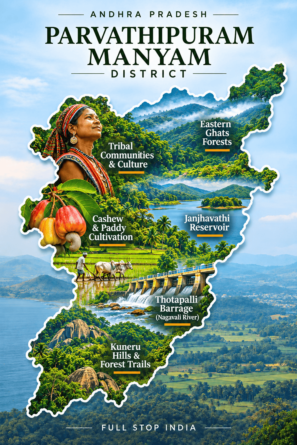
05 / Parvathipuram Manyam District
Hill communities and forest agriculture
Parvathipuram Manyam is shaped by wooded hills, scattered settlements and the complicated relationship between forest resources and village economies. Indigenous communities maintain distinct languages, foodways and cultural practices, while agriculture, horticulture and seasonal forest produce provide livelihoods. Roads, schools, healthcare and market access matter enormously in a district where distances can be deceptive.
The town of Parvathipuram serves as an administrative and trading center for the surrounding countryside. The balance between forest livelihoods and modern development continues to shape village life.Parvathipuram railway station provides regional connections; Visakhapatnam is the principal major airport serving the wider area.
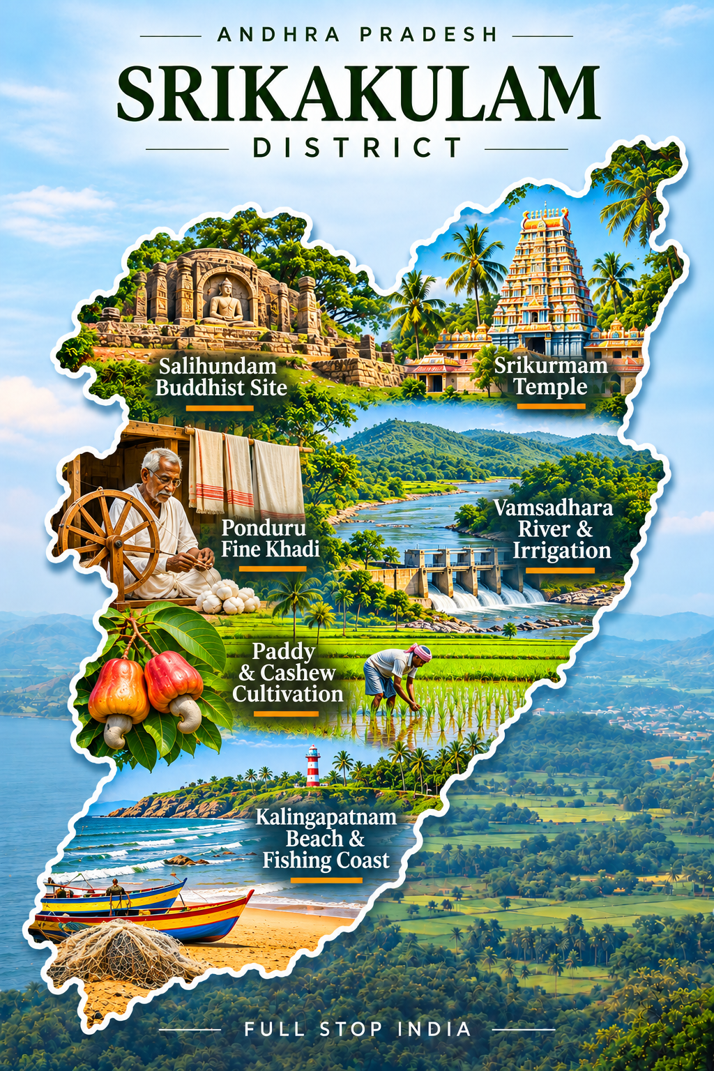
06 / Srikakulam District
Temples, rivers and the northern coast
Two rivers, the Vamsadhara and Nagavali, help explain Srikakulam’s agricultural character. Paddy fields, cashew cultivation, fishing settlements and market towns stretch from inland river valleys toward the Bay of Bengal. Arasavalli’s Sun Temple and Srikurmam’s temple traditions make the district important to pilgrims, but everyday life is equally tied to harvests, coastal trade and the movement of people between Andhra Pradesh and neighboring Odisha.
The northern location gives Srikakulam a distinctive cultural and linguistic borderland character. Srikakulam Road (CHE) is an important railway access point, while Visakhapatnam provides the nearest major airport.
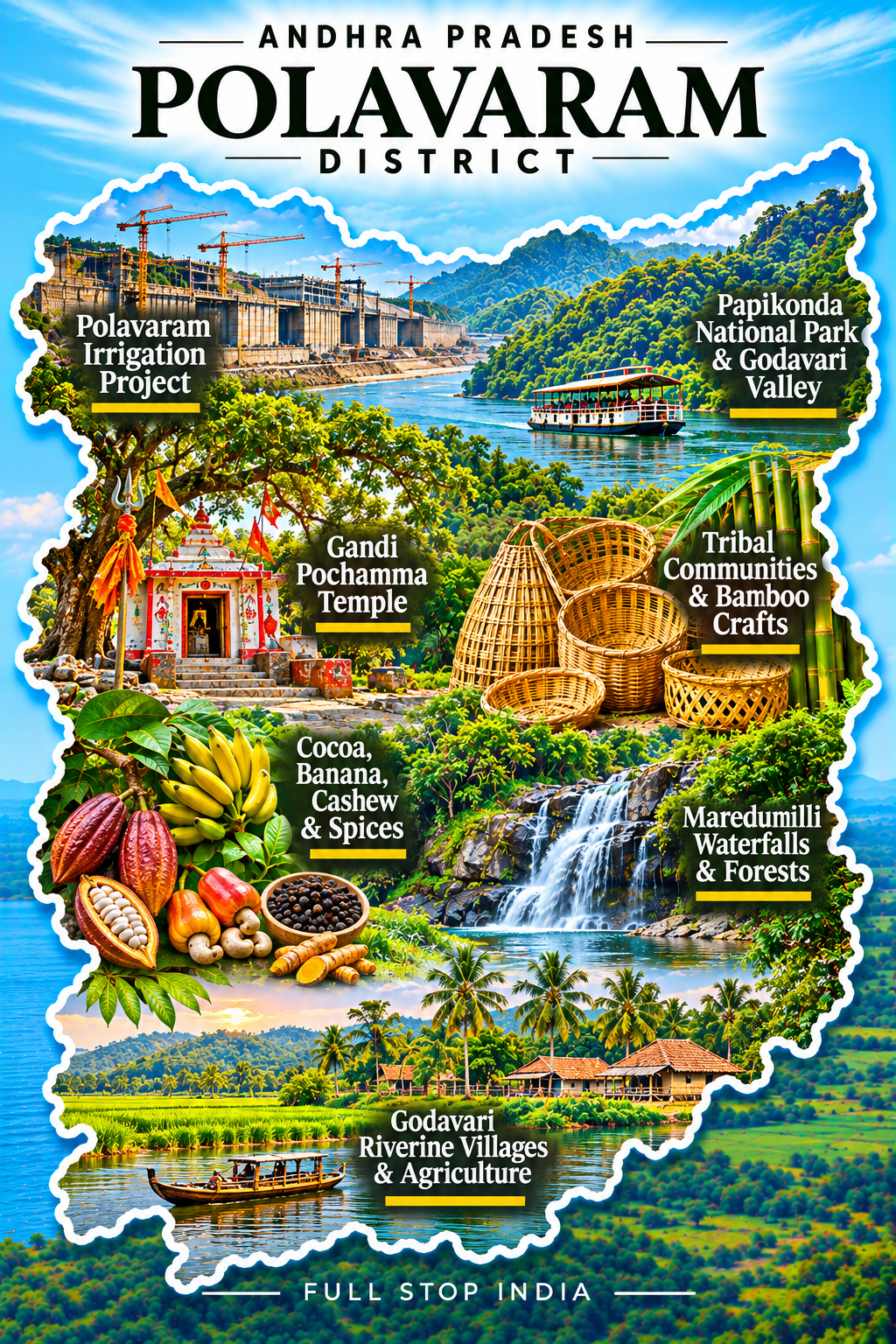
Polavaram District · Established 2025
Forest villages, the Godavari and a changing landscape
Polavaram is one of Andhra Pradesh’s newest districts, created in the December 2025 reorganization from areas formerly administered within Alluri Sitharama Raju. Its headquarters at Rampachodavaram anchors a broad landscape of forest villages, hills and the Godavari river system. Indigenous communities, small-scale farming and forest-dependent livelihoods are fundamental to understanding this region.
So is the Polavaram irrigation project, whose ambitions for water management and agriculture are inseparable from questions of displacement, rehabilitation and environmental change. Road access and travel conditions vary across its remote interior.
Region 02 / Kostaandhra · Coastal Andhra
River deltas, trading cities and the working coast
Coastal Andhra stretches through the Godavari and Krishna river systems and south along the Bay of Bengal, with a hinterland of market towns, farmland and stone-working districts. Rice, aquaculture, shipping, textiles, chilli trading and the growing Amaravati capital region shape life here.
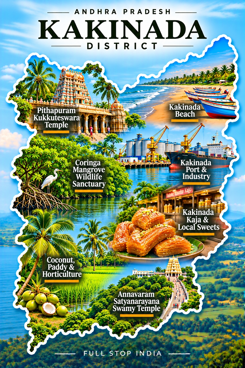
07 / Kakinada District
Port trade and a productive coast
Kakinada looks out toward the Bay of Bengal, but its relationship with the sea is commercial as much as scenic. Port activity, seafood processing, fertilizer production, edible-oil businesses and energy-related industries support a busy coastal economy. Fishing boats and mangrove environments coexist with warehouses, factories and expanding neighborhoods. Inland, paddy fields and agricultural markets connect the city to the productive Godavari region.
The Coringa mangroves are an important ecological counterpoint to the industrial shoreline, while older streets and food traditions reveal the character of a long-established trading town. Rail gateway: Kakinada Town (CCT) and Kakinada Port (COA) serve the city; Rajahmundry Airport (RJA) is a useful regional air connection.
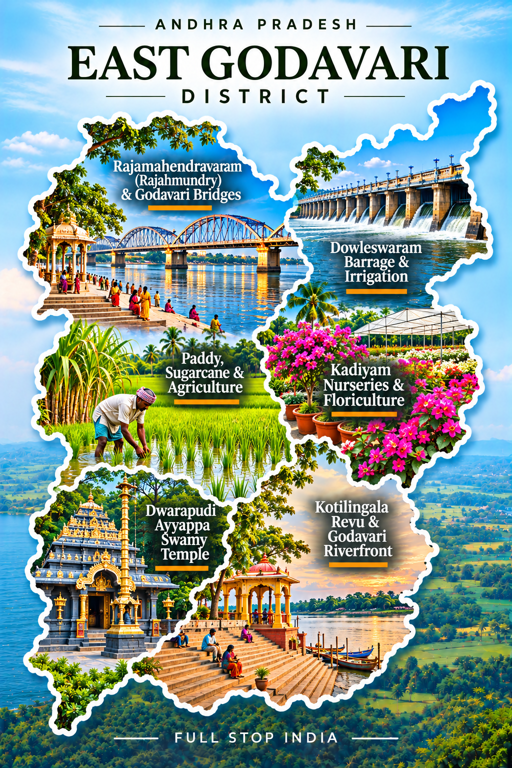
08 / East Godavari District
Rajamahendravaram and the river
Rajamahendravaram, often called Rajahmundry, gives East Godavari one of Andhra Pradesh’s strongest cultural identities. The Godavari runs broad beneath the city’s bridges, linking its riverfront to trade, religious life and a long tradition of Telugu literature. Pilgrims, students, traders and farmers all contribute to the city’s rhythm.
Beyond the urban center, irrigated agriculture and food businesses connect the district to the wider delta economy. Major transport links: Rajahmundry Airport (RJA) provides domestic air services, and Rajahmundry railway station (RJY) is an important stop on the east-coast rail corridor.
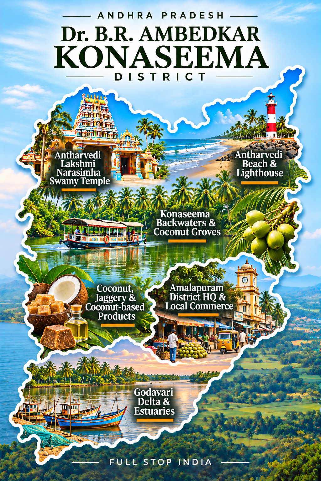
09 / Konaseema District
Coconut groves and delta waterways
Konaseema is a river-made landscape. Coconut palms lean over canals, paddy fields spread across low ground, and fishing and aquaculture are woven into village life. Boats, bridges and embankments are practical necessities in a region whose geography has long shaped the movement of people and produce. Coconut processing, rice cultivation and seafood businesses support the local economy, while temple towns and family-run markets preserve a quieter cultural texture.
Road connections through Amalapuram and surrounding towns are essential; Rajahmundry Airport and the larger railway stations beyond the district are common gateways.
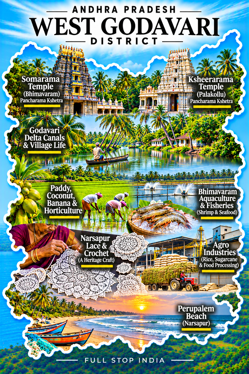
10 / West Godavari District
Farming towns and aquaculture
Bhimavaram is a commercial center in a district where agriculture and aquaculture have become powerful economic forces. Rice fields, irrigation canals, fish ponds and shrimp farms occupy a landscape that is both highly productive and intensely managed. The seafood economy connects small settlements to processing businesses and markets far beyond Andhra Pradesh.
Temple traditions and local festivals remain important, but the everyday story is one of farming families, traders, transport operators and workers who sustain the region’s food supply chains. Bhimavaram Town (BVRT) and Bhimavaram Junction (BVRM) are useful rail connections.
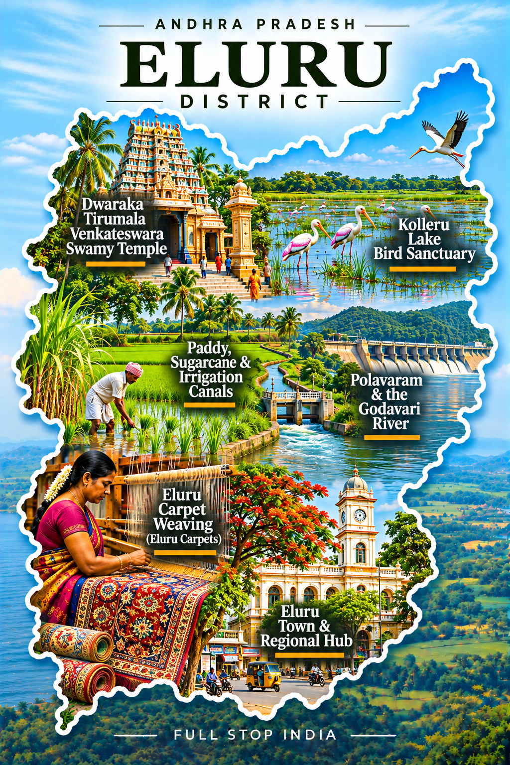
11 / Eluru District
Irrigation, lakes and market towns
Eluru’s urban markets and institutions sit close to a countryside shaped by irrigation, farming and the wetlands of Kolleru Lake. The lake is ecologically important for birds and fisheries, while the surrounding settlements reveal the pressures that agriculture, aquaculture and conservation can place on the same landscape. Paddy, food processing, trade and small businesses remain important to local livelihoods.
Eluru itself has the feel of an established regional city rather than a purpose-built visitor destination, with shops, schools and transport routes serving a broad rural hinterland. Rail gateway: Eluru station (EE) lies on the busy east-coast corridor. Vijayawada’s airport and railway hub provide additional connections for travelers entering the region.
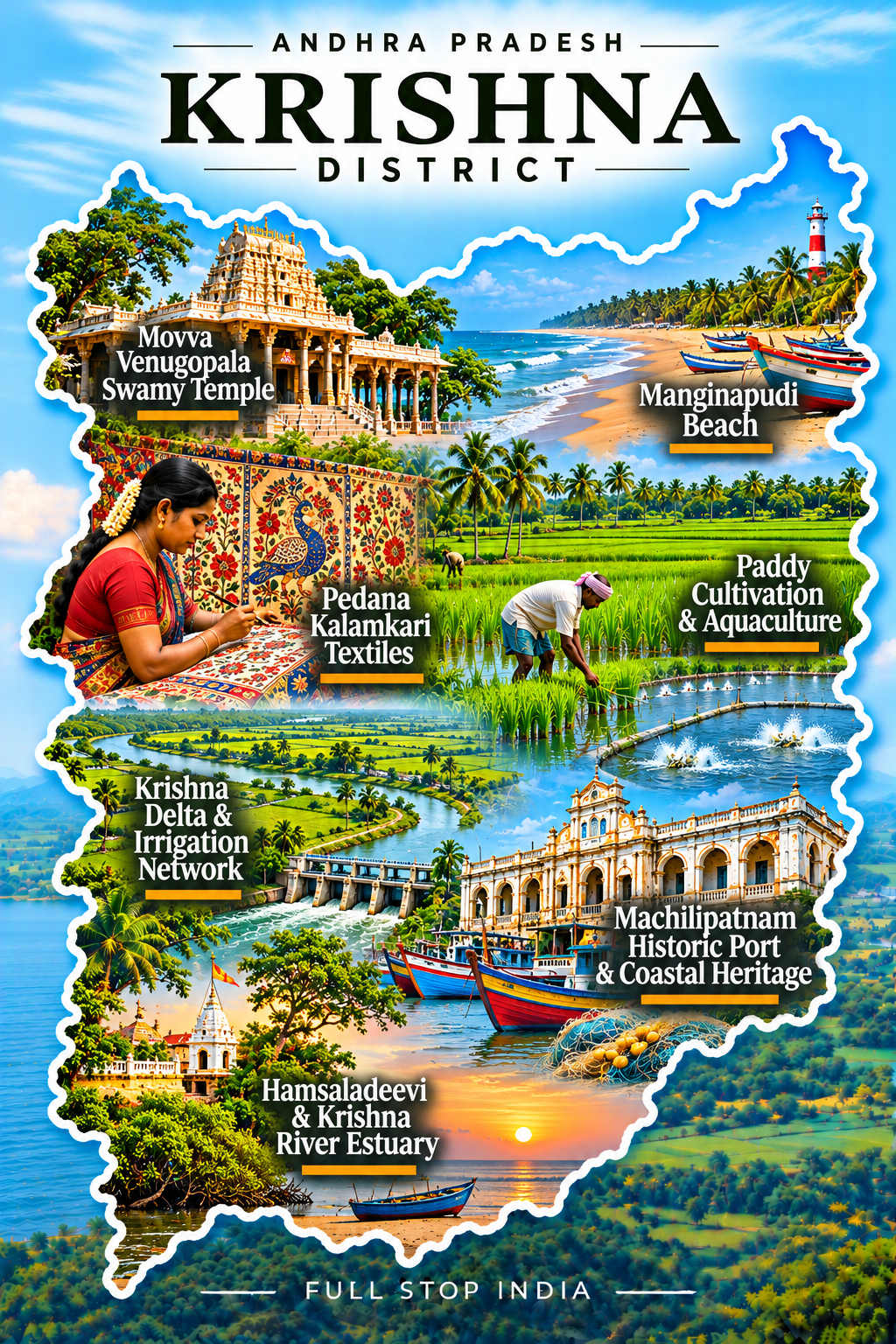
12 / Krishna District
A delta shaped by water and commerce
Machilipatnam remembers an era when merchants and ships connected this coast to wider Indian Ocean trading networks. Today the district’s economy is equally tied to the Krishna delta’s rice fields, fishing settlements and aquaculture. At Pedana, Kalamkari textile work preserves a distinctive craft tradition, with hand processes and workshop skills that deserve attention beyond the finished fabric.
Coastal weather, irrigation canals and market towns shape daily life across the low-lying landscape. Machilipatnam remains an important historic and administrative center.Machilipatnam railway station (MTM) provides a rail terminus; Vijayawada is the principal nearby air and major rail gateway.
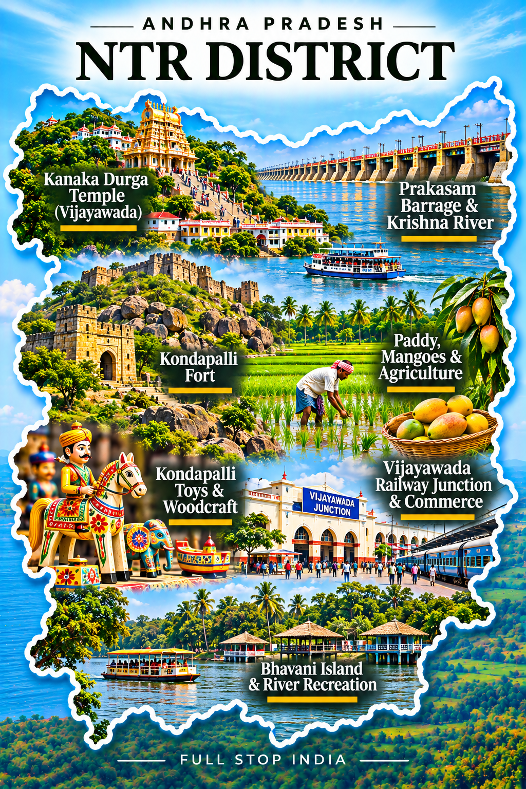
13 / NTR District
Vijayawada and the Krishna corridor
Vijayawada moves at the pace of a transport city. Trains, buses, wholesale markets and road freight connect the Krishna River corridor to much of southern and eastern India. Above the river, Kanaka Durga Temple gives the city a powerful religious landmark, while the Prakasam Barrage reflects the importance of irrigation to the surrounding agricultural region.
Education, healthcare, retail and logistics sustain an urban economy that serves far more than the district itself. Major gateways: Vijayawada Airport (VGA) provides scheduled domestic flights, and Vijayawada Junction (BZA) is one of the state’s most important railway junctions.
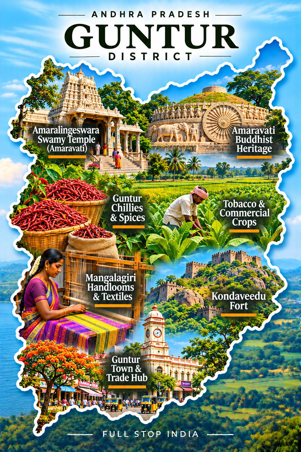
14 / Guntur District
Chillies, education and historic sites
Guntur’s chilli market is among the defining commercial images of Andhra Pradesh: a trade built on farmers, commission agents, warehouses, processors and buyers. Cotton, tobacco and other crops also connect the city to its agricultural hinterland. Educational institutions, hospitals and growing urban neighborhoods give Guntur a role far beyond farming.
The district’s wider cultural setting includes Buddhist and historical traditions, while the everyday city is busy with shops, transport and trade. Rail gateway: Guntur Junction (GNT) is a significant railway hub; Vijayawada Airport serves the broader metropolitan region.
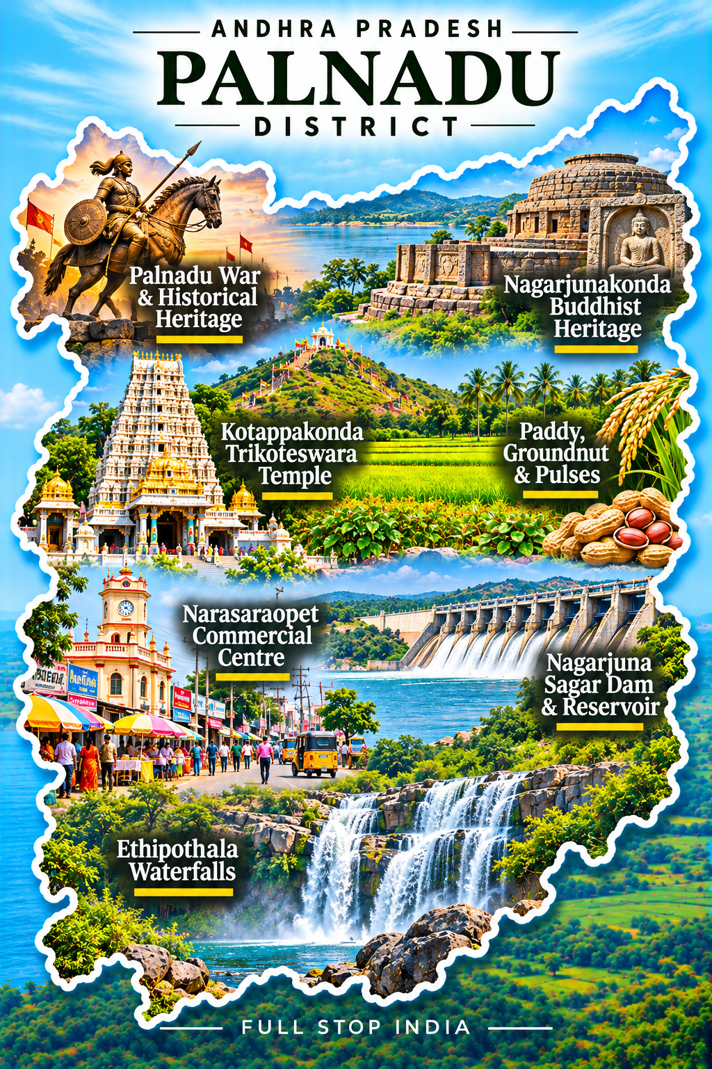
15 / Palnadu District
Limestone hills and the Nagarjuna Sagar country
Palnadu is a landscape of limestone, dry plains, agricultural settlements and the Krishna River’s wider reservoir country. Cement plants and quarrying are major features of its industrial economy, while farming depends on the availability of water across a frequently demanding climate. The region’s history includes the medieval Palnadu conflict, remembered in Telugu cultural traditions.
Around Nagarjuna Sagar, the relationship between large water infrastructure, irrigation and settlement becomes especially visible. Narasaraopet and other stations provide regional rail access, with Vijayawada and Guntur serving as larger transport hubs.
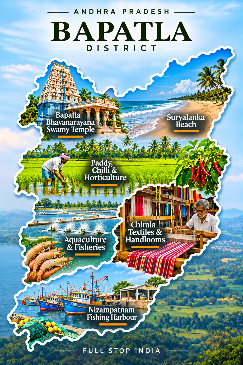
16 / Bapatla District
Beaches, farming and coastal communities
Bapatla’s identity stretches from agricultural classrooms and research institutions to fishing villages on the Bay of Bengal. Paddy cultivation, aquaculture and food-related trade support the surrounding countryside, while coastal communities work with the seasons and the changing sea. Suryalanka is known for its beach, but the district’s larger story is one of farming, education and the connection between inland fields and coastal markets.
Rail gateway: Bapatla station (BPP) is on the main coastal railway line, with connections through Guntur and Vijayawada.
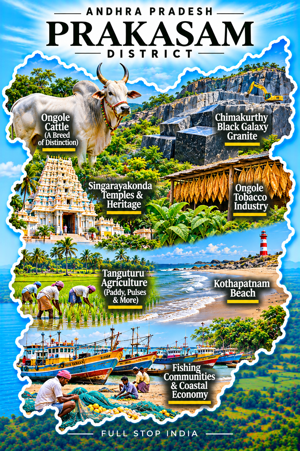
17 / Prakasam District
Granite, tobacco and the southern coast
Ongole is associated with the powerful Ongole cattle breed, an agricultural legacy that extends well beyond India. The district’s working economy also includes tobacco, pulses, fishing and the granite industry around Chimakurthy, where stone extraction and processing have created a distinctive industrial landscape. Inland conditions grow drier away from the coast, shaping the crops and livelihoods of local communities.
Market towns connect farmers, transport businesses and stone producers to wider networks. Rail gateway: Ongole station (OGL) is a major stop on the east-coast railway corridor.
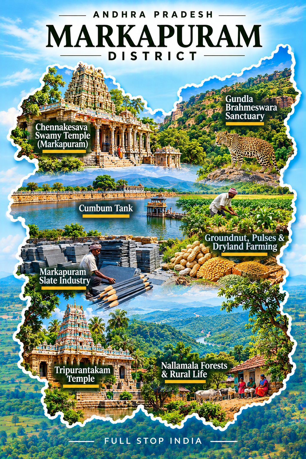
Markapuram District · Established 2025
The dry western interior of Prakasam
Markapuram, formed in the December 2025 district reorganization, brings together the dry western interior formerly administered within Prakasam. The terrain rises toward the Nallamala hills, with rocky landscapes, seasonal water constraints and agricultural settlements that depend on the rhythm of rainfall. Dryland crops, trading towns, stone-related businesses and transport activity shape the economy.
The district is still establishing its administrative identity, so its story is as much about governance and local services as about geography. Markapuram serves as headquarters and a regional market center. Markapur Road railway station (MRK) is a useful rail connection, though journeys to smaller settlements generally continue by road.
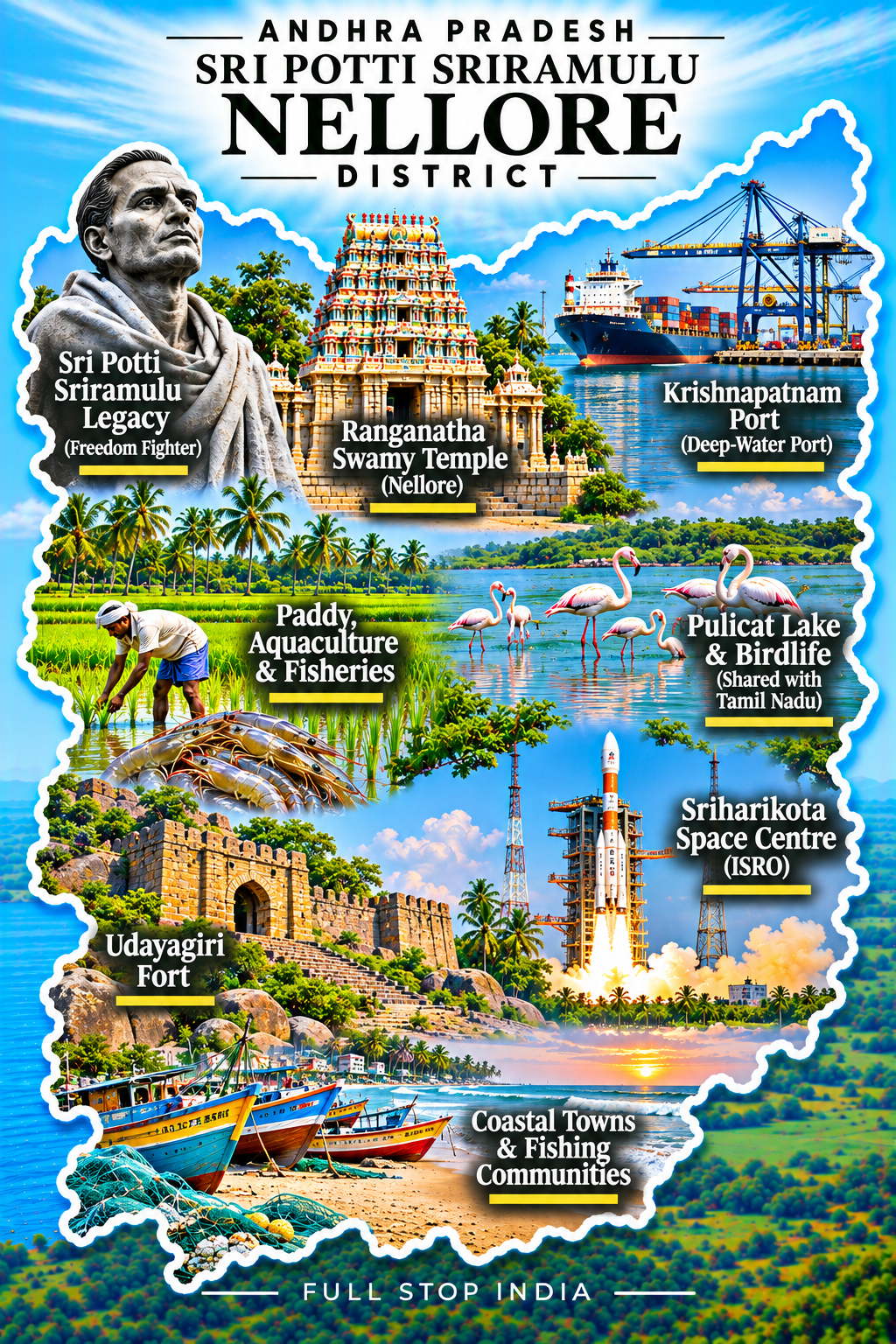
18 / Sri Potti Sriramulu Nellore District
Aquaculture, temples and the coast
Nellore is one of the state’s important centers of rice production and aquaculture, with shrimp farming and seafood businesses connecting coastal villages to export markets. Irrigation systems, wetlands and farming settlements give the countryside its character, while Nellore city provides education, healthcare, retail and transport services. The region’s temples and coastal ecology add layers to an economy dominated by food production and trade.
The nearby Pulicat Lake ecosystem is a reminder of how closely livelihoods and sensitive environments can overlap. Rail gateway: Nellore station (NLR) is an important stop on the Chennai–Vijayawada rail corridor. Tirupati and Chennai airports are often practical options depending on the destination.
Region 03 / Rayalaseema
The Deccan plateau, carved in stone
Rayalaseema is the state’s dry southwestern interior, where rocky hills, groundnut farms, historic forts and pilgrimage towns meet the challenges of scarce rainfall. Its regional identity is expressed as much in food, language and agricultural life as in its celebrated temples.
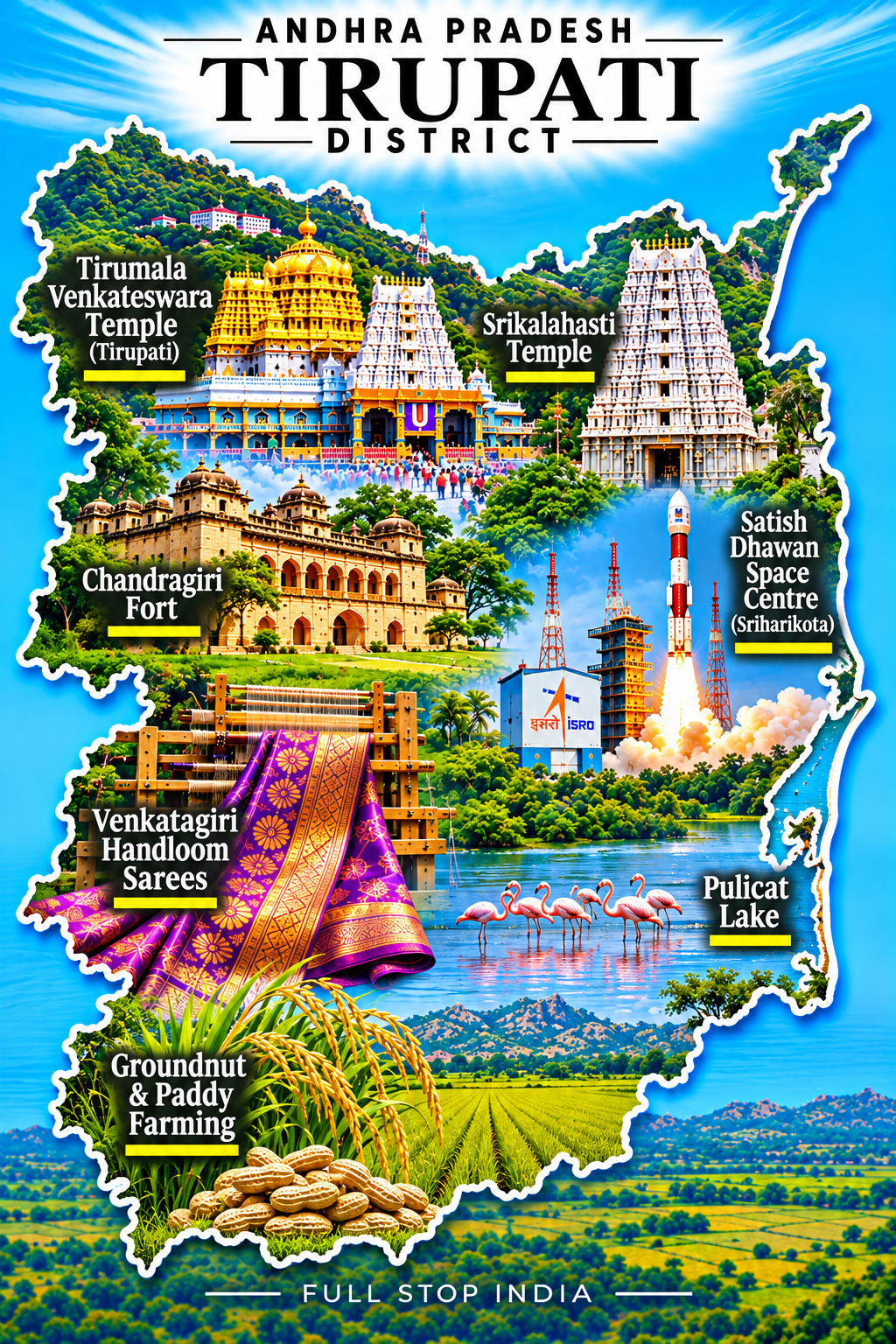
19 / Tirupati District
Pilgrimage on an extraordinary scale
Tirupati’s economy is inseparable from pilgrimage. The journey up to Tirumala and the Venkateswara Temple sustains a vast network of hospitality, transport, food preparation, retail, administration and employment. Yet the district also includes manufacturing, education and coastal settlements, making it more varied than the temple town alone suggests.
The Seshachalam hills give the inland landscape its dramatic setting, while the southern coastal belt includes the Sriharikota space-launch center and the Pulicat Lake region. Major gateways: Tirupati Airport (TIR) offers scheduled flights, and Tirupati railway station (TPTY) is an important passenger rail hub; Renigunta Junction (RU) provides additional long-distance connections.
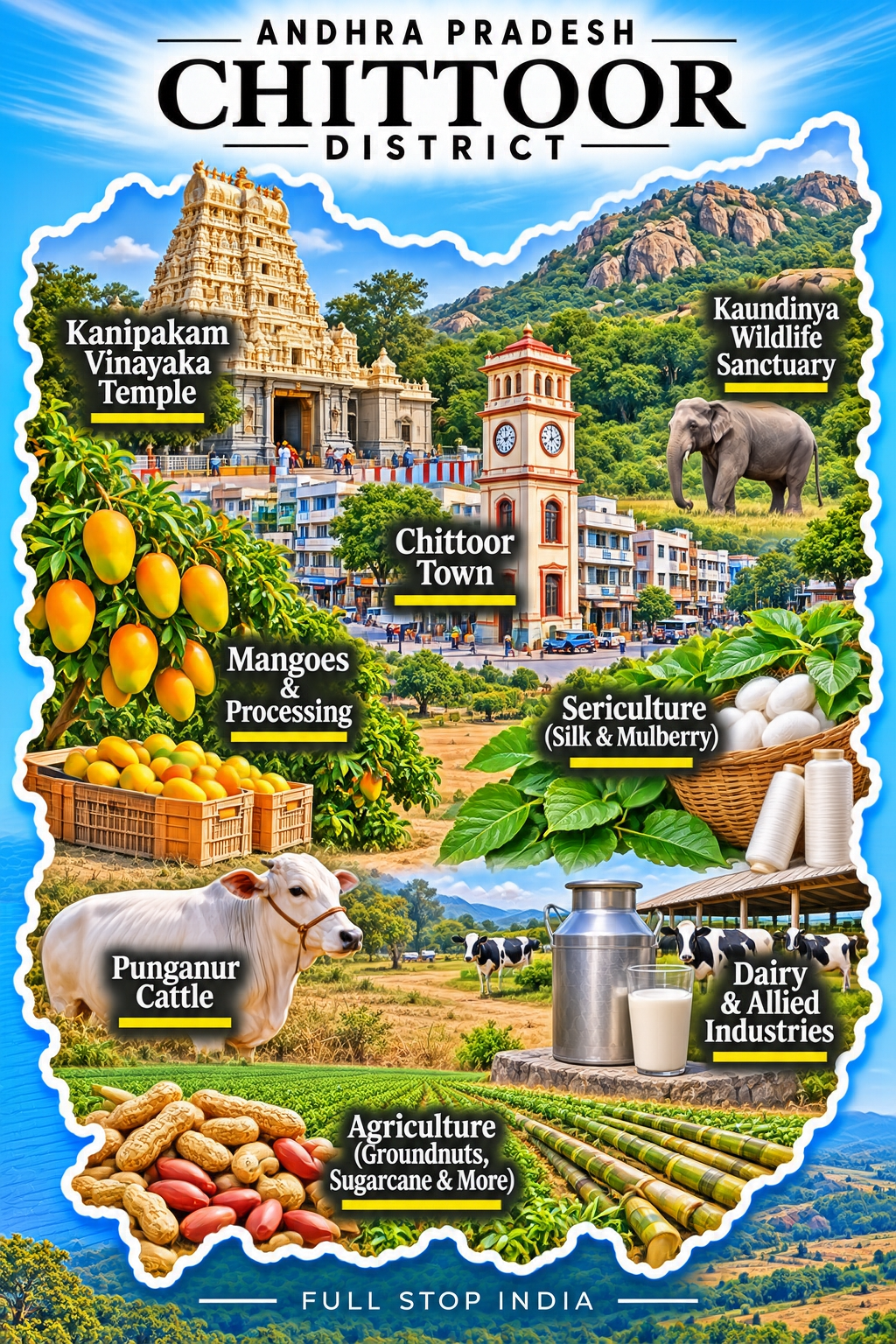
20 / Chittoor District
Mangoes, dairy and borderland trade
Chittoor lies in a borderland shaped by movement between Andhra Pradesh, Tamil Nadu and Karnataka. Mango orchards, fruit processing, dairy farming and poultry businesses support a broad rural economy, while towns serve traders and commuters crossing state boundaries. Multiple languages and commercial influences are part of ordinary life here, especially in markets and transport corridors.
Historic settlements and temples add cultural depth without turning the whole district into a tourist route. Chittoor railway station (CTO) provides regional connections, while Tirupati, Bengaluru and Chennai airports may be useful depending on the journey.
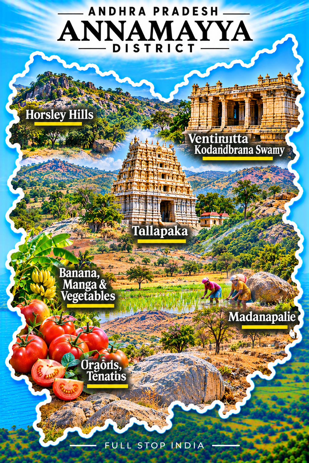
21 / Annamayya District
Temple towns and the southern hills
Named for the devotional poet-composer Annamacharya, Annamayya district links temple traditions with the working landscapes of southern Rayalaseema. Rayachoti and its surrounding towns serve farming communities whose livelihoods include groundnuts, horticulture, livestock and small-scale trade. Hills and stretches of dry countryside reveal how closely agriculture depends on water availability.
Local markets, religious festivals and family businesses are the everyday institutions that hold these communities together. Road travel is essential for many places, with larger railway and airport connections generally reached through neighboring districts.
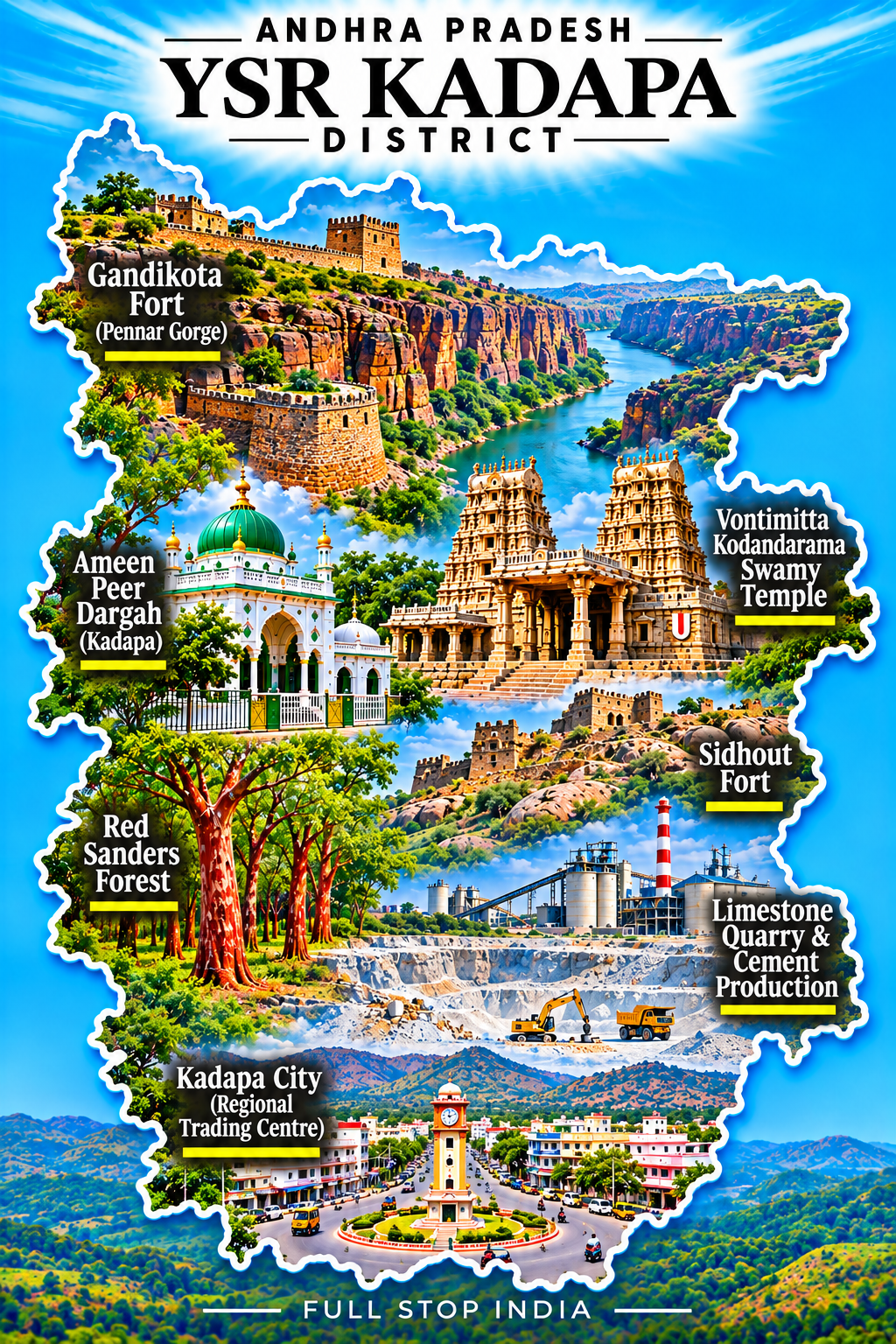
22 / YSR Kadapa District
Stone, history and the Pennar basin
Kadapa’s history is written into forts, temple sites and settlements along the Pennar basin. Gandikota’s dramatic gorge gives the district a striking landmark, but the modern economy is equally shaped by limestone, cement, mineral extraction, agriculture and horticulture. Stone and construction-related industries employ workers across the region, while market towns connect villages to larger trading centers.
Dry landscapes and seasonal rivers have always influenced settlement and farming decisions here. Transport gateways: Kadapa Airport (CDP) has limited scheduled domestic services, subject to current airline schedules, and Kadapa railway station (HX) connects to regional and longer-distance routes.
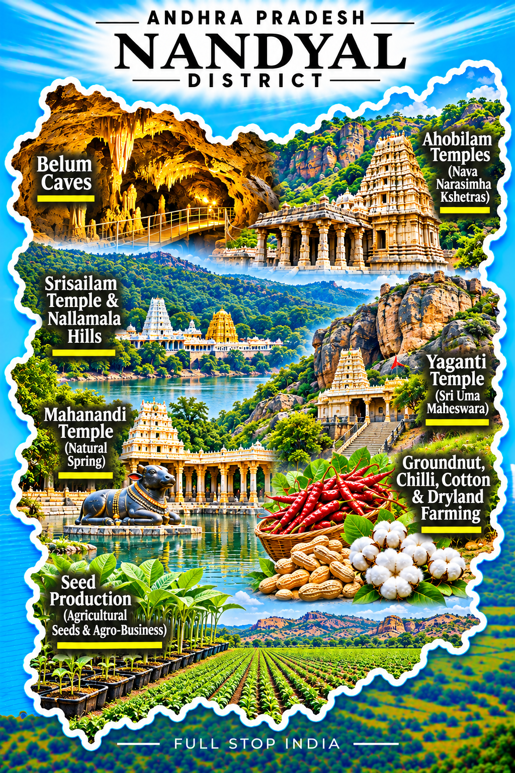
23 / Nandyal District
Sacred sites and forested escarpments
Nandyal brings together a varied landscape of forested hills, limestone country, agricultural plains and important pilgrimage sites. Srisailam’s temple complex and the Nallamala hills are prominent cultural and geographical features, while Belum Caves reveal a very different underground landscape. Beyond these landmarks, farming, quarrying and cement production sustain much of the district’s working economy.
Water availability and access through hilly terrain help explain the pattern of towns and settlements. Rail gateway: Nandyal Junction (NDL) provides regional connections; onward road journeys are generally necessary for hill and pilgrimage destinations.
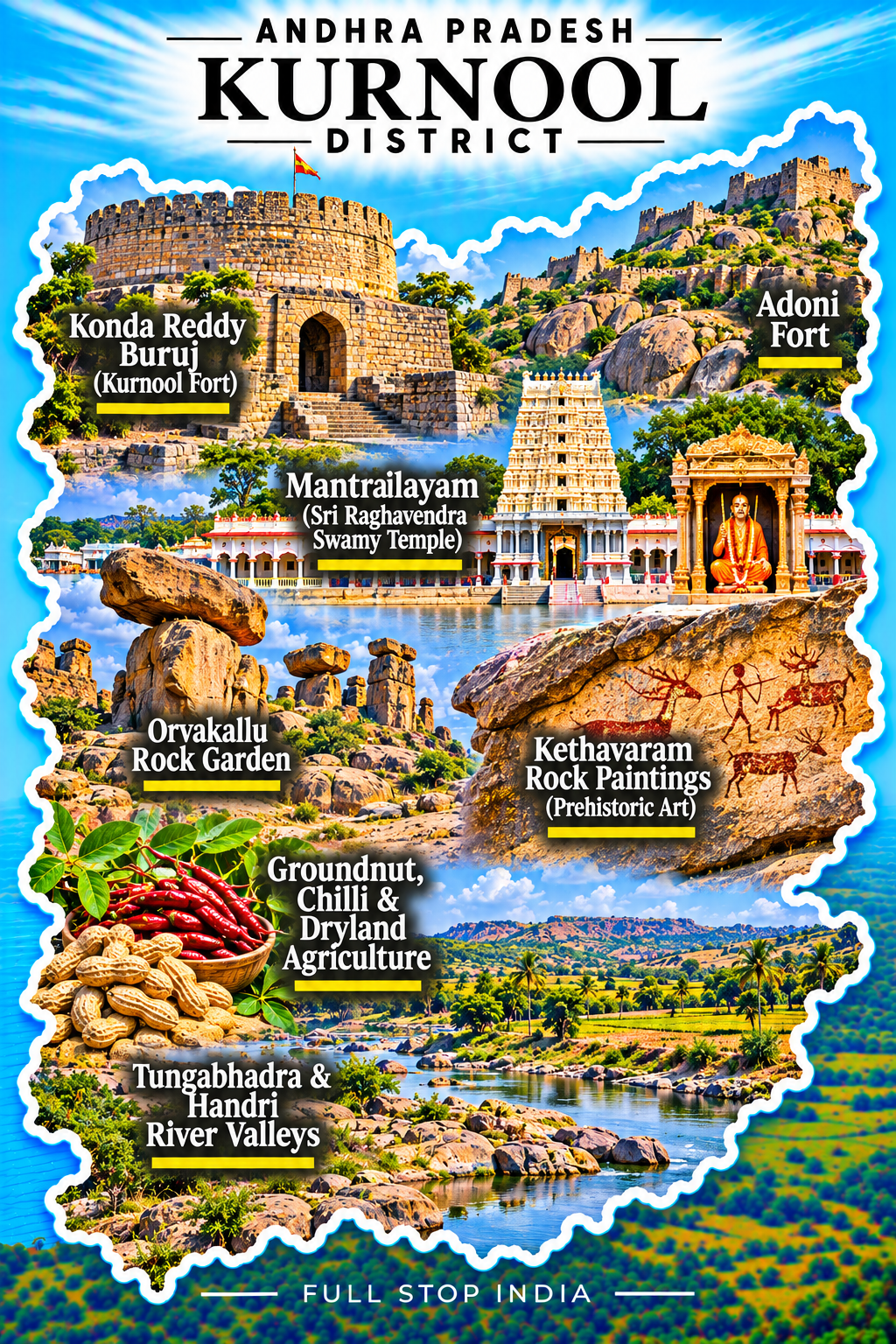
24 / Kurnool District
Fort history and a Deccan crossroads
Kurnool has long occupied a strategic position between Rayalaseema and the wider Deccan. Its forts, old neighborhoods and trading history reflect generations of movement through this inland corridor. Agricultural markets, stone industries, education and public services anchor the modern city, while the surrounding countryside shifts between rocky plains and cultivated river valleys.
Road freight and rail links help connect local producers with markets across southern India. Rail gateway: Kurnool City station (KRNT) serves the city; the larger rail network is also accessible through nearby junctions. Air travelers typically use airports farther afield.
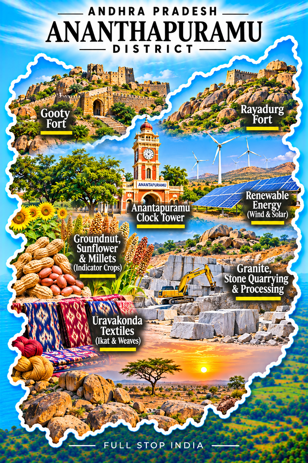
25 / Anantapuramu District
Groundnuts and an arid interior
Anantapuramu is defined by the demands of dryland farming. Groundnuts have long been important here, alongside livestock, small trading businesses and the continual challenge of uncertain rainfall. Wind and solar installations now add a new industrial layer to the landscape, making renewable energy part of the district’s contemporary identity. Its towns are commercial and administrative centers for a countryside where water management and agricultural resilience remain everyday concerns.
Rail gateway: Anantapur station (ATP) connects the city to major southern routes. Lepakshi, often associated with the wider region, lies in neighboring Sri Sathya Sai district.
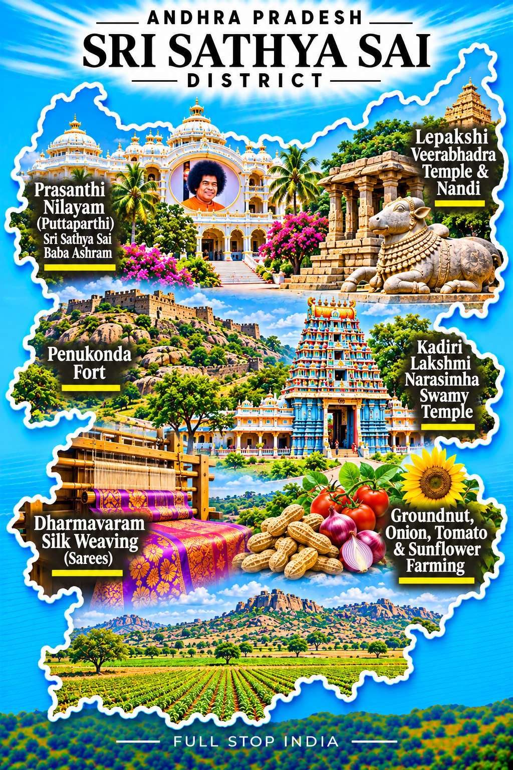
26 / Sri Sathya Sai District
Puttaparthi and southern plateau towns
Puttaparthi has given Sri Sathya Sai district an international religious profile, with spiritual institutions, hospitals, schools and charitable services forming a significant local economy. Hindupur and other trading towns maintain strong commercial links with neighboring Karnataka, while manufacturing, groundnut cultivation and other dryland agriculture support the wider plateau.
The district also contains Lepakshi, whose historic temple and sculptural traditions provide an important cultural landmark. Rail gateway: Hindupur station (HUP) is a useful connection on the Bengaluru–Guntakal corridor. Bengaluru’s airport is often a practical arrival point for the southern part of the district.
Andhra Pradesh beyond the map
Food & everyday life
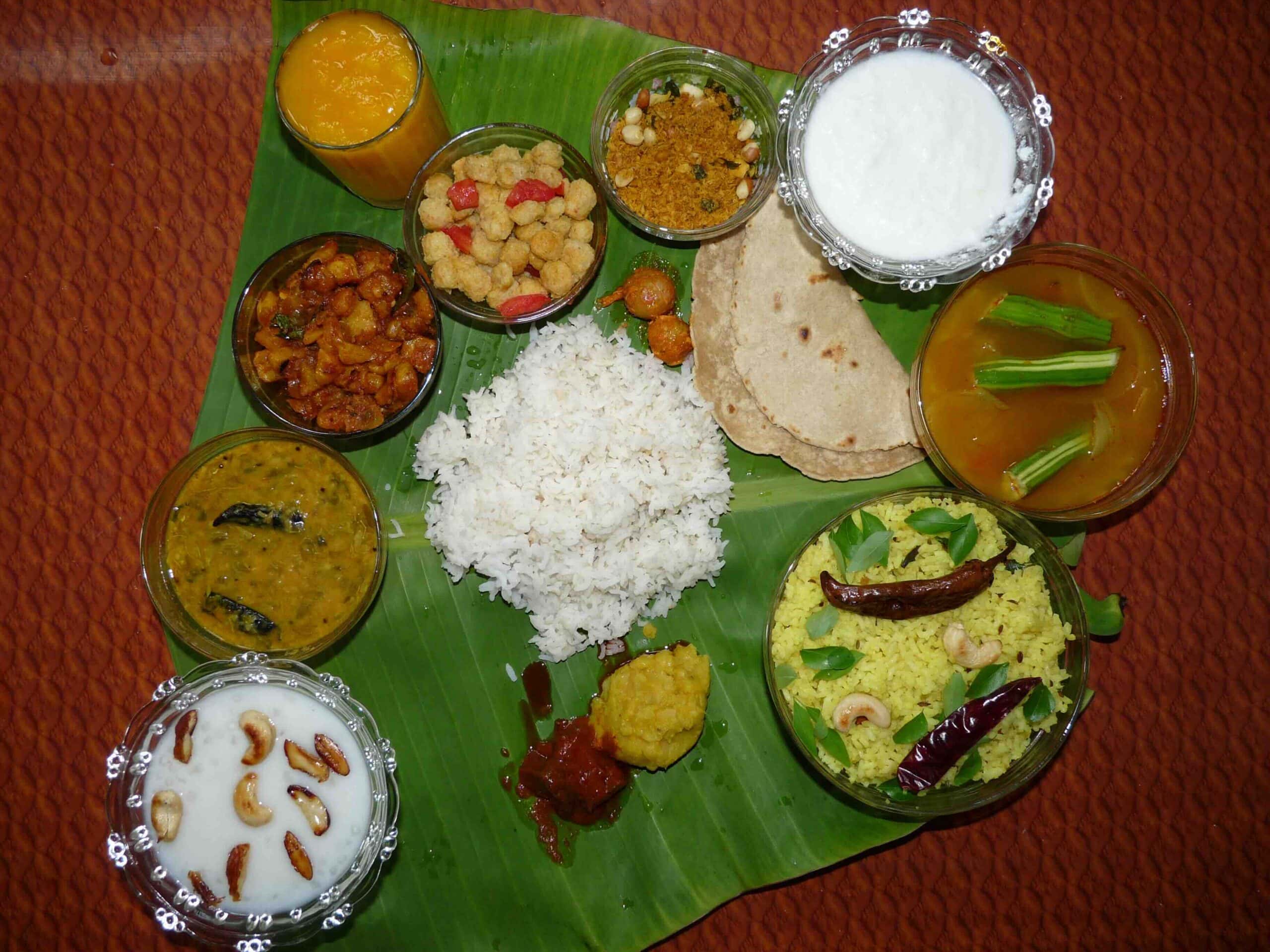
Andhra cooking has a reputation for heat, but it is far more varied than its chilli-laden dishes suggest. Rice, pappu (dal), tangy pulusu stews, vegetable curries and pickles are everyday staples. Along the coast, fish and prawns appear in home kitchens and market stalls; inland Rayalaseema has its own tradition of millet-based dishes, groundnut chutneys and robust spice blends. Gongura, the tart leafy green, turns up in chutneys and curries across the state.
Crafts & commerce
Handloom weaving, kalamkari printing, painted wooden toys and lacquerware remain part of Andhra Pradesh’s commercial and cultural life. Workshops and family businesses preserve skills passed between generations, even as factory production changes local markets. The state’s larger economy spans agricultural processing, aquaculture, pharmaceuticals, heavy industry and maritime trade.
Festivals & traditions
Sankranti brings decorated thresholds and harvest gatherings to villages, while Ugadi marks the Telugu New Year with family rituals and seasonal foods. Tirumala’s Brahmotsavam reflects the scale of the state’s pilgrimage traditions. In the northern hills, Dhimsa dance is associated with Adivasi communities, particularly around Araku; elsewhere, temple festivals, music and storytelling carry distinct local traditions.

ARRIVING & GETTING AROUND
Getting to Andhra Pradesh
By air
Visakhapatnam Airport (VTZ) and Vijayawada Airport (VGA) are two of the state’s principal air gateways, serving the northern coast and central Andhra Pradesh respectively. Tirupati Airport (TIR) is useful for the south and Tirumala pilgrims, while Rajahmundry Airport (RJA) serves the Godavari region. Kadapa Airport (CDP) has more limited domestic connections. Flight options differ considerably by airport.
By train
Vijayawada Junction (BZA) and Visakhapatnam Junction (VSKP) are major rail gateways, with extensive connections across India. Rajahmundry (RJY), Guntur Junction (GNT), Nellore (NLR), Tirupati (TPTY) and Renigunta Junction (RU) serve important regional and long-distance routes. Search trains and book through IRCTC.
By bus and road
State buses and private operators connect the major cities with district towns, villages and neighboring states. For official Andhra Pradesh services, see APSRTC. Hired cars and local buses are often the practical choice for reaching smaller settlements, hill communities and places beyond the railway network.
When to visit Andhra Pradesh
November to February generally brings the most comfortable weather for exploring the coastal cities, temple towns and inland districts. The Eastern Ghats around Araku can be pleasantly cool, especially in the mornings. March to May is much hotter, particularly across Rayalaseema, where long journeys and midday walks can be exhausting. The June to September monsoon brings greener hills and replenishes rivers and fields, but heavy rain and occasional coastal storms can complicate travel. The northeast monsoon can also bring substantial rain to southern coastal districts in October and November.
Festival periods can change the practicalities of a trip. Sankranti in January, Ugadi in spring and major celebrations at Tirumala can mean crowded roads, trains and hotels. Plan overnight stays and onward travel around these dates.
Choosing where to stay
Plan separate bases for separate regions. The northern hills, Godavari delta, central cities and southern pilgrimage towns are too far apart for convenient day trips from a single hotel.
Visakhapatnam is the strongest base for the northern coast, with the broadest range of hotels, restaurants and onward connections toward Araku and the Eastern Ghats. Rajamahendravaram (Rajahmundry) works well for the Godavari region, while Kakinada is useful for the eastern coastal and port districts.
Vijayawada is a practical transport hub for central Andhra Pradesh, with Guntur a useful alternative for nearby agricultural and commercial districts. Tirupati is the obvious base for Tirumala and the southern temple circuit, although pilgrimage crowds can affect room availability and road journeys. Nellore makes sense for the southern coast, while Kurnool, Nandyal and Kadapa provide more practical overnight stops for inland Rayalaseema routes.
For remote hill districts and smaller agricultural towns, accommodation may be limited. Choose overnight stops around the roads and places you actually intend to reach, rather than assuming neighboring districts are a short drive apart.
Explore More of India
Local celebrations, cultural events and annual festivals.
The geography between the state and the village.
How India’s states and Union Territories differ.
India’s currency, its symbols and a few surprises.