
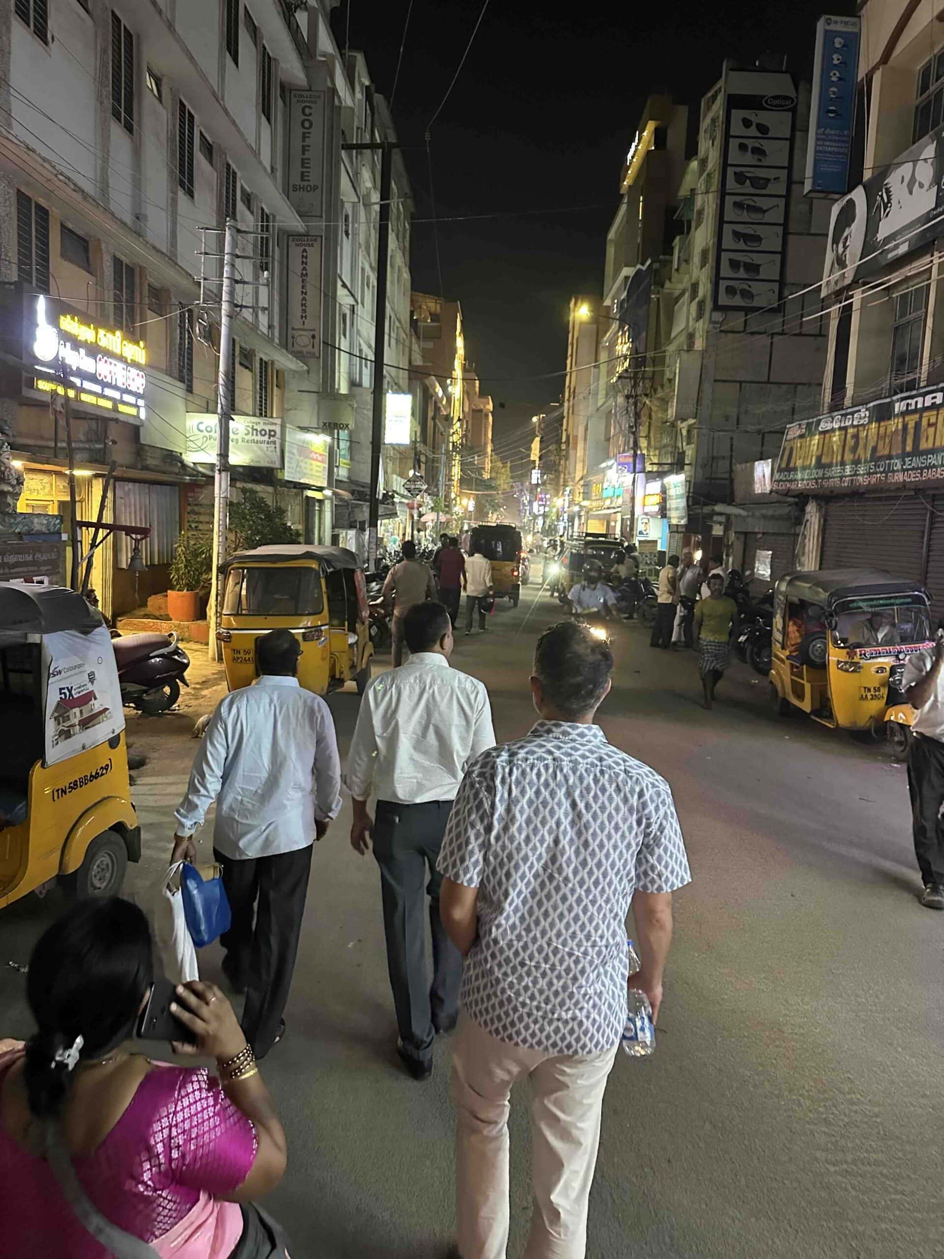
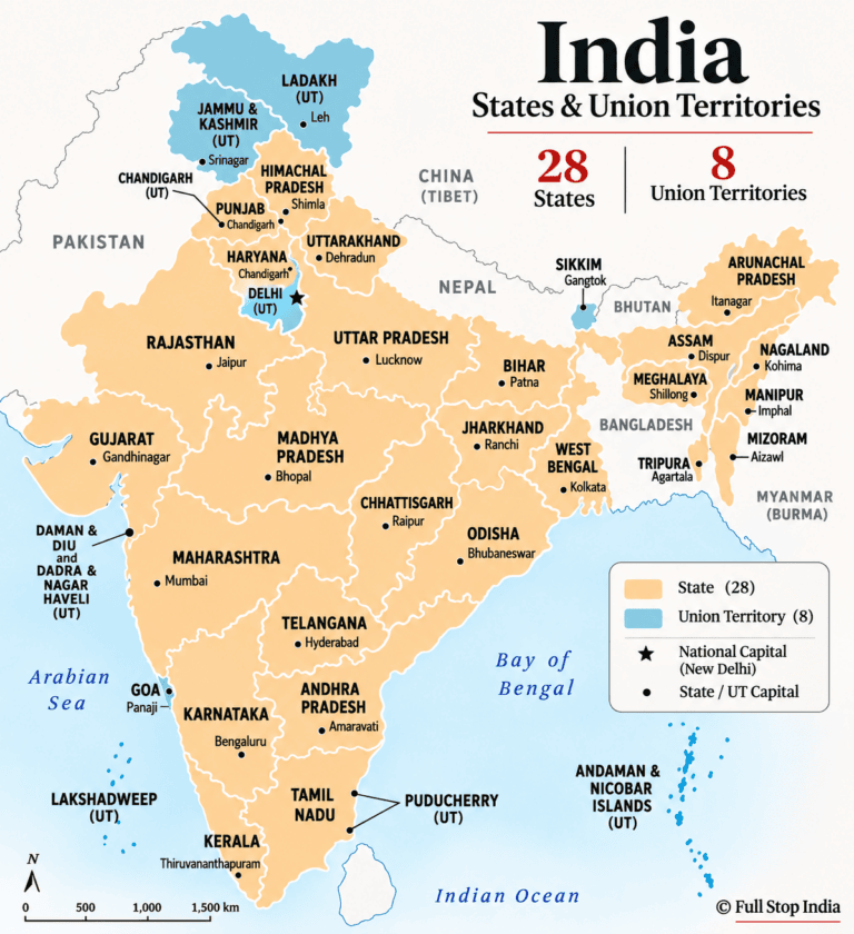
India has 28 states, eight Union Territories, and hundreds of districts. You’ve probably traveled through dozens without giving them much thought.
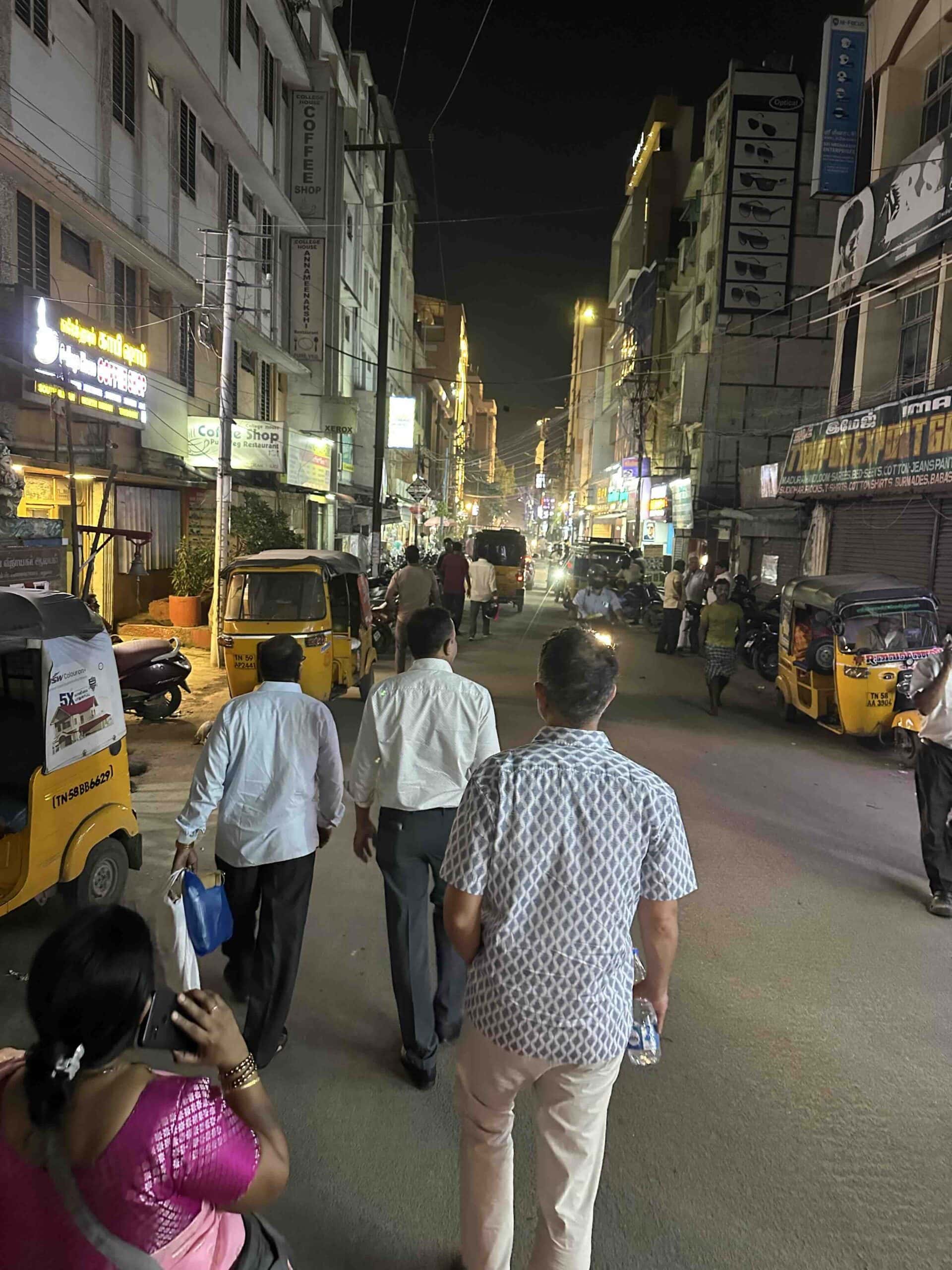
So, What Exactly Is a District?
I get it. You’re overwhelmed.
You’ve been reading about Tipu Sultan, Delhi, thali, and whether you should drink the water in India. Now someone’s throwing state names and districts at you?
What the hell?
You just want to know where you’re having dinner tonight.
Been there!
But here’s the thing. Once you begin traveling around India, those names start to mean something. Rajasthan, Uttar Pradesh, Kerala, Tamil Nadu. You’ll see them on maps, hear them in conversations, and eventually begin to recognize what makes each one different.
And then, just when you think you’ve got India’s geography figured out, along come the districts.
Hundreds of them.
So what exactly is a district, and why should you care?
A district is an administrative division within a state or Union Territory. It’s one of the ways India organizes government services across an enormous country.
For my American readers, think of an Indian district as something loosely comparable to a county. In France, you might compare it to a department; in Germany, a Kreis; and in parts of South America, a departamento.
The names and responsibilities aren’t identical, but the general idea is familiar. A large country needs smaller administrative divisions to keep things running.
India simply has its own vocabulary for them.
Just How Big Is a District?
Here’s where India’s geography gets interesting.
Consider Mahe, a tiny coastal district belonging to the Union Territory of Puducherry. It occupies roughly nine square kilometers, or about 3.5 square miles.
Now consider Kutch, in Gujarat.
At approximately 45,600 square kilometers, or 17,600 square miles, Kutch is more than 5,000 times larger than Mahe.
One is a compact coastal enclave surrounded by Kerala. The other stretches across salt flats, desert landscapes, towns, villages, agricultural land, and the enormous expanse of the Great Rann of Kutch.
Both are districts.
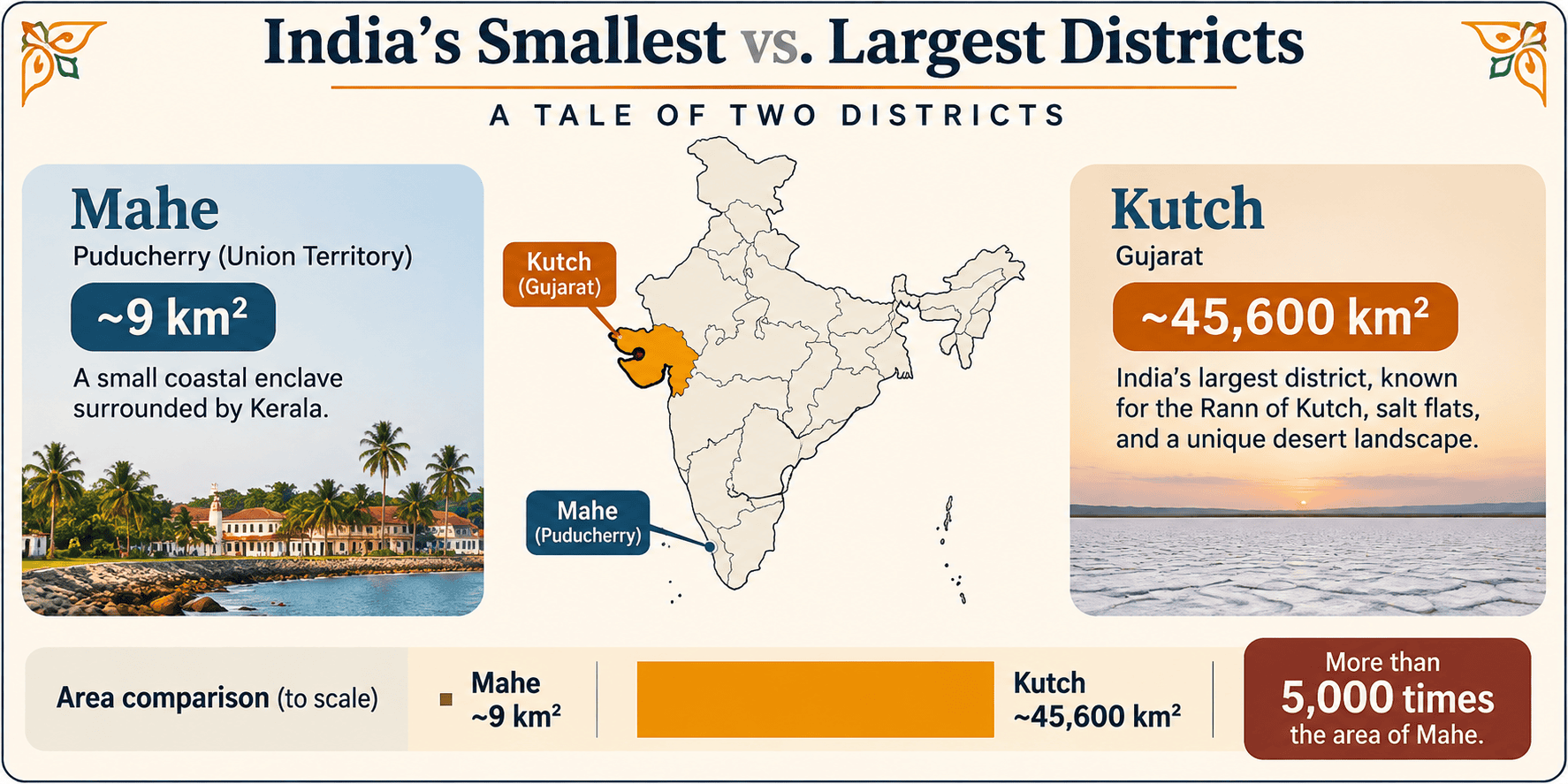
And Mahe introduces another peculiar feature of India’s administrative map. Although it’s geographically surrounded by Kerala, it belongs to Puducherry, a Union Territory whose other territories are scattered across southern India.
Confused about the difference between a state and a Union Territory? Read our State vs. Union Territory guide.
So don’t assume that a district’s location necessarily tells you which state or Union Territory governs it.
A district may contain a large city, dozens of towns, hundreds of villages, or vast stretches of countryside. Some are densely populated urban centers. Others encompass mountains, forests, and communities separated by hours of travel.
There’s no standard size.
A City Isn’t Necessarily a District
Take Madurai in Tamil Nadu.
There’s the city of Madurai, with its magnificent Meenakshi Amman Temple, crowded markets, and streets that seem to operate according to their own understanding of traffic regulations.
Then there’s Madurai district.
The district includes the city, but also smaller towns, villages, agricultural land, and communities whose daily lives have little to do with the temple crowds.
The same distinction applies to Chennai, Coimbatore, Jaipur, and countless other places.
A city is an urban settlement, generally governed by a municipal body. A district is an administrative area that may encompass both urban and rural communities.
The two may share a name, but they aren’t interchangeable.
And the town or city serving as a district’s administrative headquarters isn’t necessarily its only important population center.
Who’s Actually in Charge?
Most Indian districts have an official commonly known as the District Collector or District Magistrate, often referred to simply as the DM. In many districts, these are two titles held by the same official.
The title sounds rather old-fashioned, and there’s a reason for that.
Under British colonial administration, district collectors were responsible for collecting land revenue.
Hold on. Can we break the fourth wall for a moment?
Some of you may not know that Britain controlled, or perhaps more accurately, ruled, much of India for nearly two centuries. The British East India Company’s territorial expansion began in the 1700s, followed by direct British Crown rule from 1858.
India gained independence on August 15, 1947, following decades of resistance, including the nonviolent independence movement associated with Mahatma Gandhi. Independence also came with Partition, which divided British India into India and Pakistan, triggering enormous population movements and widespread violence.
There. Nearly two centuries of history in a few sentences. We’ll give that subject the attention it deserves another day.
Now, back to our District Collector.
The office survived independence, although its responsibilities have changed considerably.
Today, depending on the state, a collector or district magistrate may oversee revenue administration, coordinate government programs, supervise disaster response, and exercise certain legal and administrative powers.
These officials are frequently members of the Indian Administrative Service (IAS).
But what does that mean for ordinary people?
Imagine heavy monsoon rains causing rivers to overflow, roads to disappear beneath floodwater, and entire communities to require evacuation.
The district administration may coordinate emergency shelters, relief supplies, road restrictions, and assistance from multiple government departments.
During elections, district officials also have important administrative responsibilities. In other circumstances, their work may involve land records, public grievances, or the implementation of government programs.
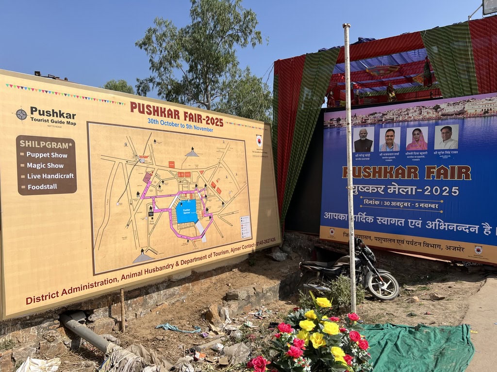
District administrations also help coordinate major public gatherings. At the 2025 Pushkar Fair in Rajasthan, for example, the event’s tourist map identified the Ajmer district administration alongside the animal husbandry and tourism departments.
The collector doesn’t personally run every aspect of a district. Police administration, municipal government, education, healthcare, and rural development involve their own departments and officials.
But when something significant happens locally, the district administration is frequently at the center of the response.
And if you’ve ever wondered why Indian newspapers report that the District Collector has ordered something, you’re now a little closer to understanding the position.
Districts Have Districts of Their Own
Well, not quite. But the administrative divisions continue.
A district is commonly divided into smaller administrative units called tehsils, taluks, or talukas, depending on the state.
These subdivisions play important roles in land records, revenue administration, and other government functions.
And just when you’ve learned what a district is, you’ll discover that some states divide their districts into tehsils, others into taluks, and still others into talukas.
Same general idea. Different names. Welcome to India.
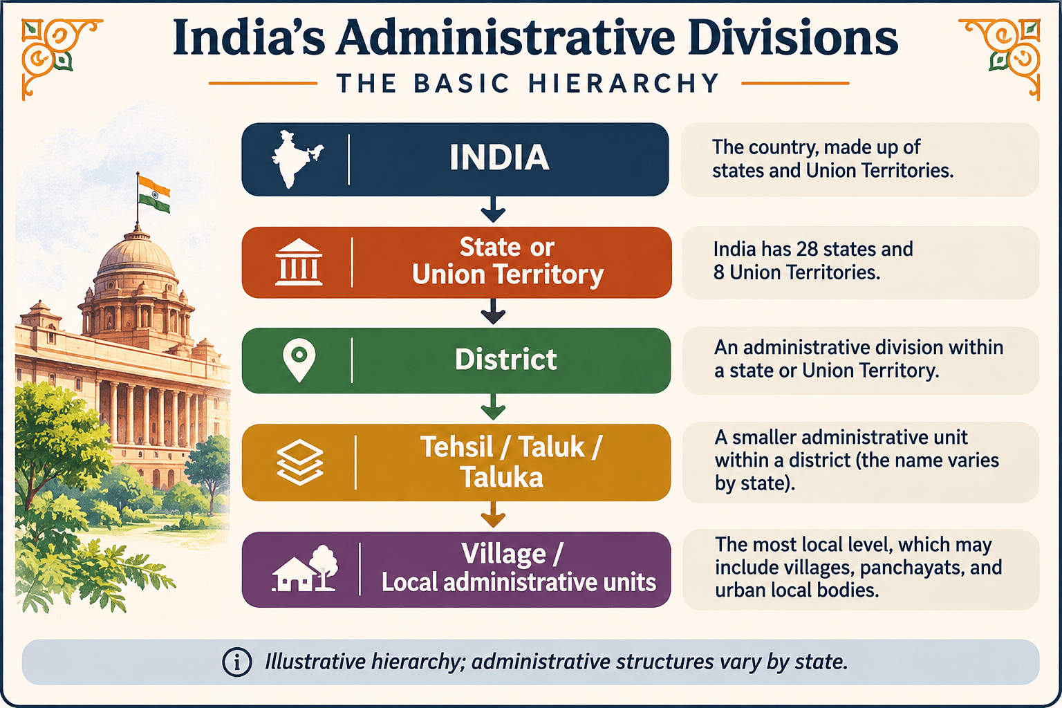
Below these subdivisions are villages and other local administrative units, although the precise arrangement varies across the country.
Urban areas have their own municipal structures, while rural local government operates through the Panchayati Raj system in much of India.
Here’s something you might not realize. For all the attention given to India’s enormous cities, approximately 62% of the country’s population lives in rural areas, according to 2026 population projections.
That’s roughly 911 million people, compared with 556 million living in cities and towns.
Nearly two out of every three Indians call rural India home.
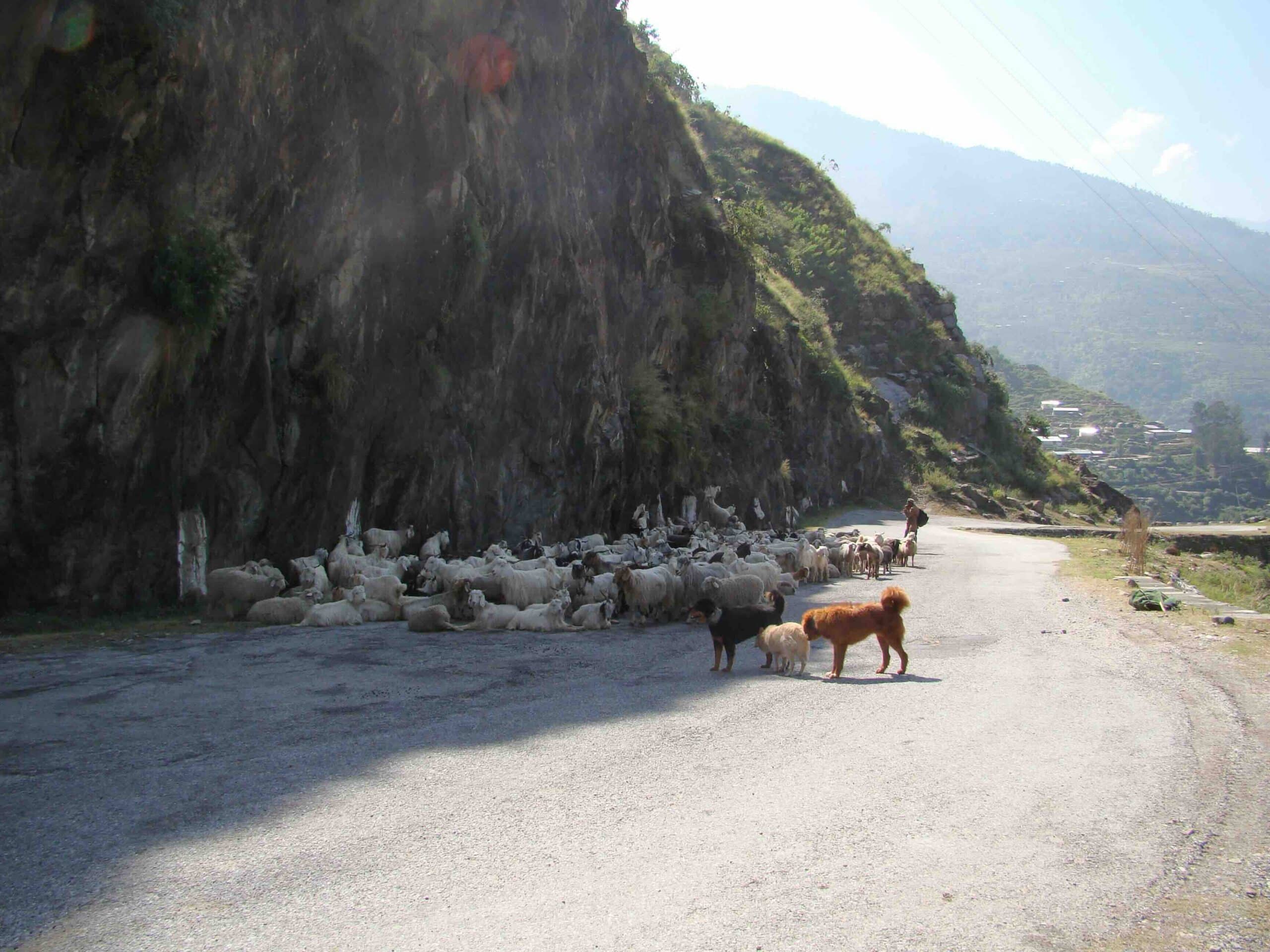
And rural doesn’t necessarily mean agricultural. There are factories, family businesses, schools, hospitals, workshops, and entire local economies operating beyond the major cities.
It’s a substantial part of the country to overlook when trying to understand how India works.
One thing to remember is that India doesn’t have one perfectly uniform administrative ladder. Some states have additional divisions between the state and district levels, and local government structures don’t always follow the same boundaries as revenue administration.
If you’re expecting the same arrangement everywhere, India has other plans.
Thirty-Eight Districts, One Tamil Nadu
Tamil Nadu is a particularly good example of why districts are interesting beyond their administrative purpose.
The state has 38 districts, and their differences are remarkable.
Start with Chennai, the state capital. Its economy includes technology, automobile manufacturing, financial services, shipping, and international trade. The metropolitan area extends well beyond Chennai district into neighboring districts.
Travel west to Coimbatore, and you’ll encounter a very different industrial landscape. The city and surrounding district have long been associated with textile manufacturing, spinning mills, engineering, and the production of pumps and machinery. Agriculture and smaller manufacturing enterprises are important beyond the city itself.
Head into the Nilgiris, and the landscape changes entirely. Tea estates spread across the hillsides, while forests, mountain communities, horticulture, and the cooler climate of the Western Ghats shape everyday life.
Down in Thanjavur, agriculture has long been central to the district’s identity. The fertile Cauvery delta, fed by a river so revered that it’s often called the Ganga of the South, has made this one of southern India’s great rice-growing regions. The district’s magnificent temples, traditional bronze casting, and classical arts speak to its extraordinary cultural history.
And then there’s Madurai, where commerce, education, textile-related industries, agricultural trade, and manufacturing exist alongside one of India’s great temple cities. The city’s markets and businesses serve a much larger region than the urban center alone.
All five belong to Tamil Nadu.
But you’d have a difficult time convincing anyone that they’re the same place.
That’s one reason we’re developing Full Stop India’s state guides district by district. I want to know more than which temples to visit or where to take a photograph. What do people grow here? What do they manufacture? What businesses and industries support the local economy? What makes this district different from the one next door?
Those questions reveal a side of India that a conventional sightseeing itinerary can easily miss.
How Many Districts Does India Have?
There’s no single number that remains correct indefinitely.
India has hundreds of districts, and the total changes as governments create new ones, divide existing districts, merge administrative areas, or reorganize boundaries.
The stated reason is often straightforward: bringing government services closer to the people who use them.
Consider Telangana.
When the state was formed in 2014, it had ten districts. In 2016, the government reorganized those ten into 31 districts, with the stated intention of improving administrative access and efficiency. Subsequent changes brought the total to 33.
That meant new district headquarters, administrative offices, and changes to the way government services were organized.
But it also raised questions about which towns would become headquarters, how boundaries would be drawn, and which communities would fall under the new districts.
And let’s not pretend politics doesn’t enter the picture.
Creating a new district can bring government offices, jobs, infrastructure, and political attention to a particular town or region. For an elected official, announcing a new district can be a popular move, especially when local communities have been demanding one for years.
But there’s an important distinction. Changing administrative district boundaries isn’t the same as redrawing electoral constituencies to gain an advantage at the ballot box, something Americans will recognize as gerrymandering.
India has a separate legal process for drawing parliamentary and state assembly constituencies, known as delimitation.
That doesn’t mean politics disappears from the discussion. It means the two kinds of boundaries serve different purposes.
So when you hear that an Indian state has created several new districts, there’s often more to the story than administrative convenience.
And if you’re looking at an older map of India, don’t be surprised if the district boundaries no longer match those on a newer one.
Does a District Have Its Own Culture?
Not necessarily.
District boundaries are administrative, not cultural. Languages, cuisines, religious traditions, and communities frequently extend across them.
A coastal fishing district may have different industries and food traditions from an inland agricultural district. A mountain district may have its own architecture, crops, and seasonal rhythms.
Sometimes the differences are obvious. Sometimes they’re subtle enough that you need to spend a little time there to notice them.
And sometimes a district boundary means very little to the people living on either side of it.
A line on a government map doesn’t automatically create a separate culture.
Why Should a Traveler Care?
You don’t need to memorize India’s hundreds of districts. I certainly haven’t.
But there are occasions when knowing which district you’re in becomes rather important.
Take travel permits, for example.
Certain northeastern states have Inner Line Permit (ILP) requirements, while foreign travelers may be subject to separate protected-area regulations. Depending on the destination and the traveler’s nationality, applications may be handled online, through authorized offices, or with assistance from a tour operator.
And the Northeast isn’t the only place where special permissions matter.
Foreign travelers visiting certain border areas of Himachal Pradesh, particularly parts of Kinnaur and Lahaul-Spiti, may need protected-area permits involving authorized district or subdistrict officials. Not all of Spiti Valley is subject to the same requirements.
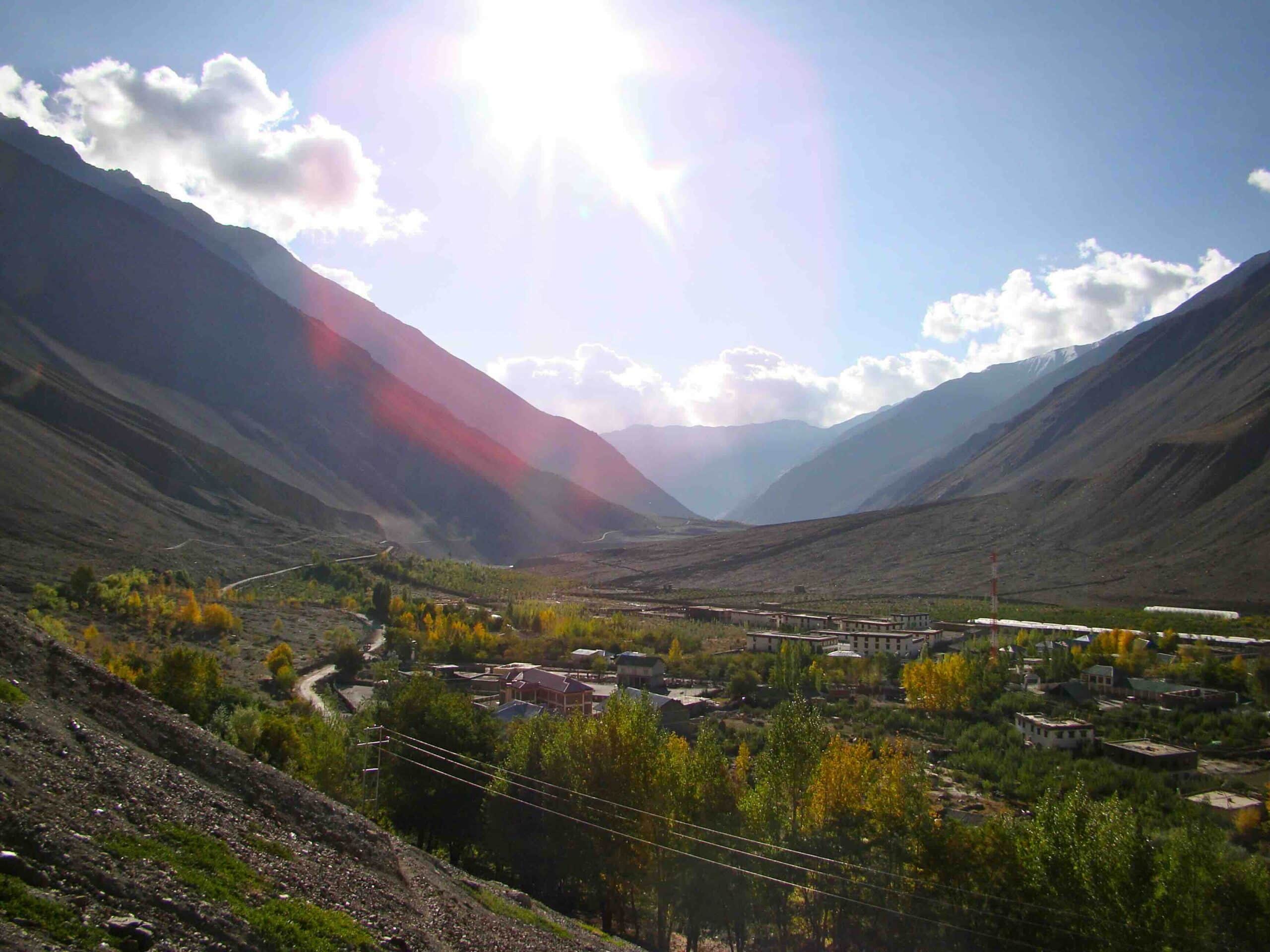
Consider Ladakh, one of India’s great high-altitude travel destinations. Leh is both a city and an important district headquarters, and excursions to places such as Nubra Valley, Pangong Lake, and Tso Moriri can involve visitor registration, environmental fees, or special permissions.
Foreign visitors traveling into certain protected border areas may require additional permits, while Indian citizens generally face fewer restrictions. Much of the paperwork can be handled online or through local tour operators, but the district administration manages important parts of the process.
For official visitor registration and permit information, see the Leh District Tourist Management System.
Then there’s Lakshadweep, the island Union Territory off the coast of Kerala. The entire territory is administered as one district, with its headquarters in Kavaratti. Visitors require an entry permit from the Lakshadweep administration, although applications can be made online.
And permits aren’t the only reason district administration might matter.
If you’re heading into the mountains and a landslide closes the road, the District Magistrate may be responsible for ordering restrictions or coordinating the emergency response.
And beyond the paperwork, districts can help explain why neighboring places have different industries, agricultural products, festivals, and local customs.
Will knowing all this change your trip to India? Probably not. But the next time someone mentions a district, at least you’ll know what they’re talking about.
And if you happen to find yourself at the District Collector’s office, I’d be curious to hear why.

 Ganesha: India’s Beloved Elephant-Headed God
 States vs. Union Territories: What’s the Difference?
 Salwar Kameez: India’s Everyday Three-Piece Outfit