Karnataka, Beyond the Landmarks
A state of royal cities, coffee hills, busy ports, ancient forts and working agricultural plains.
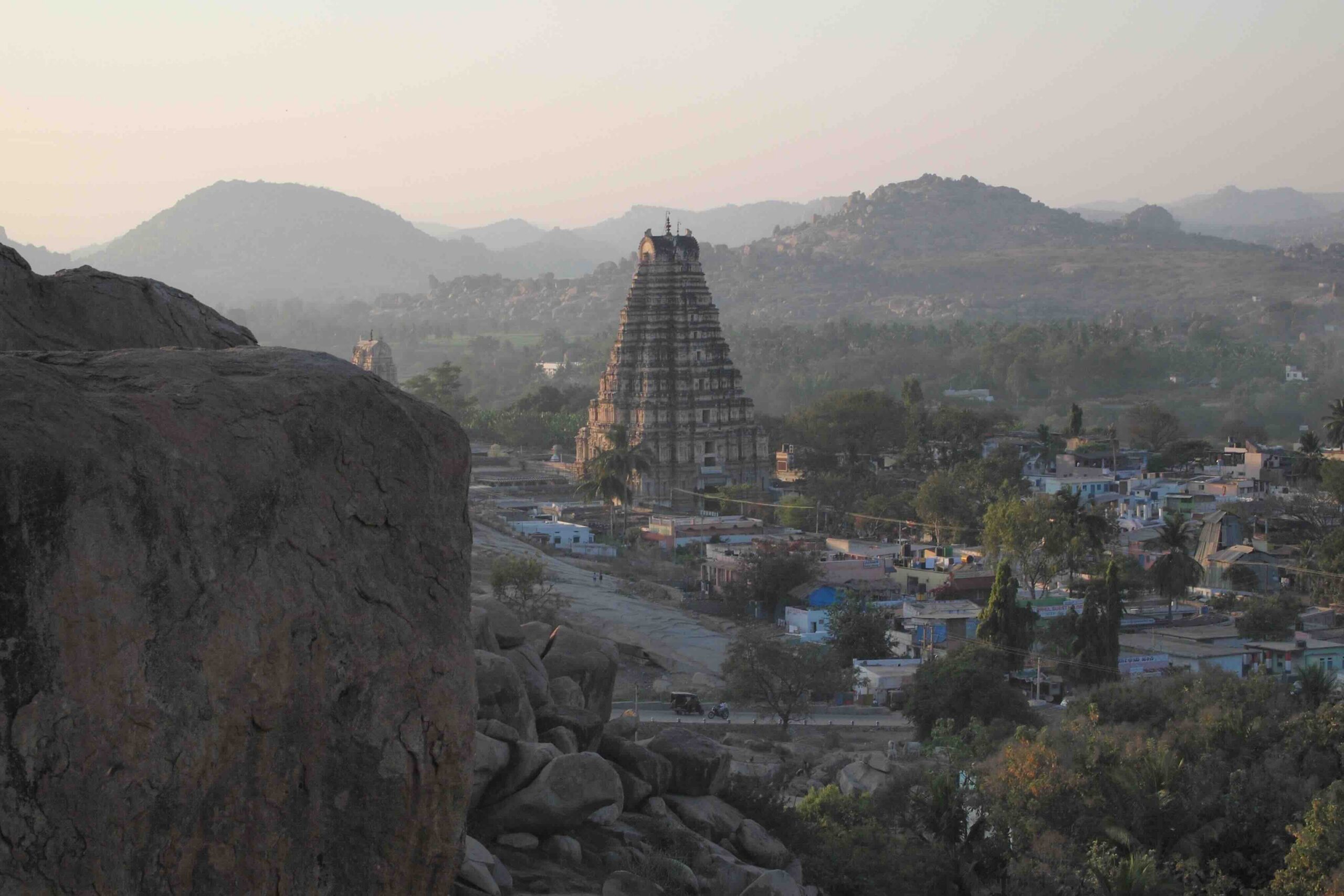
Karnataka refuses to fit into a single picture. Bengaluru’s technology economy, Mysuru’s royal avenues, the coffee estates of Kodagu, Hampi’s extraordinary ruins and the fishing harbors of the western coast belong to the same state, but they tell very different stories.
Travel inland from the Arabian Sea and the Western Ghats give way to dry plateau towns, cotton fields, sugar factories and old trading centers. Languages, food traditions, rainfall and livelihoods change with the landscape. The state’s most interesting details are often found outside the headline attractions: in agricultural markets, craft workshops, university towns and industrial districts.
This guide explores Karnataka through its 31 districts, grouped into four administrative divisions: Bengaluru, Mysuru, Belagavi and Kalaburagi. Each district profile looks at the places people visit and the work, industries and traditions that shape local life.
History & identity
Many Karnatakas, one state
The Hoysalas, Chalukyas, Vijayanagara rulers, Deccan sultanates and the kingdom of Mysore left architectural and cultural legacies across Karnataka. Kannada is the official language, while Tulu, Kodava, Konkani, Urdu, Marathi and other languages are important in different communities. Bengaluru is the capital, but the state cannot be understood through its largest city alone.
From heavy monsoon rainfall on the coast to water-scarce stretches of the northeastern plateau, geography shapes the economy as much as history does. Coffee, silk, software, mining, manufacturing, fisheries and agriculture all have a place in the story.
The districts
Four divisions. Thirty-one districts.
Below, Karnataka’s districts are arranged by administrative division rather than by a tourist circuit. Each illustrated district map will sit beside its editorial profile, using the same alternating magazine layout as our Andhra Pradesh guide.
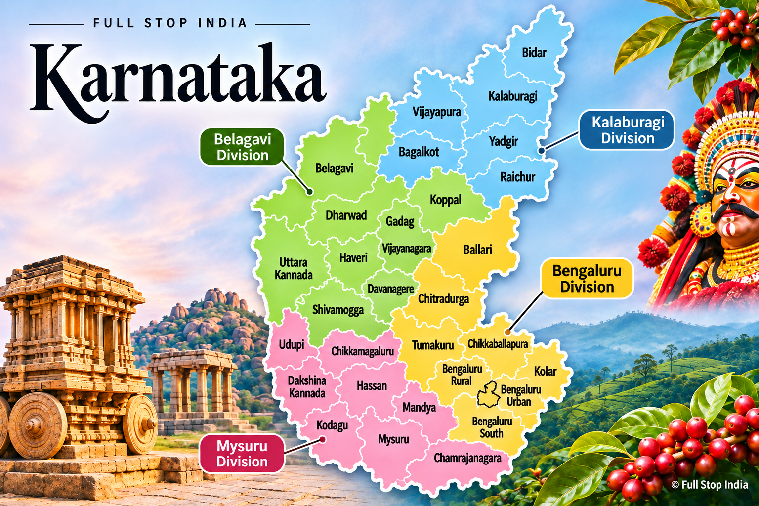
Division 01 / Bengaluru
Technology, market towns and the southern plateau
The Bengaluru division reaches well beyond the state capital. Technology and aerospace share the region with silk production, horticulture, granite, historic forts and the industrial towns of the central plateau.
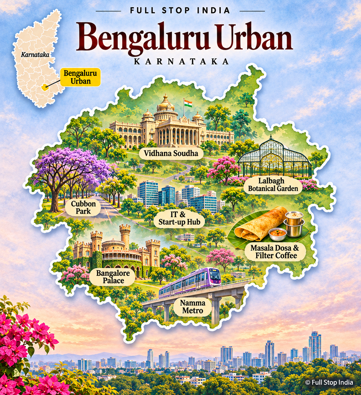
01 / Bengaluru Urban District
India’s technology capital, and a city of older neighborhoods
Bengaluru is the headquarters of India’s technology and startup economy, but its identity also rests on aerospace, research institutes, universities, garment factories and an enormous service workforce. The city grew around old market districts such as Chickpet and Basavanagudi, with lakes, parks and temple neighborhoods surviving amid the traffic and construction.
Lalbagh and Cubbon Park provide green relief, while the city’s food culture ranges from neighborhood darshinis to contemporary restaurants. The contrast between global corporate campuses and traditional wholesale markets is central to understanding Bengaluru. The old Pete neighborhoods, the city’s traditional markets and the public parks give Bengaluru a life that is easy to miss if you see only its technology campuses. Its aerospace and research institutions also predate much of the recent startup boom.
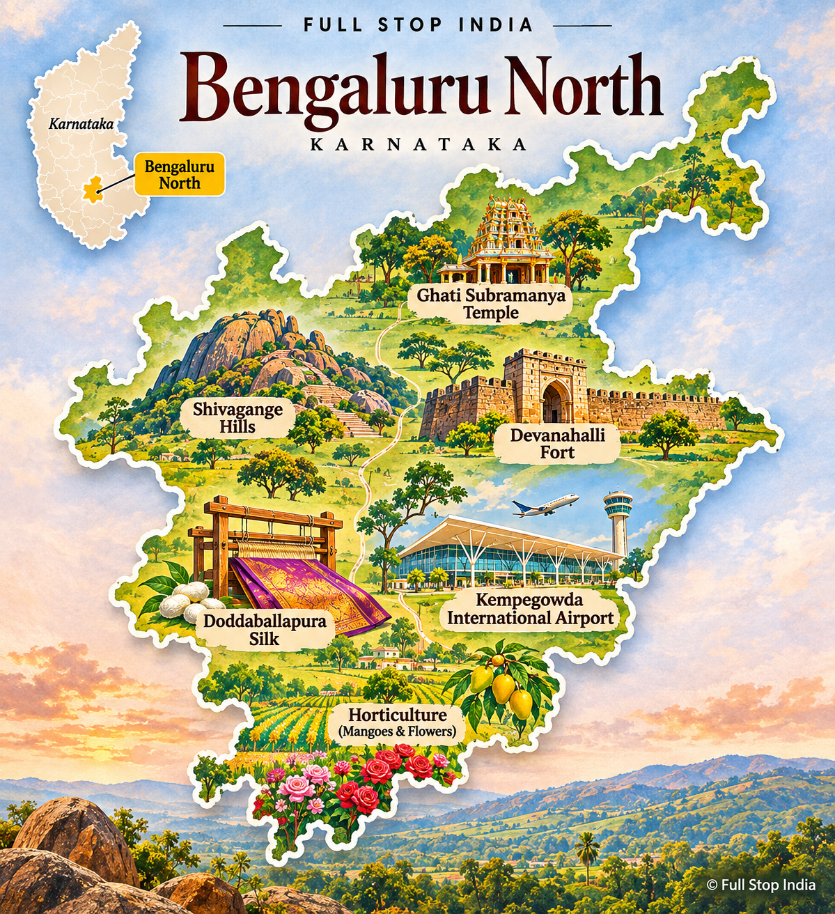
02 / Bengaluru Rural District
Silk, farming and the capital’s expanding edge
North and east of Bengaluru, villages and market towns are being reshaped by the capital’s outward growth. Devanahalli is associated with Kempegowda International Airport and its surrounding logistics and industrial investment, while farming remains important in many taluks. Grapes, vegetables, flowers and sericulture connect rural producers to urban markets.
Historic sites, including Devanahalli Fort, sit alongside new roads and warehouses. The district is neither purely agricultural nor simply suburban: land use, water supplies and employment are changing quickly as the metropolitan economy expands. Devanahalli’s airport has accelerated logistics and commercial construction, while farms continue to supply flowers, fruit and vegetables to the capital. That tension between farmland and metropolitan growth is one of the district’s defining stories.
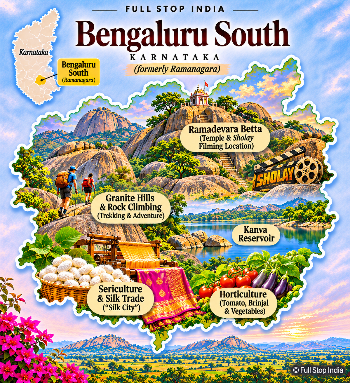
03 / Bengaluru South (formerly Ramanagara) District
Silk markets, granite hills and film landscapes
The district formerly known as Ramanagara is closely associated with sericulture and its silk cocoon markets. Rocky granite hills have made the area familiar to climbers and filmmakers, while Channapatna’s brightly painted wooden toys remain an important craft tradition. Agriculture, quarrying, small workshops and commuter connections to Bengaluru all contribute to the local economy.
The landscape changes rapidly between highway towns, reservoirs and boulder-covered hills. The district was renamed Bengaluru South in 2025; older maps and business listings may still use Ramanagara. Channapatna’s lacquered wooden toys remain a working craft industry, not simply a tourist purchase. Silk markets and granite outcrops give the district a character distinct from Bengaluru’s expanding suburbs.
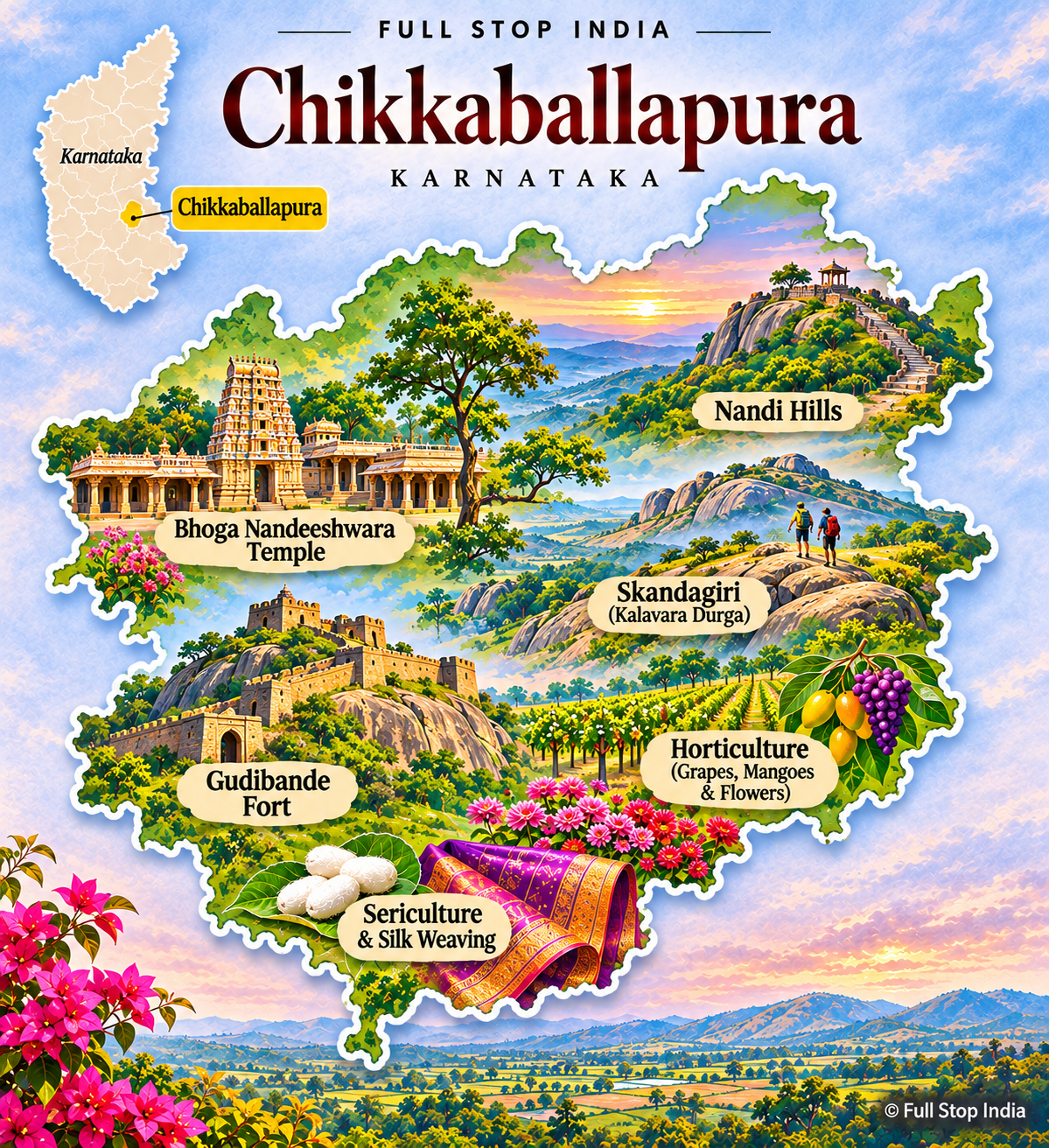
04 / Chikkaballapura District
Hill country, vineyards and horticultural farms
Nandi Hills is the best-known landmark, but Chikkaballapura is also a district of vegetable farms, flower growers, vineyards and market towns serving Bengaluru. Its rocky hills and comparatively cooler elevations influence agriculture, while road links to the airport and capital have encouraged warehousing and new investment. The birthplace of engineer and statesman M.
Visvesvaraya at Muddenahalli adds an important historical connection. Away from the weekend crowds at Nandi Hills, the district’s everyday character is shaped by growers, traders and the challenge of managing water on the dry southern plateau. Nandi Hills draws weekend visitors, but flower markets, vineyards and vegetable farms are equally characteristic of the area. Water scarcity makes the management of wells and irrigation a constant concern.
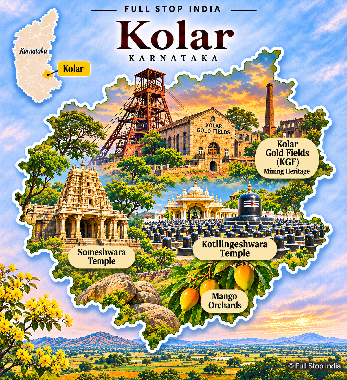
05 / Kolar District
Gold-mining history and a working agricultural landscape
Kolar Gold Fields shaped generations of labor, migration and industrial life, leaving behind mining settlements and a distinctive architectural legacy. Although the historic mines are no longer the economic engine they once were, the district remains important for dairying, vegetable production, horticulture and manufacturing connected to the Bengaluru region. Kolaramma and Someshwara temples reflect an older history.
Its countryside is relatively dry, so groundwater and irrigation are persistent concerns. Kolar is best understood as a district negotiating between its mining past and its agricultural and industrial present. The mining settlements of Kolar Gold Fields retain traces of a distinctive industrial and social history. Beyond them, dairying and vegetable cultivation connect the district closely to Bengaluru’s food markets.
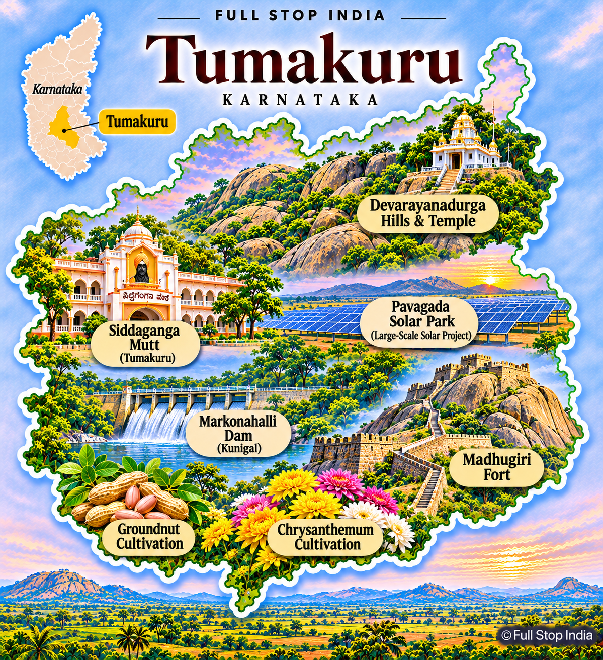
06 / Tumakuru District
Industrial corridors, coconut farms and pilgrimage hills
Tumakuru sits on major road and rail routes northwest of Bengaluru. Engineering, food processing and industrial estates have expanded alongside coconut, millet and other dryland agriculture. The district includes the pilgrimage center of Siddaganga Mutt, the hill fortress at Madhugiri and Devarayanadurga’s temples and wooded slopes.
Rural livelihoods vary sharply with rainfall and access to water, while proximity to the capital draws investment and commuters. Tumakuru is one of the clearest examples of Karnataka’s agricultural interior becoming part of a wider manufacturing corridor. Siddaganga Mutt and the fortified hill at Madhugiri show two sides of the district’s cultural landscape. Along the highways, industrial development is changing the relationship between Tumakuru’s towns and the villages around them.
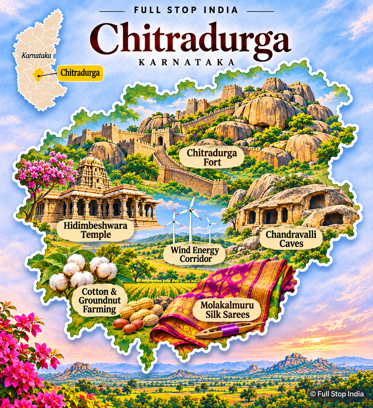
07 / Chitradurga District
Granite fortifications and wind-swept plains
Chitradurga Fort rises from a landscape of enormous granite formations and dry plains. Its walls, gateways and stories of Onake Obavva give the district a powerful historical identity. Beyond the fort, agriculture relies on crops suited to limited rainfall, including millets, pulses and oilseeds.
Wind-energy installations and mineral-related activity have become visible parts of the economy. Small towns function as trading centers for surrounding villages. The open terrain feels quite different from coastal Karnataka or the Western Ghats, and that geography explains much of the district’s farming and settlement pattern. Onake Obavva’s story remains part of the fort’s local identity, while dryland farming and wind power show how residents use the surrounding open plateau.
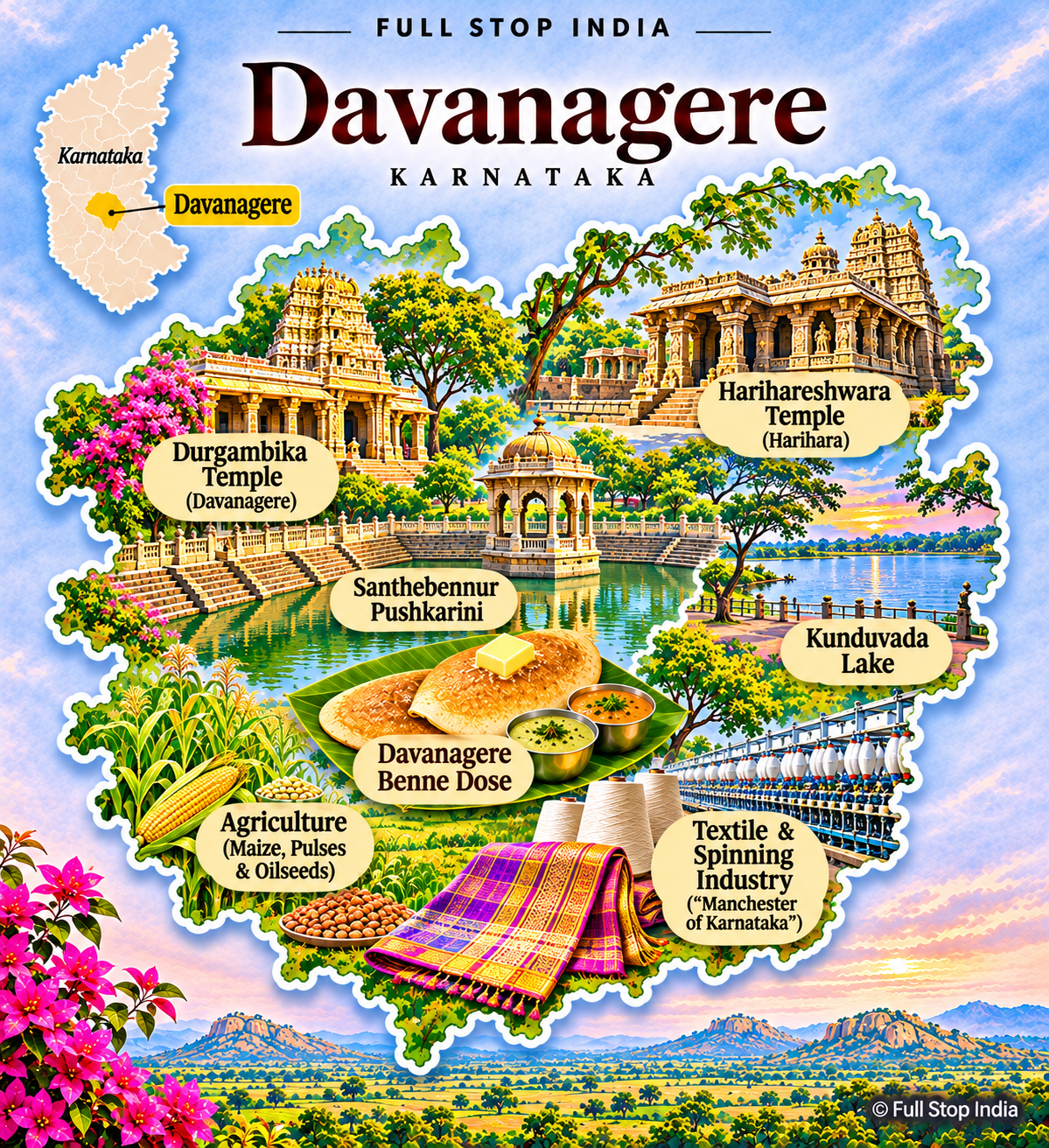
08 / Davanagere District
Textile heritage and the central Karnataka trading economy
Davanagere grew as a textile and cotton-trading center, with mills and commerce helping define its modern identity. Today education, healthcare, food businesses and wholesale markets are important alongside agriculture in the surrounding plains. The city is famous for benne dosa, but its commercial role reaches well beyond food.
Irrigated and rain-fed farming coexist across the district, and transport routes make Davanagere a practical link between northern and southern Karnataka. The region’s story is one of industrial heritage, expanding services and working agricultural communities. The textile legacy survives in the city’s commercial identity, although education, healthcare and food businesses now employ many residents. Benne dosa is a local institution, but the wholesale markets tell as much about Davanagere’s place in the region.
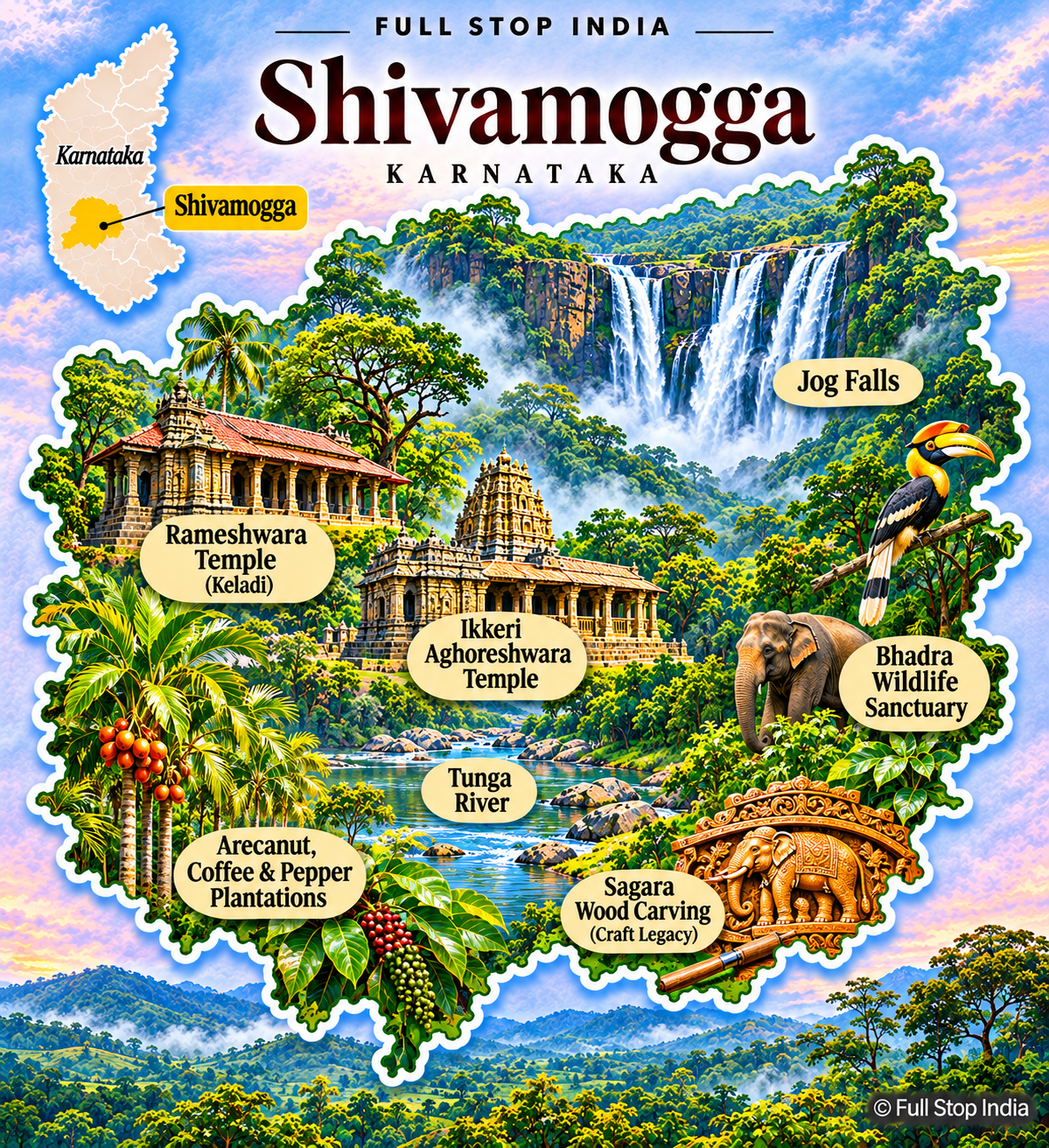
09 / Shivamogga District
Malnad forests, arecanut and river valleys
Shivamogga marks a transition from the central plateau to the rain-rich Malnad hills. Arecanut, paddy, spices and forestry-linked livelihoods shape the countryside, while the city serves as an educational, administrative and trading center. Jog Falls, the Sharavathi river system and forest landscapes are major attractions, but hydroelectric development and conservation are equally important to local life.
The district also includes historic and religious sites around Sagara and other towns. Rainfall, forest cover and agricultural markets give Shivamogga a distinctly different rhythm from the drier districts to the east. In the western taluks, the monsoon and forested river catchments shape both farming and electricity generation. The difference between these hills and the drier plateau is striking even within a short journey.
Division 02 / Mysuru
Royal cities, coffee hills and the Arabian Sea
The Mysuru division stretches from the heritage city of Mysuru through the Cauvery basin and coffee-growing Western Ghats to the Tulu-speaking coast. Tourism is only one part of a region built on farming, fisheries, ports, education and craft traditions.
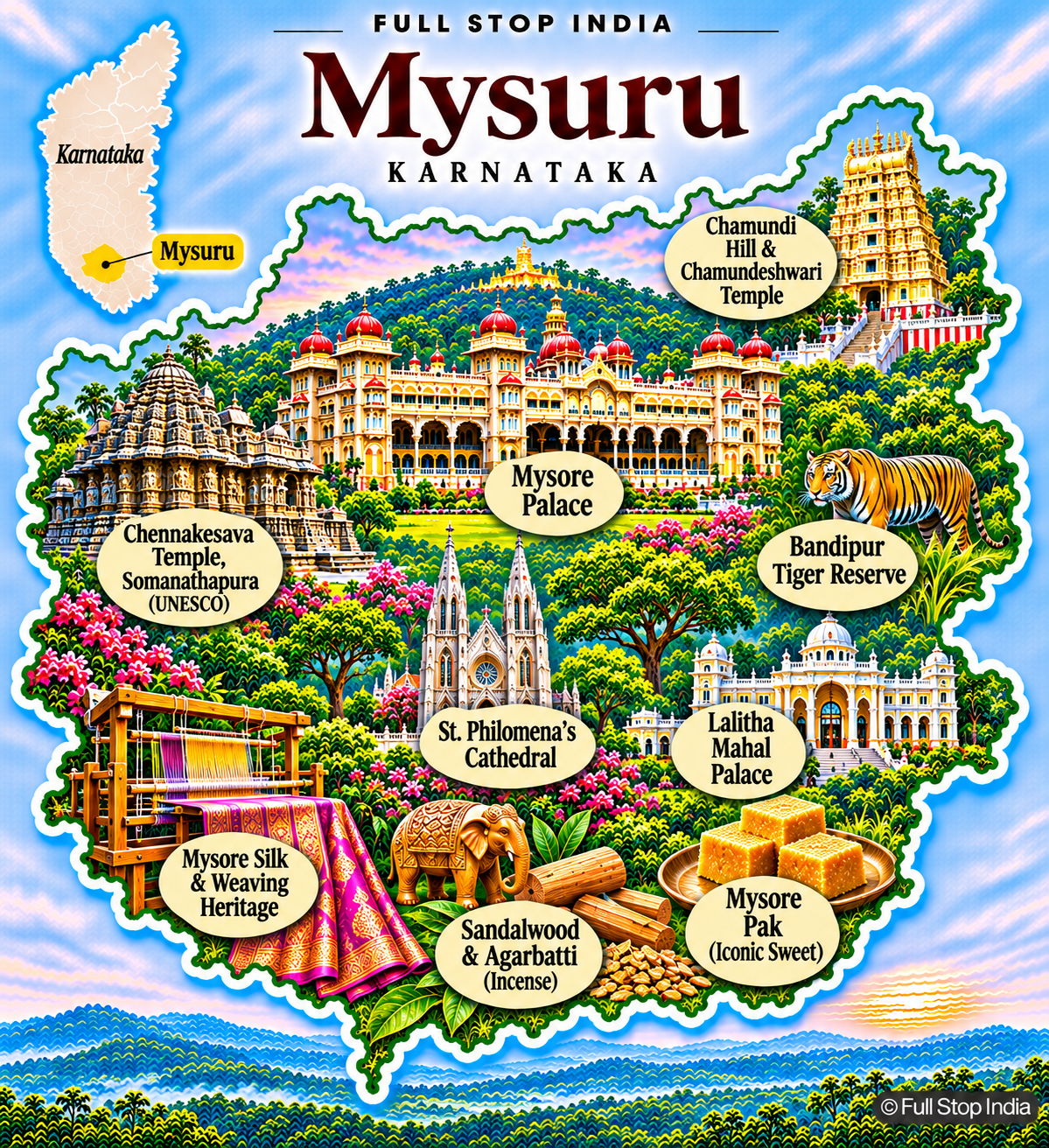
10 / Mysuru District
Palaces, silk and a regional cultural capital
Mysuru Palace and Dasara celebrations are famous, but Mysuru is also a university city, manufacturing center and important regional market. Silk weaving, sandalwood-related industries and incense production contribute to its commercial identity, while older residential neighborhoods preserve a slower urban rhythm than Bengaluru. The Chamundi Hills, Somanathapura’s Hoysala temple and the city’s markets reveal different layers of history.
Surrounding agriculture depends on the Cauvery basin. Mysuru’s strength is the combination of royal heritage, public institutions, craft industries and everyday urban life. Mysuru’s silk and incense businesses are part of an active manufacturing and trading economy. Its universities and older neighborhoods are just as important to the city as the palace and its ceremonial history.
11 / Mandya District
Sugarcane country on the Cauvery
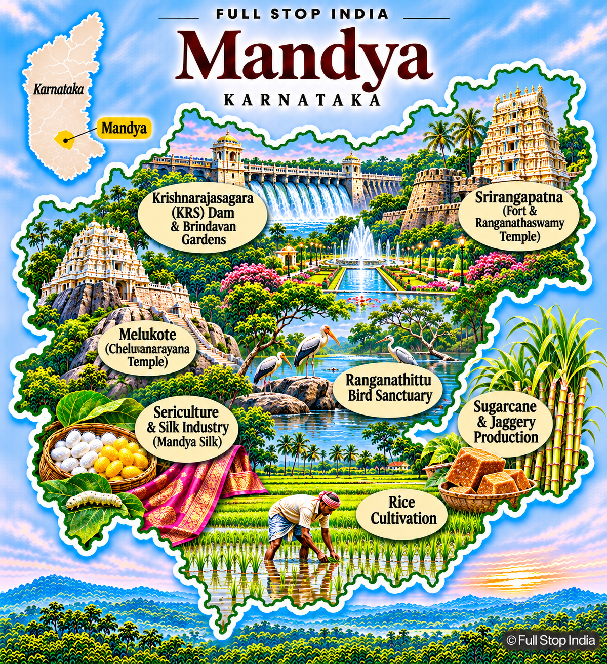
Mandya is one of Karnataka’s most recognizable agricultural districts. Irrigation from the Krishna Raja Sagara system supports sugarcane, paddy and other crops, and sugar mills and jaggery production are integral to its economy. Srirangapatna preserves the history of Tipu Sultan and the Mysore kingdom, while Melukote remains an important pilgrimage center.
Water management is a constant political and practical issue in a district dependent on the Cauvery. Mandya’s identity is as much about farmers, mills and irrigation canals as it is about its historic monuments. Sugar mills, irrigation canals and crop markets give Mandya a distinct working landscape. The district’s dependence on Cauvery water also makes the politics of river sharing especially immediate for local farmers.
12 / Hassan District
Hoysala architecture and the Malnad agricultural transition
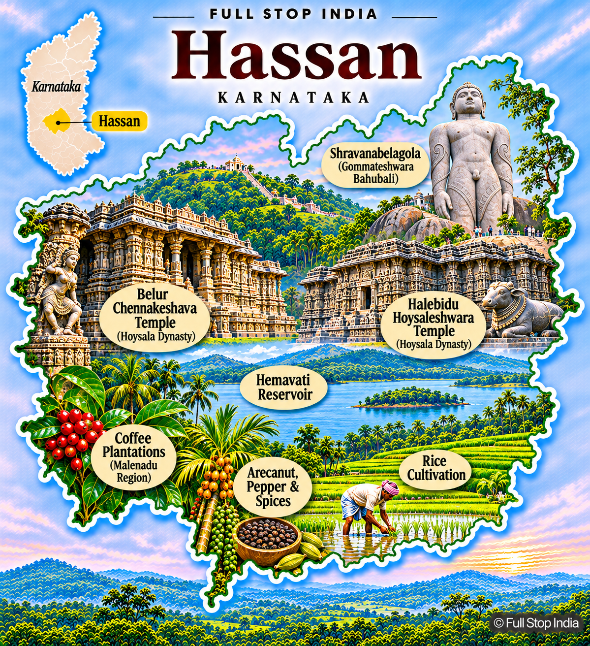
Belur and Halebidu contain some of the finest surviving Hoysala temples, and Shravanabelagola is a major Jain pilgrimage site. Yet Hassan’s district economy also includes coffee and arecanut in its wetter western areas, paddy and other crops on the plains, and trade centered on Hassan town. The Hemavathi reservoir plays a role in irrigation and water supply.
The district sits between the drier interior and the Western Ghats, producing a striking range of landscapes and livelihoods. Temple tourism and agricultural commerce exist side by side. The western coffee-growing slopes and the drier agricultural plains have different crops and rhythms. Visiting Hassan’s temples alone misses that contrast, and the trading towns that connect these landscapes.
13 / Chamarajanagar District
Forest reserves and the southern borderlands
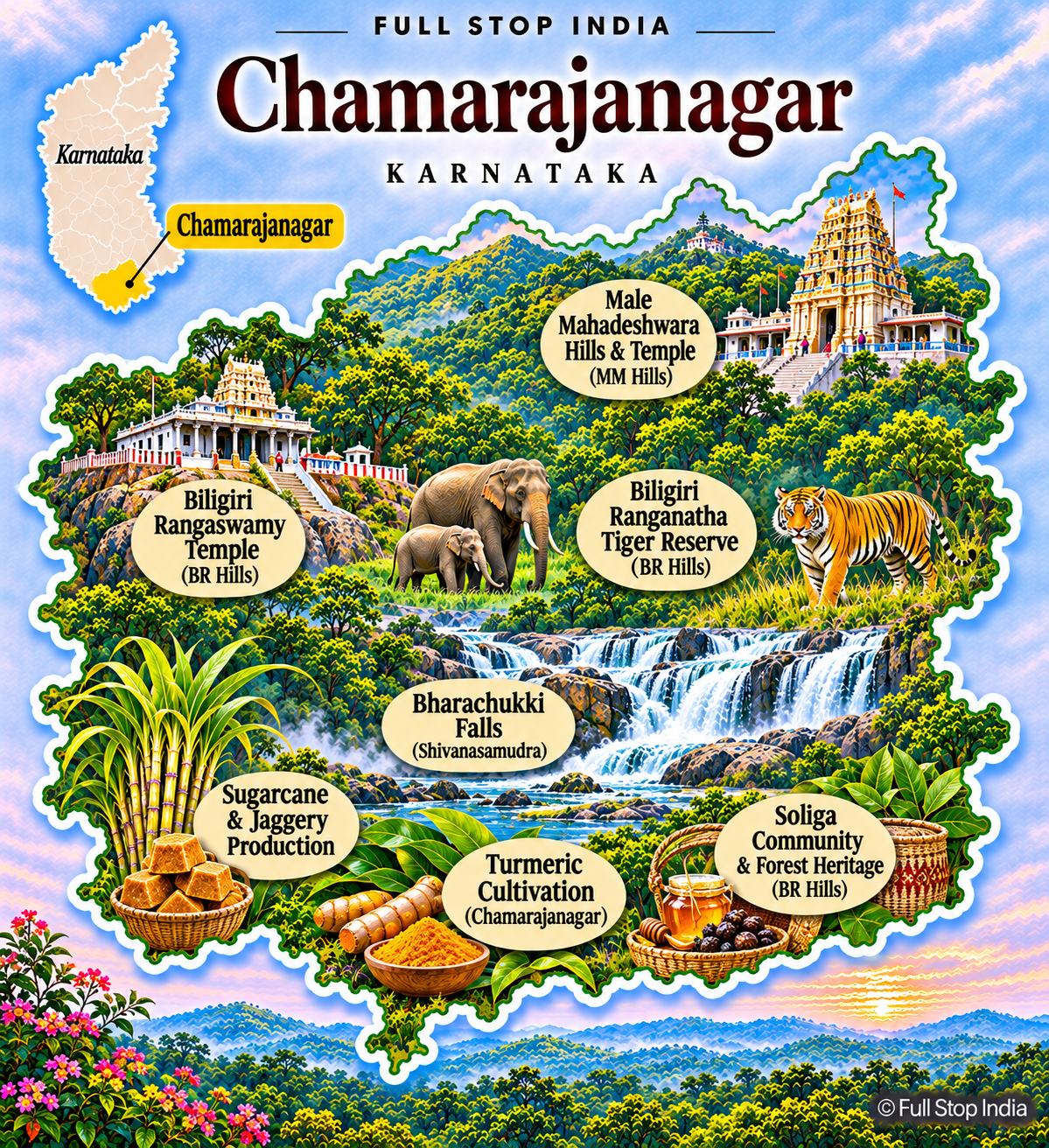
Chamarajanagar is closely associated with the Biligiri Ranganatha Hills, Bandipur’s forest landscape and the Male Mahadeshwara Hills pilgrimage area. Its protected forests support important wildlife habitats, while surrounding communities depend on agriculture, livestock and forest-linked livelihoods. The district borders Tamil Nadu and Kerala, giving some of its roads and markets an inter-state character.
Sugarcane, millets and horticulture appear across different farming zones. Conservation, pilgrimage traffic and rural development often meet in the same landscape, making this far more than a wildlife destination. The district’s forests are also inhabited landscapes. Pilgrimage routes, farming villages and protected wildlife areas exist close together, bringing practical questions about access and conservation.
14 / Kodagu District
Coffee estates and Kodava cultural identity
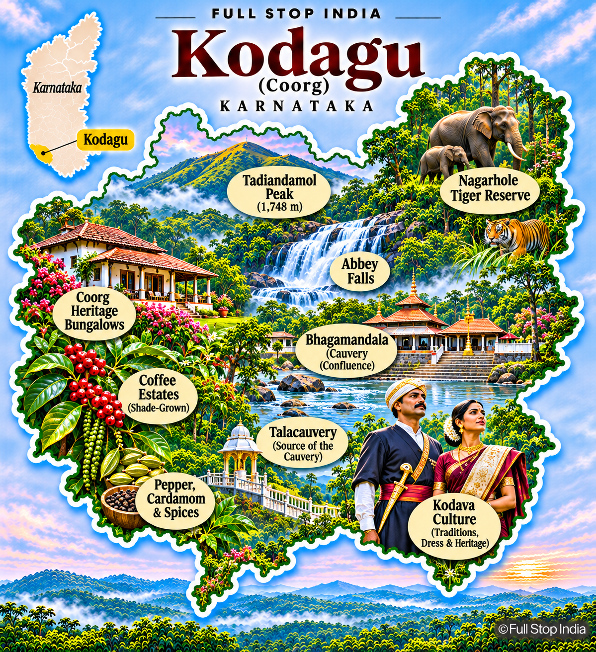
Kodagu, often called Coorg, is one of India’s best-known coffee-growing regions. Estate agriculture also produces pepper and other spices, and its wooded hills feed important river systems, including the Cauvery. Kodava language, dress, cuisine and family traditions give the district a cultural identity distinct from much of Karnataka.
Madikeri serves as an administrative and market center, while homestays and plantation tourism support a large visitor economy. Heavy rainfall, wildlife corridors and land-use pressures shape local debates about roads, tourism and conservation. Coffee may dominate Kodagu’s image, but the estates depend on workers, transport networks and trading centers. The region’s distinct cultural traditions are best understood alongside that everyday plantation economy.
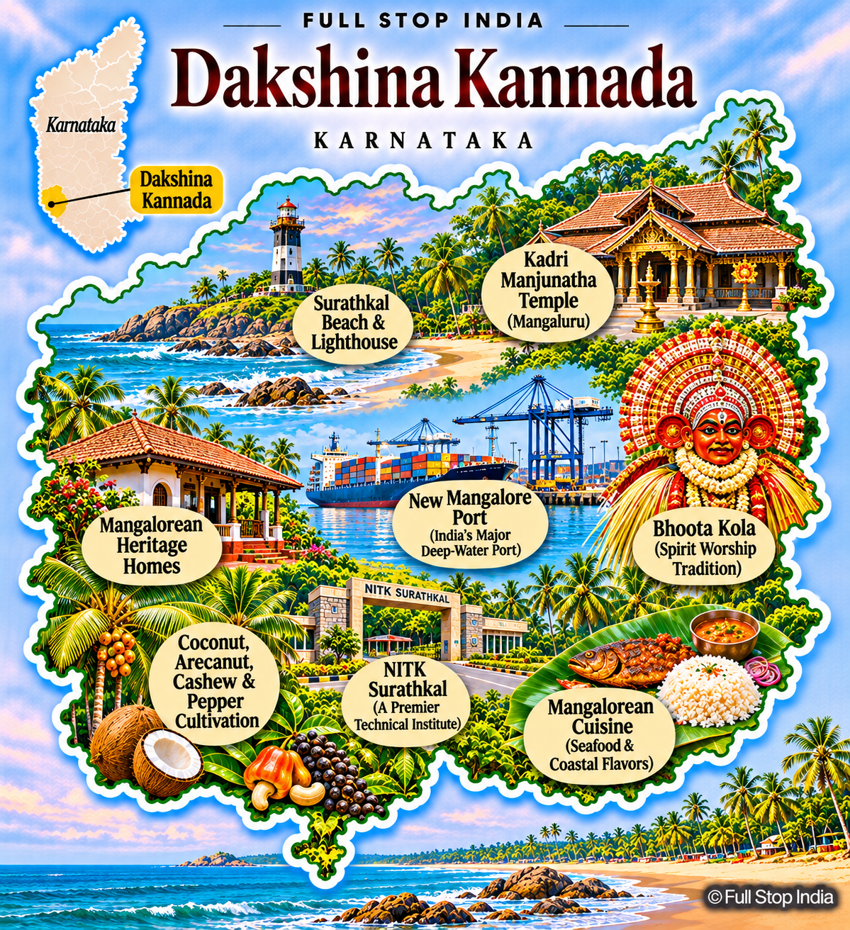
15 / Dakshina Kannada District
Mangaluru’s port economy and the Tulu coast
Mangaluru is a working port city with shipping, fisheries, education, banking, petrochemicals and food-processing industries. Inland villages grow arecanut, coconut, cashew and spices, while coastal settlements remain closely tied to fishing. Tulu culture, Bhoota Kola traditions, temples, churches and mosques reflect a complex regional history.
The district’s cuisine is celebrated, but its economic role as a gateway between the Arabian Sea and the Western Ghats is equally significant. Monsoon rainfall and coastal development shape both infrastructure and daily life. The port, fish markets and inland plantation crops make Dakshina Kannada one of Karnataka’s more varied regional economies. Mangaluru’s educational and financial institutions also draw people from well beyond the coast.
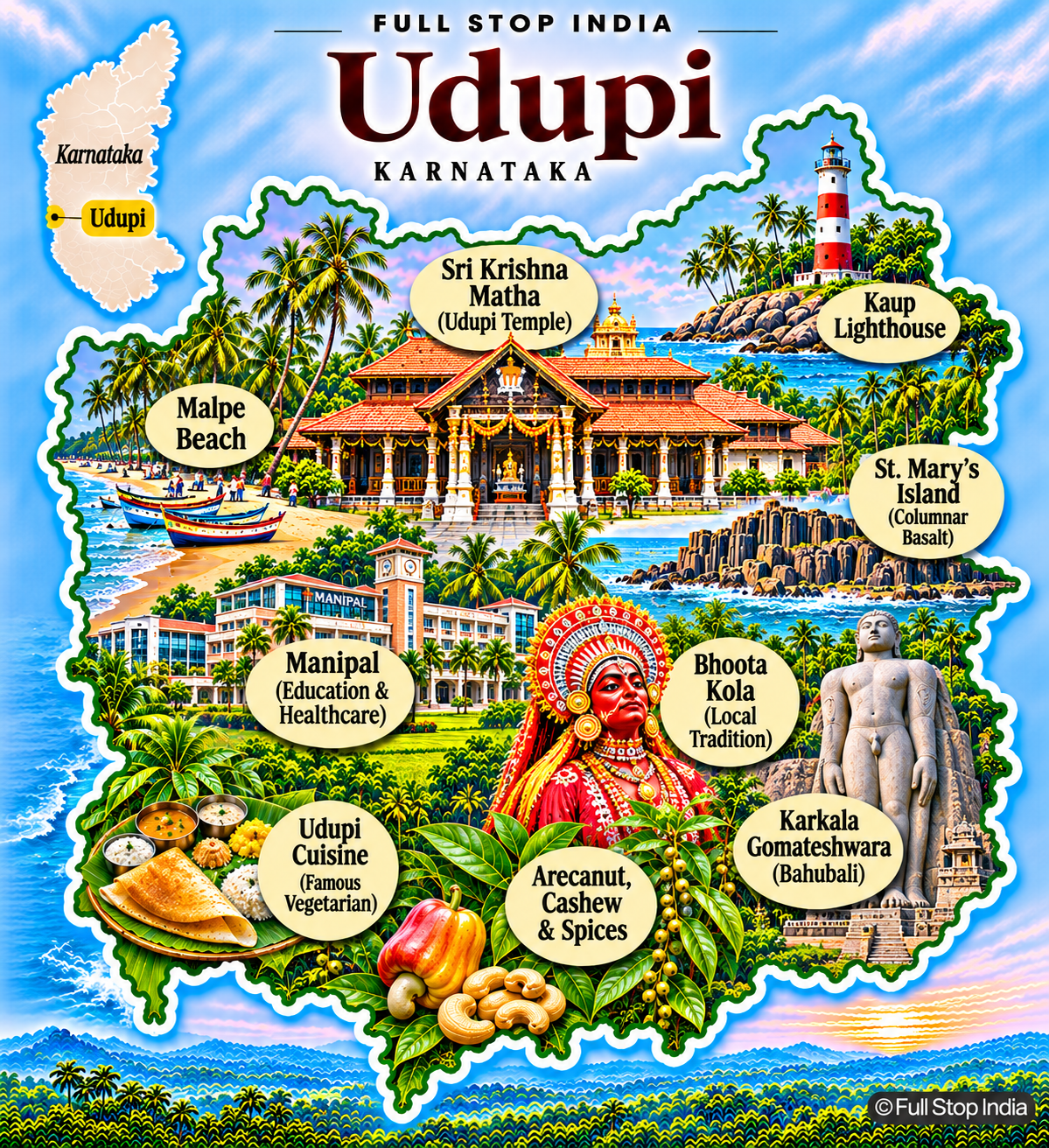
16 / Udupi District
Temple traditions, fisheries and coastal enterprise
Udupi is associated internationally with its vegetarian cooking and Krishna temple, but the district also has busy fishing harbors, educational institutions, banks and a substantial coastal economy. Coconut, arecanut, cashew and spices grow inland, while Malpe and other coastal communities depend on the sea.
The islands off Malpe, the lighthouse at Kaup and the Jain heritage of Karkala offer different perspectives on the region. Udupi’s identity blends religious institutions, entrepreneurship, fisheries and the everyday life of the Tulu-speaking coast. Fishing at Malpe and agriculture around Karkala provide a different perspective from the temple streets of Udupi town. Those industries are central to the district’s everyday life.
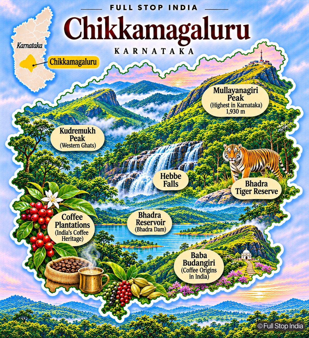
17 / Chikkamagaluru District
Coffee plantations beneath Karnataka’s highest hills
Chikkamagaluru is central to the history of coffee cultivation in India. Estates producing arabica and robusta extend across the Malnad hills, alongside pepper, cardamom and other crops. Mullayanagiri, the state’s highest peak, and the Kudremukh landscape make the district attractive to trekkers, while the Bhadra reservoir and protected forests reveal its ecological importance.
Chikkamagaluru town serves as a trading and service center for a wide agricultural hinterland. Coffee prices, labor availability, rainfall and forest protection are as much a part of local life as the scenery. Coffee cultivation supports a network of estate workers, processors, merchants and transport businesses. The district’s agricultural identity is therefore much broader than its scenic hill viewpoints.
Division 03 / Belagavi
The western coast, Deccan farms and historic trading towns
The Belagavi division spans coastal forests, the Western Ghats and the northern Deccan. Its districts are known for forts, temple architecture, textile traditions, sugar factories, educational institutions and crops adapted to very different rainfall patterns.
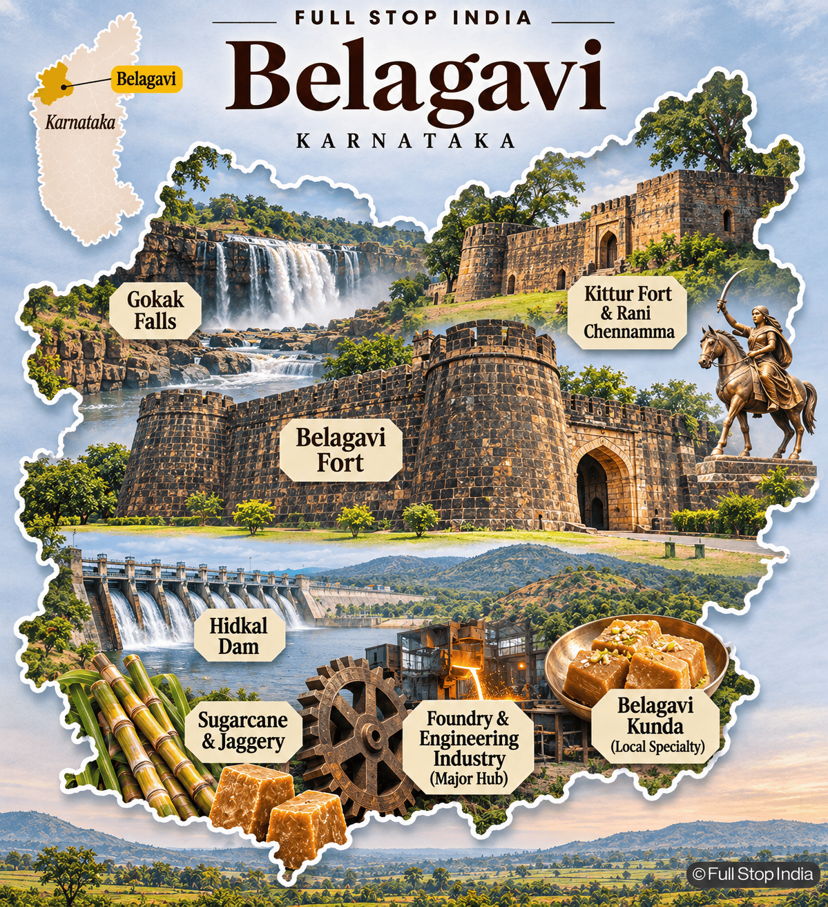
18 / Belagavi District
A borderland of forts, sugar mills and manufacturing
Belagavi lies close to Maharashtra and Goa, and its Kannada- and Marathi-speaking communities reflect a long borderland history. Foundries, engineering workshops and industrial estates make the city an important manufacturing center, while the wider district produces sugarcane and supports a substantial sugar industry. Belagavi Fort, Kittur’s history and Gokak Falls are prominent landmarks.
Khanapur’s wetter forested landscapes contrast with the northern plains. The district’s identity is inseparable from cross-border trade, agricultural processing and its role as a regional educational and commercial hub. The language mix and the trade crossing into neighboring states are evident in everyday markets. Sugar factories and engineering businesses connect Belagavi’s agricultural countryside to its industrial towns.
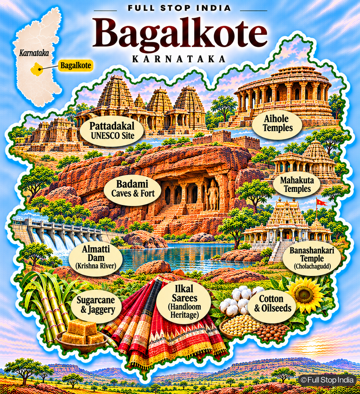
19 / Bagalkote District
Chalukya temples and the northern farming economy
Aihole, Badami and Pattadakal make Bagalkote one of India’s most important districts for early temple architecture; Pattadakal is a UNESCO World Heritage Site. The district also contains the Almatti Dam and agricultural communities growing sugarcane, cotton, pulses and oilseeds. Ilkal’s handwoven saris connect local craft to wider textile markets.
Limestone and other mineral resources support industry. Bagalkote combines extraordinary historic monuments with the working economy of the northern Deccan, where irrigation and rainfall strongly influence farm livelihoods. Ilkal weaving and the markets around the irrigated farming belt are reminders that the district’s history is not confined to temple architecture. Agriculture and mineral extraction remain important sources of work.
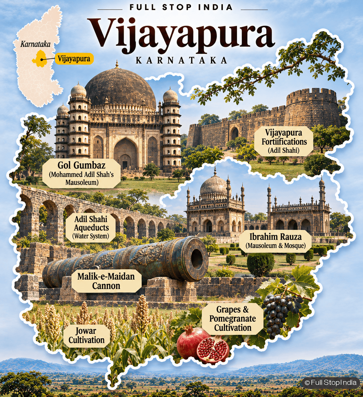
20 / Vijayapura District
Adil Shahi monuments and the dry Deccan
Vijayapura, historically Bijapur, is defined architecturally by the Adil Shahi period. Gol Gumbaz and Ibrahim Rauza are among the city’s best-known monuments, while fortifications, waterworks and mosques reveal a sophisticated historic capital. The surrounding district is much more agricultural than its monuments suggest, with jowar, pulses, sunflower, onions and horticulture important to local markets.
Water availability shapes farming choices in this relatively dry region. The district is a compelling meeting point between Deccan Sultanate history and the everyday economy of northern Karnataka. Beyond the monumental core of Vijayapura city, dryland farms and produce markets dominate much of the district. The availability of irrigation changes what can be grown and the security of farm incomes.
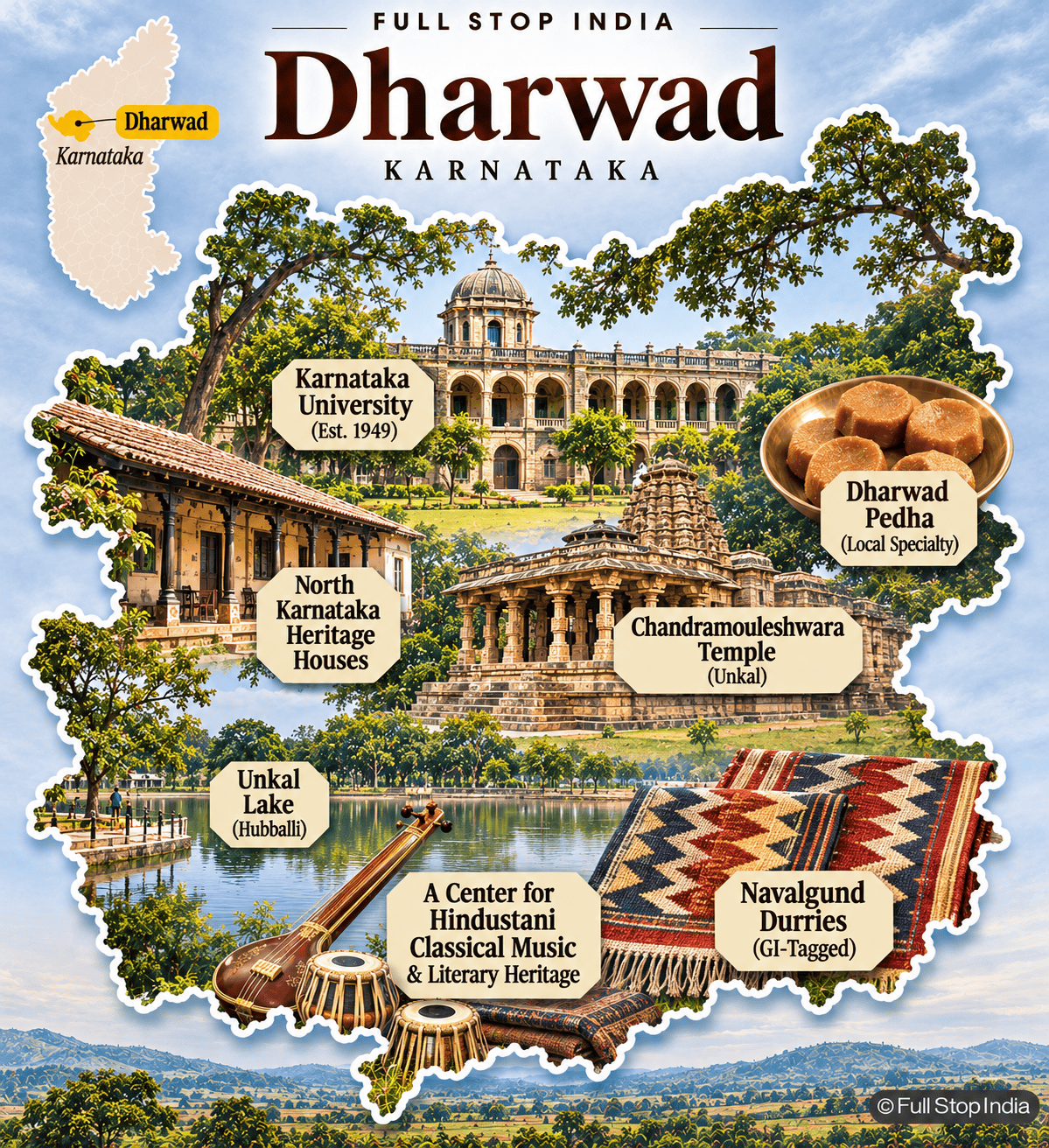
21 / Dharwad District
Universities, music and commercial towns
Dharwad and neighboring Hubballi form a major urban and commercial center of northern Karnataka. Universities, rail connections, wholesale markets, engineering businesses and services support a diverse economy. Dharwad has a distinguished association with Hindustani classical music, Kannada literature and education.
Its famous pedha is a small but memorable part of local food culture. Beyond the twin cities, villages grow a range of crops and support trading networks. The district’s significance comes less from a single tourist attraction than from its cultural institutions and its role as a northern Karnataka transport hub. Hubballi’s transport and wholesale economy complements Dharwad’s academic and musical institutions. Together the cities form a regional center whose importance is far greater than any one landmark.
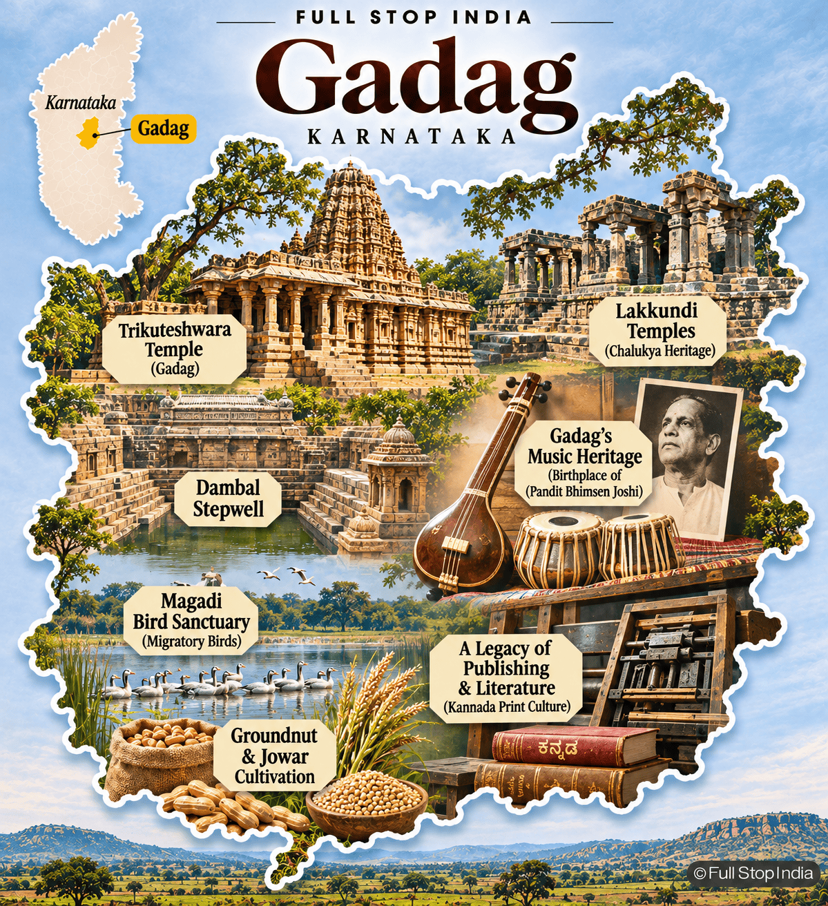
22 / Gadag District
Temple architecture and cotton-growing plains
Gadag is known for its Chalukya-era architectural heritage, especially Trikuteshwara Temple and the monuments of nearby Lakkundi. These sites preserve remarkable stone carving and early Kannada cultural history. The district’s economy also depends on cotton, groundnut, jowar and other crops suited to the northern plateau, with handloom work and trading towns contributing to local livelihoods.
Rainfall variability and access to irrigation affect farming decisions. Gadag rewards attention both to its historic temples and to the practical rural economy that surrounds them. The villages around Lakkundi and Gadag are shaped by dryland crops, seasonal rainfall and trading networks. The district’s architecture is remarkable, but its agricultural economy remains central to daily life.
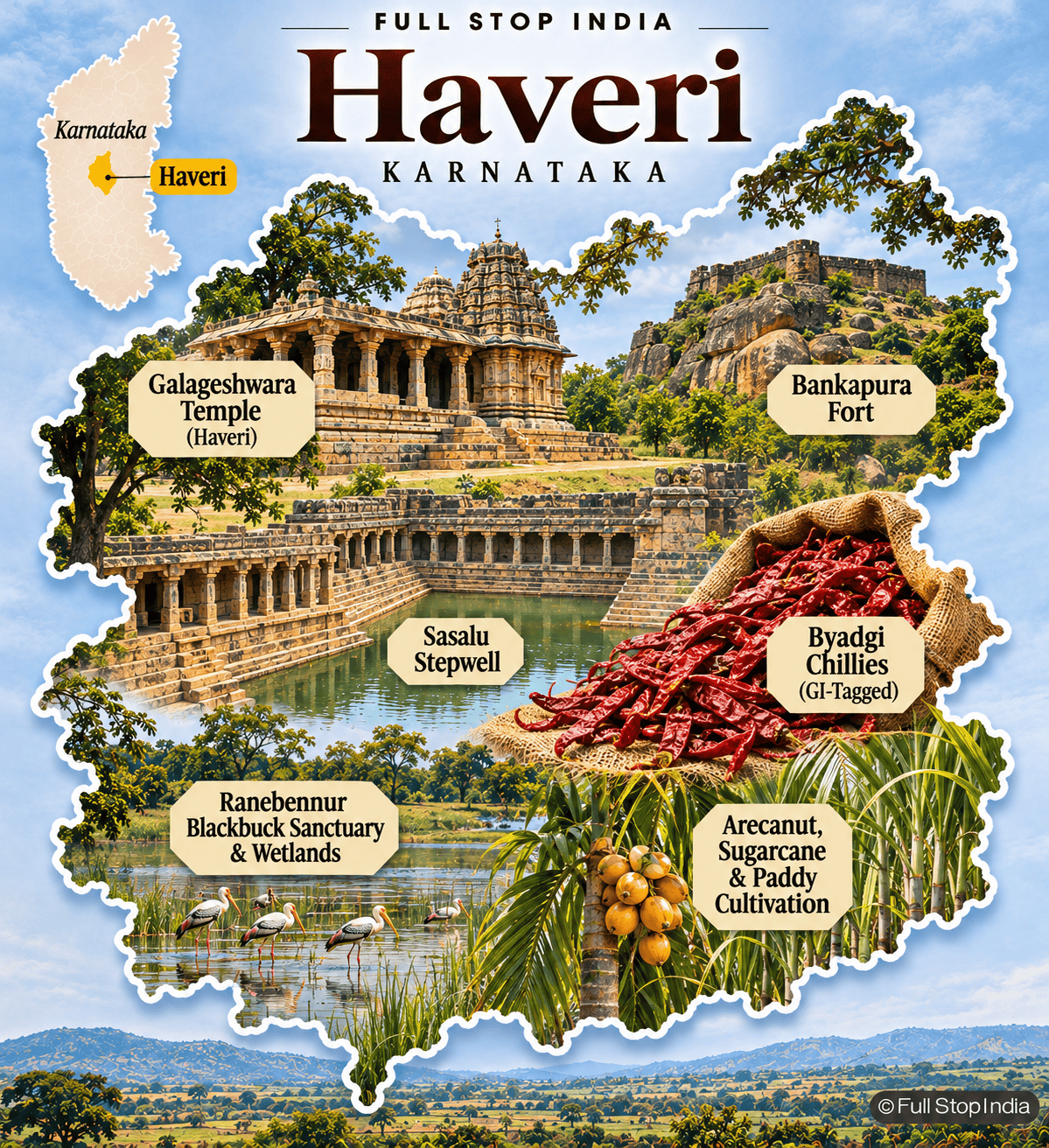
23 / Haveri District
Byadgi chillies and agricultural market towns
Haveri’s best-known agricultural product is the Byadgi chilli, valued for its deep color and used in kitchens far beyond Karnataka. Markets, processors and growers connect this crop to a wider food economy, while arecanut, paddy, sugarcane and other crops appear across the district. Historic temples, including Galageshwara, and the Bankapura area add architectural interest.
Ranebennur’s blackbuck sanctuary is an ecological landmark. Haveri is a district where agricultural commerce and small-town life provide as much context as its heritage sites. The Byadgi chilli trade connects growers with merchants and processors supplying markets far beyond Karnataka. The district’s smaller towns are important links in that chain.
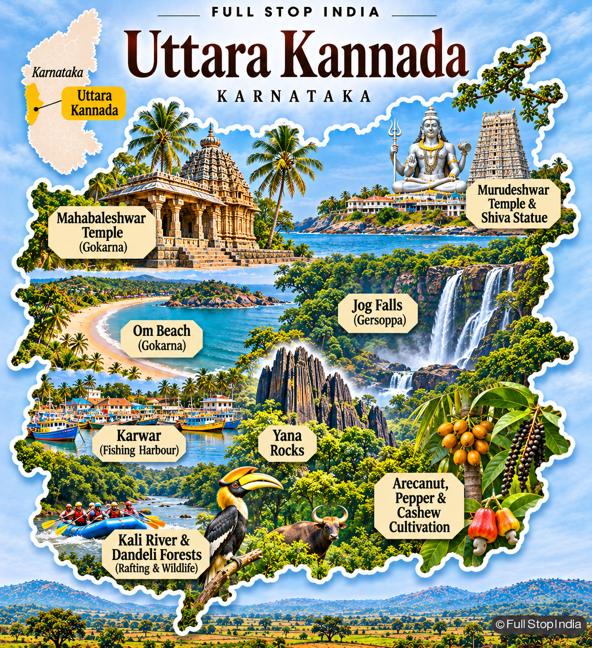
24 / Uttara Kannada District
Forests, beaches and the Kali River
Uttara Kannada stretches along the Arabian Sea and inland into the Western Ghats. Fishing villages, ports, coastal tourism, forestry-linked livelihoods and plantation crops share a landscape of heavy monsoon rainfall. Gokarna and Murudeshwar are important religious and coastal destinations, while Dandeli and the Kali River region are associated with forests and wildlife.
Karwar is an administrative and maritime center. The district’s economic and ecological questions include fishing livelihoods, hydropower, tourism pressure and the protection of one of southern India’s most extensive forest landscapes. Coastal fishing communities, inland plantations and forest settlements face very different conditions within the same district. The Western Ghats and heavy monsoon rainfall explain much of that variation.
Division 04 / Kalaburagi
Deccan forts, grain markets and the northeastern plains
The Kalaburagi division covers much of northeastern Karnataka, where Deccan Sultanate architecture, historic forts, major river systems, irrigation projects, mining and dryland agriculture shape a distinct regional identity.
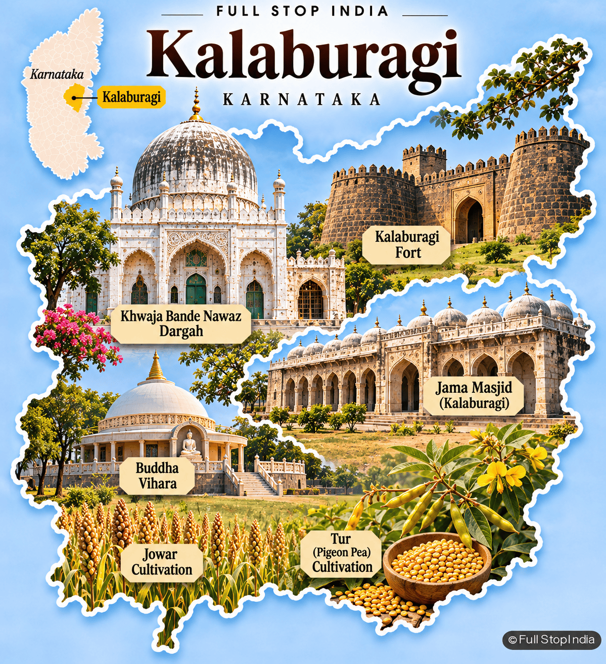
25 / Kalaburagi District
Sufi heritage and the pulse-growing Deccan
Kalaburagi, formerly Gulbarga, preserves important Bahmani-era monuments, including its fort and congregational mosque. The shrine of Khwaja Bande Nawaz remains a major center of devotion. The district is also closely associated with tur, or pigeon pea, cultivation and processing, along with jowar and other dryland crops.
Universities, public institutions and regional commerce support the city. Water availability, agricultural prices and employment opportunities are central concerns across the countryside. Kalaburagi’s identity is a blend of Deccan history, Sufi traditions and the working economy of the northeastern plateau. The district’s tur markets and processing businesses connect dryland farmers to food buyers across India. They are a significant part of Kalaburagi’s identity alongside its Bahmani and Sufi heritage.
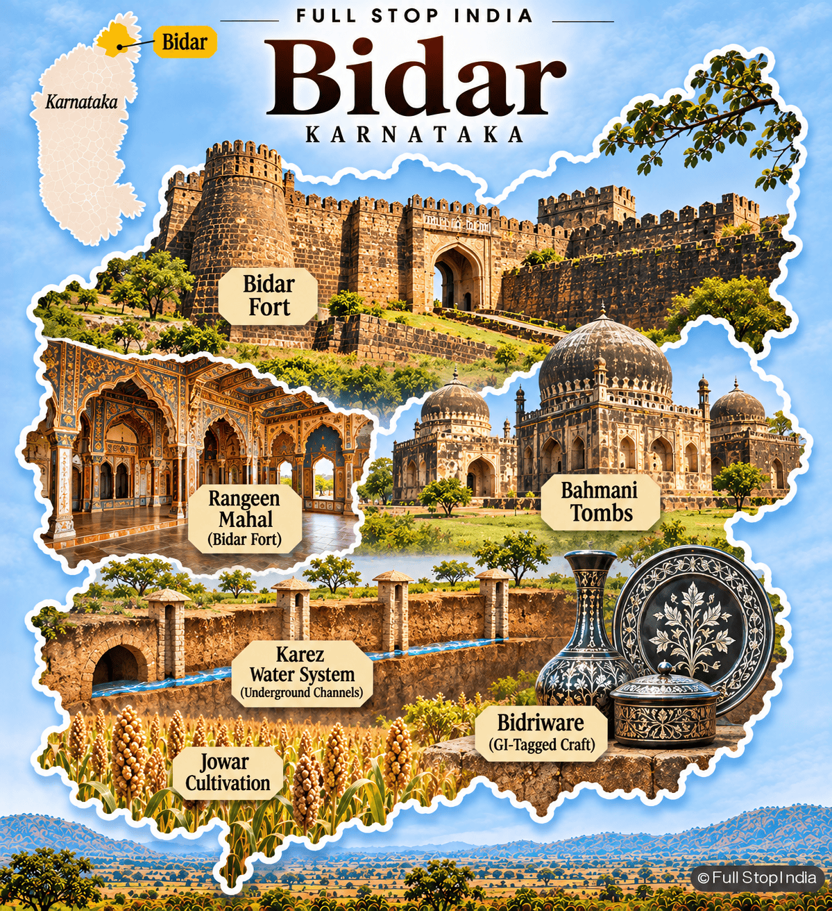
26 / Bidar District
Bahmani architecture and Bidri metalwork
Bidar’s great fort, Bahmani tombs and historic water systems speak to its role as a Deccan political and cultural center. The city’s Bidriware—dark metal objects decorated with silver inlay—is one of Karnataka’s most distinctive craft traditions. Agriculture across the district includes jowar, pulses and oilseeds, with horticulture and livestock also important.
Bidar’s location near Telangana and Maharashtra gives it a cross-border commercial character. Its heritage is unusually rich, but local livelihoods extend far beyond the monuments into workshops, farms and markets. Bidriware remains a living craft, with artisans continuing the city’s distinctive metal-inlay tradition. Agricultural markets and cross-border trade give the surrounding district a different, equally important identity.
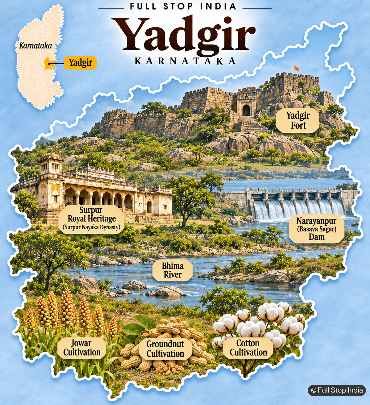
27 / Yadgir District
Rocky forts, irrigation and dryland crops
Yadgir is a district of granite outcrops, historic fortifications and agricultural settlements. The old fort overlooks Yadgir town, while Surpur’s royal history adds another layer to the district’s identity. The Krishna and Bhima river systems and the Narayanpur, or Basava Sagar, reservoir are important to irrigation and water management.
Jowar, cotton, groundnut and pulses support rural livelihoods, although rainfall and access to water remain decisive. Yadgir is less developed as a visitor destination than many Karnataka districts, which makes its everyday farming and trading landscape particularly important to describe. The reservoir and river systems are central to agriculture, but access to dependable irrigation varies from place to place. That difference helps explain the district’s rural economy.
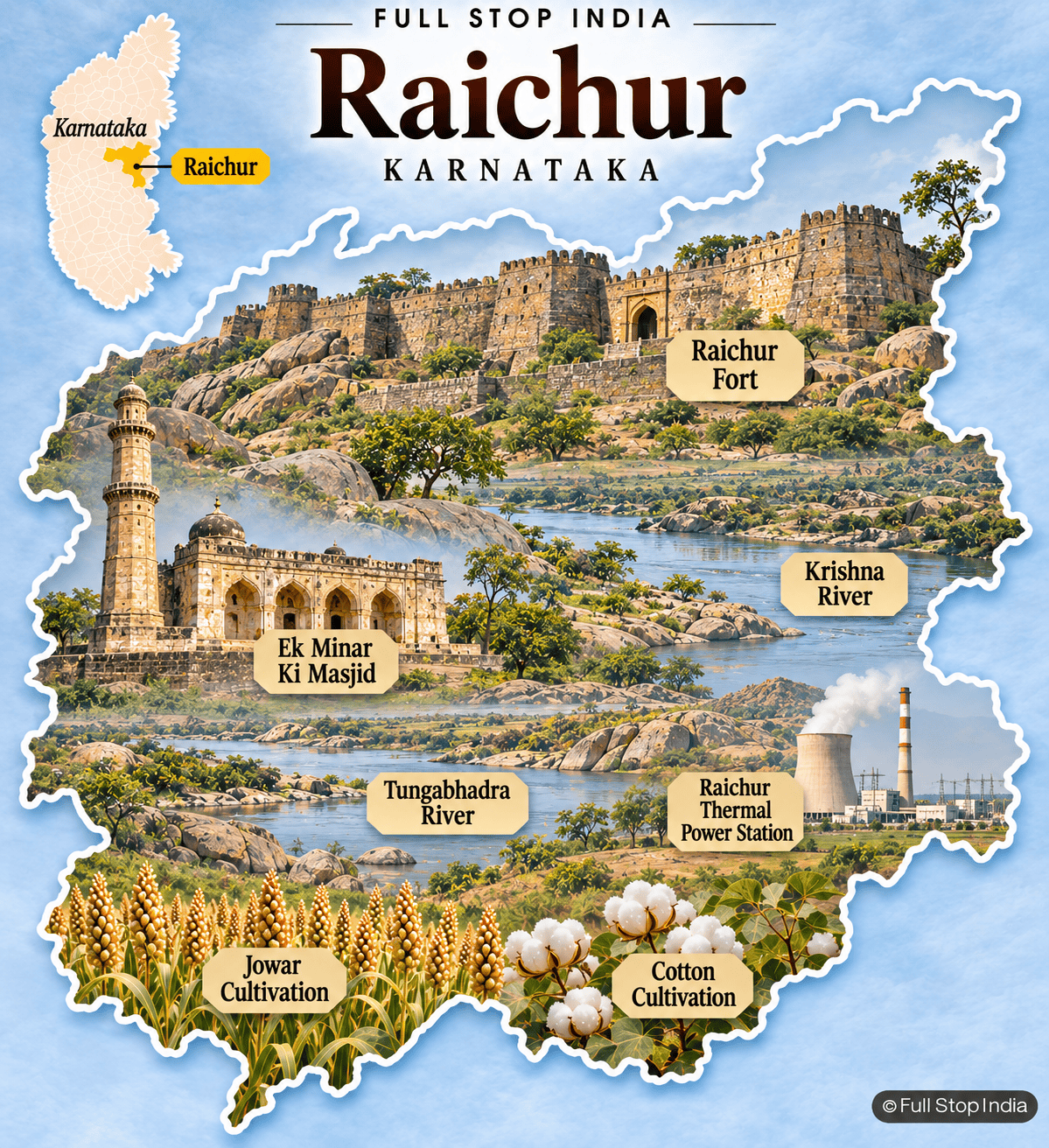
28 / Raichur District
Fort walls, power generation and the Krishna basin
Raichur lies between the Krishna and Tungabhadra rivers, an area whose fertile irrigated tracts contrast with drier farming land. Raichur Fort and other historic structures reflect centuries of competition over this strategically placed region. The Raichur Thermal Power Station is a major industrial landmark, while rice, cotton, jowar and other crops support agricultural markets.
Irrigation infrastructure, electricity generation and water management play a substantial role in the district’s economy. Raichur’s story connects medieval fortifications with modern energy production and farming. Thermal power generation, irrigated cultivation and dryland farming sit close together in Raichur. The contrast shows why energy and water management matter so much to the district’s economy.
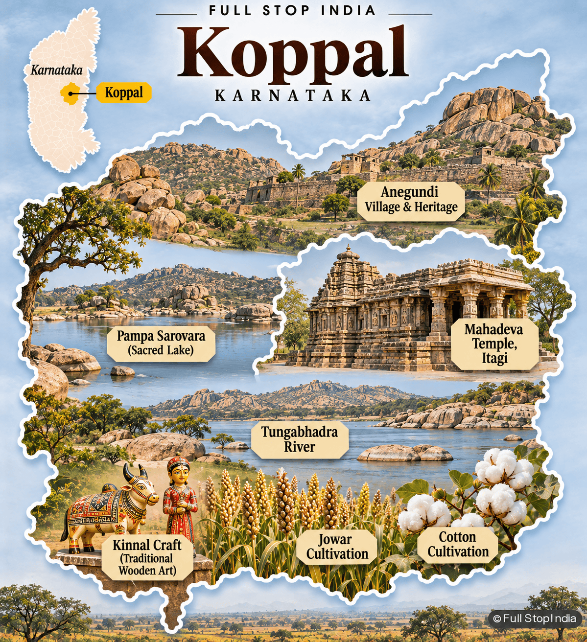
29 / Koppal District
Anegundi, granite landscapes and farming
Koppal contains Anegundi and important parts of the wider Hampi cultural landscape, where the Tungabhadra River winds through hills of rounded granite boulders. Historic sites and temple traditions coexist with farms producing jowar, cotton, sunflower and other crops. Gangavathi is a significant agricultural trading center, especially in irrigated areas.
Stoneworking, transport and local businesses contribute to the economy. The district’s appeal lies in the contrast between extraordinary historic landscapes and the villages and fields that remain part of the same river basin. Gangavathi’s markets and irrigated fields demonstrate that the Hampi landscape is also a working agricultural region. The river supports livelihoods as well as the monuments that bring visitors.
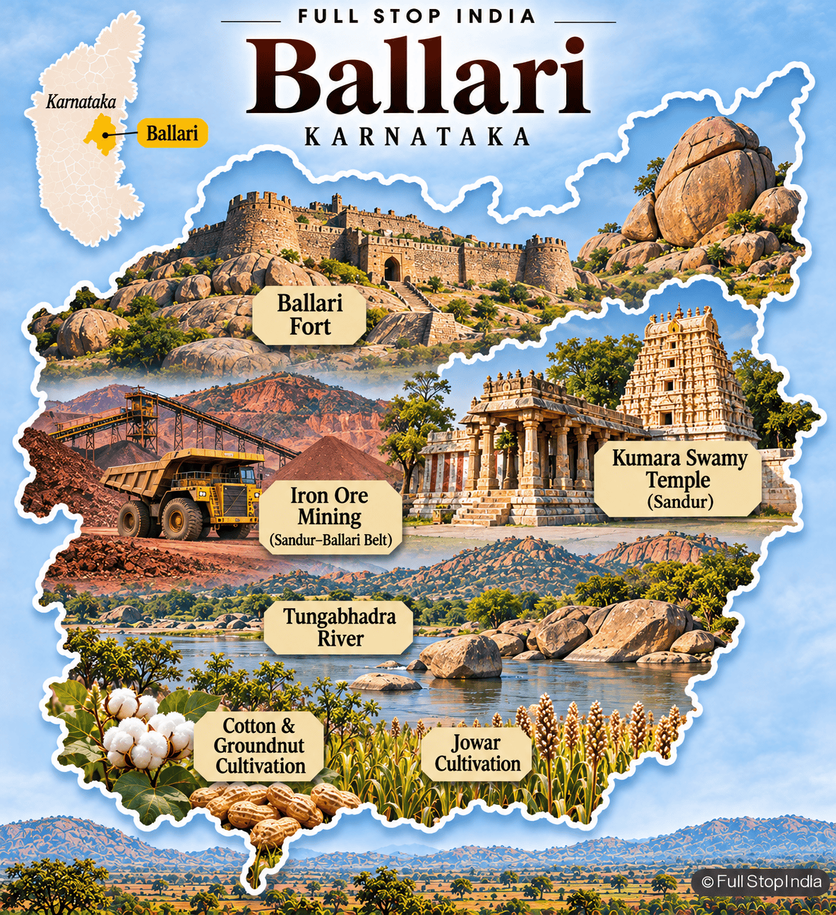
30 / Ballari District
Iron ore, industry and a fortified hill city
Ballari’s granite hills and historic fort are visible reminders of an older strategic city, but the district’s modern economy is heavily influenced by iron-ore mining, steel-related industry and transport. The region also supports cotton, groundnut, jowar and other agriculture, with water access determining where irrigation is possible.
Ballari’s mining history has brought employment, environmental controversy and major changes to local infrastructure. Hampi is often associated with the wider Ballari region, but it now lies in the separate Vijayanagara district created in 2021. The mining industry has transformed transport, employment and land use around Ballari. Its environmental consequences are part of the modern district’s story, not a separate issue.
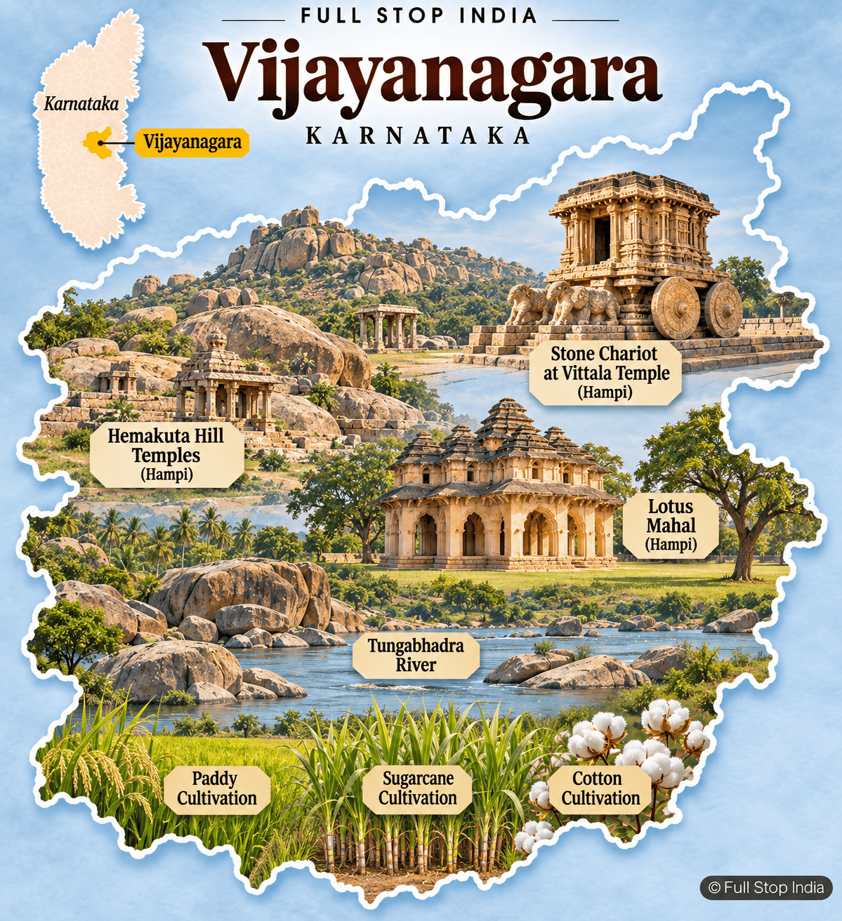
31 / Vijayanagara District
Hampi’s ruins and the working Tungabhadra valley
Vijayanagara district, with Hosapete as its headquarters, includes Hampi’s UNESCO-listed monuments and much of the remarkable granite landscape of the former imperial capital. The Stone Chariot, Virupaksha Temple and the royal enclosures attract visitors from around the world. Yet the district is also shaped by the Tungabhadra River, irrigated farming, sugarcane, paddy, cotton and industrial activity around Hosapete.
The creation of a separate district in 2021 distinguished this historic area administratively from Ballari. Heritage protection, agriculture and modern development now share the same landscape. The river valley around Hosapete supports farms, markets and industrial activity alongside Hampi’s archaeological landscape. The district’s 2021 separation from Ballari makes it especially important to distinguish the two in a contemporary guide.
Karnataka beyond the map
Food & everyday life
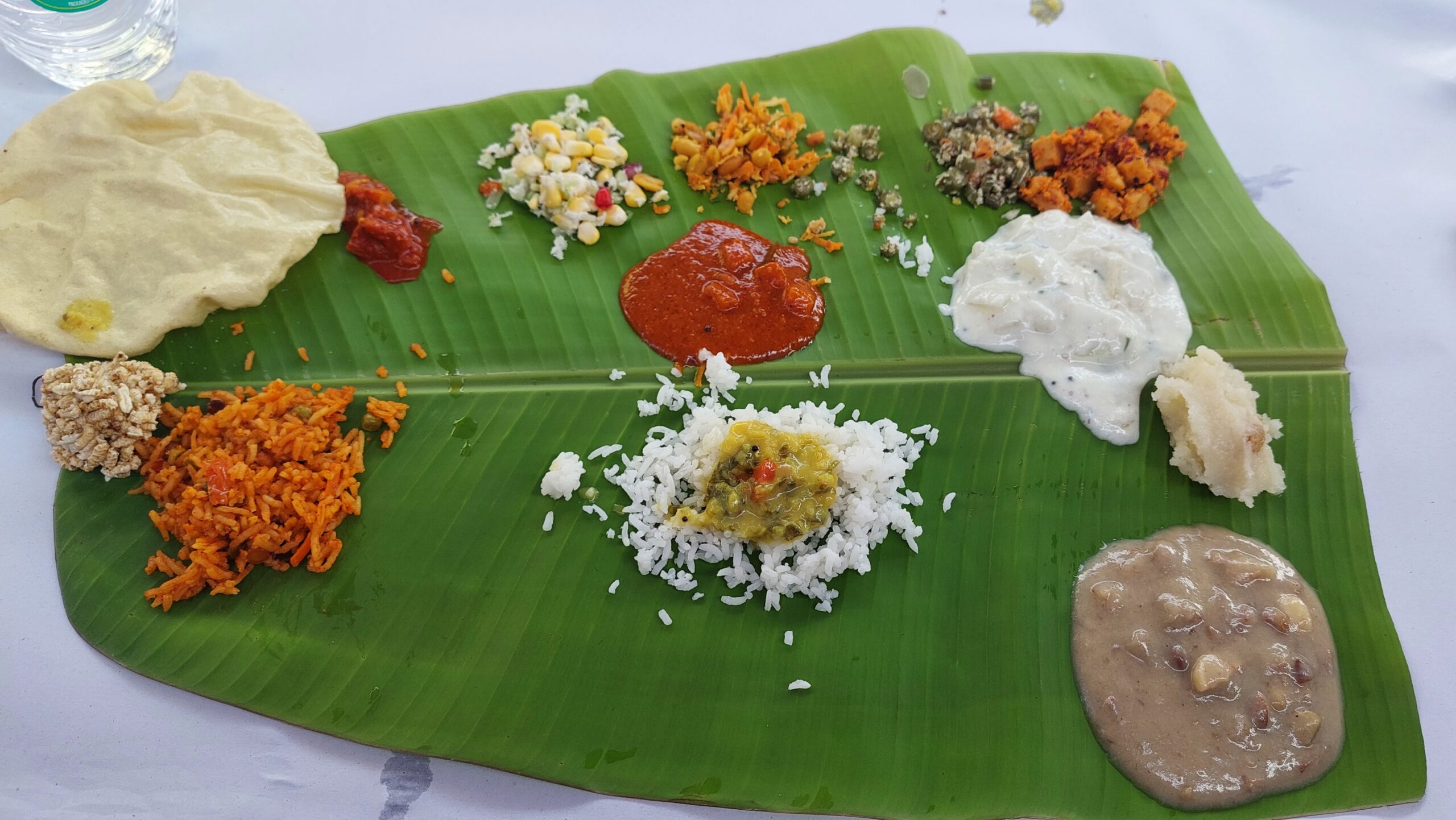
There is no single Karnataka cuisine. In Bengaluru and Mysuru, breakfast might mean idli, vada or a crisp masala dosa with chutney and sambar; farther north, jowar roti, brinjal preparations and pulses are everyday staples. Coastal kitchens make generous use of coconut, rice and seafood, while Kodagu has its own traditions, including kadambuttu rice dumplings and pork dishes. Udupi’s vegetarian cooking has influenced restaurants far beyond the state. Mysore pak and Dharwad pedha are two sweets with particularly strong local identities.
Crafts & commerce
Mysuru silk, Channapatna’s lacquered wooden toys, Bidar’s silver-inlaid bidriware and Ilkal sarees are more than souvenirs: they represent workshops, trading networks and skills sustained by local makers. Karnataka is also a major center for information technology, aerospace, biotechnology and manufacturing. Coffee estates in the Western Ghats, sugar mills in the Cauvery basin, iron-ore mining around Ballari and the port economy of Mangaluru show how varied its working landscape is.
Festivals & traditions
Mysuru Dasara is the state’s best-known public celebration, with royal traditions, processions and performances that draw large crowds. Along the coast, Yakshagana combines dance, music, elaborate costumes and storytelling, while Bhoota Kola remains an important ritual tradition in parts of Tulu Nadu. Bengaluru’s Karaga festival, village jatres, temple car festivals and harvest celebrations offer different windows into community life. These traditions are not interchangeable: each belongs to particular places, languages and communities.

Planning a journey through Karnataka
The distances between Karnataka’s regions can be deceptive. Bengaluru and Mysuru work well together, while the Western Ghats and coastal districts reward a separate journey. Hampi and the northern heritage towns are another distinct route, particularly if you want time for Badami, Aihole and Pattadakal. The monsoon changes road conditions and the feel of the landscape, especially in the Ghats and along the coast.
By air
Bengaluru (BLR) is Karnataka’s main international gateway. Mangaluru (IXE) serves the coast, while Hubballi (HBX) and Belagavi (IXG) are useful for northern Karnataka. Smaller airports include Mysuru and Vidyanagar, near Hampi; flights may be limited.
By train
Bengaluru City (SBC), Mysuru (MYS) and Hubballi (UBL) are major hubs. For the coast, use Mangaluru Central (MAQ); for Hampi, Hosapete Junction (HPT). Check schedules and book through IRCTC.
By bus and road
State and private buses reach cities and smaller towns. KSRTC serves much of the state, alongside regional operators NWKRTC and KKRTC. A hired car is useful for the Badami–Aihole–Pattadakal circuit and rural areas; allow extra time in the Western Ghats during monsoon.
When to visit Karnataka
November to February is generally the most comfortable period for exploring Bengaluru, Mysuru, Hampi and the northern heritage sites. The coast stays warm and humid, while hill areas such as Coorg and Chikkamagaluru can be cool in the mornings. March to May brings more intense heat inland, particularly around Hampi and northern Karnataka.
June to September transforms the Western Ghats into lush green country, but heavy monsoon rain can affect roads, treks and coastal plans. The waterfalls are especially dramatic during and after the rains. Mysuru Dasara, usually in September or October, draws large crowds; book accommodation well ahead if you plan to attend.
Choosing where to stay
Use different bases for different regions. Karnataka is too large to explore comfortably from Bengaluru alone. Bengaluru works for the capital and nearby excursions, while Mysuru is a better base for the palace city and southern Karnataka.
For Hampi, stay in Hospet or the Hampi area; Badami is a practical base for Aihole and Pattadakal. Madikeri and Chikkamagaluru suit separate Western Ghats trips, while Mangaluru, Udupi or Gokarna make sense for different stretches of the coast. Choose the region first, then the hotel; distances and mountain roads can make day trips longer than they appear on a map.
Explore More of India
Local celebrations, cultural events and annual festivals.
The geography between the state and the village.
How India’s states and Union Territories differ.
India’s currency, its symbols and a few surprises.