Telangana, Beyond Hyderabad
Kakatiya stonework, Deccan cities, cotton fields, weaving towns and forests along the Godavari.
Hyderabad is the first thing many travelers associate with Telangana: the Charminar, biryani, old bazaars and the technology companies spreading across the western suburbs. It is a fascinating city, but it is not the whole state.
Travel north and you find cotton markets, paper mills, coalfields and forested country. Eastward, the great temples and stone gateways of the Kakatiya period stand near lakes, villages and weaving towns. South of the capital, the landscape opens into the drier Deccan, where agriculture, pilgrimage and trade follow different routes.
Telangana became a separate state in 2014. Its 33 districts tell a story of regional identities, working industries, languages and communities that are easily missed when a visit begins and ends in Hyderabad. This guide follows those districts in broad geographic sweeps, beginning in the north.
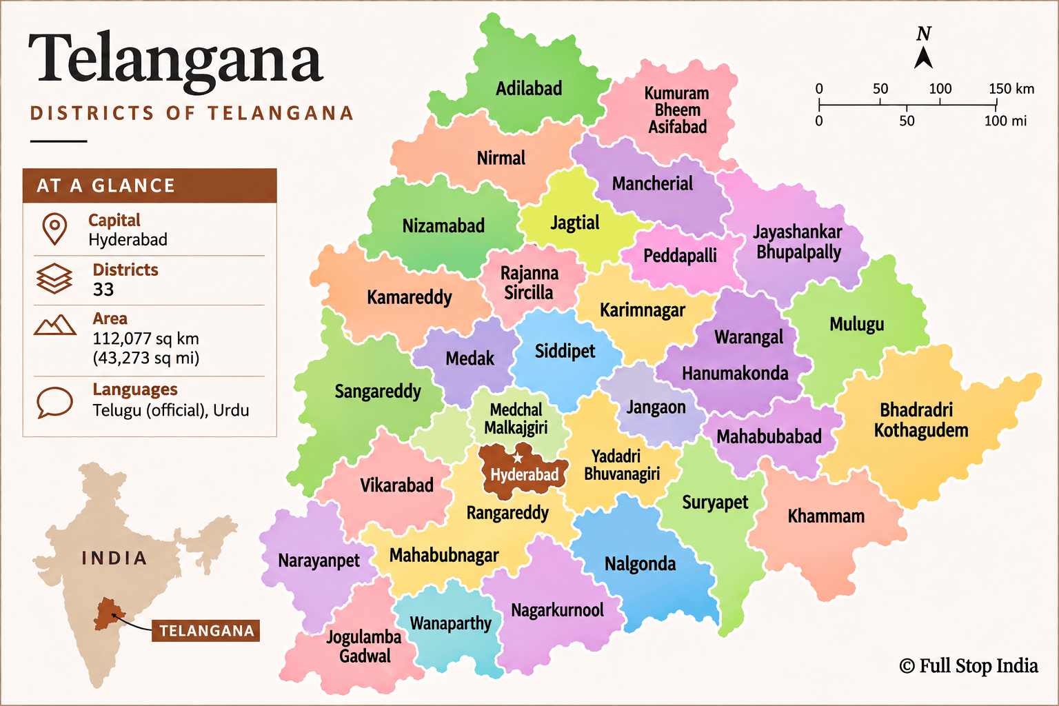
Thirty-three districts, many different Telanganas
From the northern forests and the Godavari basin through the Hyderabad metropolitan area to the southern Krishna valley, these district portraits look beyond monuments to the occupations, industries and traditions that make each place distinct.
History & identity
How Telangana became Telangana
The Kakatiya rulers, whose capital was at Warangal, left a legacy of stone temples, fortified gateways and irrigation tanks. Later, the Qutb Shahi sultans established Hyderabad, which became the center of the Nizams’ princely state. These histories remain visible in the region’s architecture, languages and everyday culture.
In 1956, the Telugu-speaking Telangana region of Hyderabad State was merged with Andhra State to form Andhra Pradesh. Disputes over public employment, water, resources and political representation fueled a long campaign for separate statehood. On 2 June 2014, Telangana became a separate state, following decades of campaigning for statehood. Its identity reflects both Telugu-speaking rural traditions and Hyderabad’s distinctive Urdu and Deccani heritage.
The districts · Northern Telangana
Forests, farms and the Godavari
Across the northern districts, cotton and turmeric fields meet forested hills, river valleys and the homelands of Gond, Kolam and other Adivasi communities.
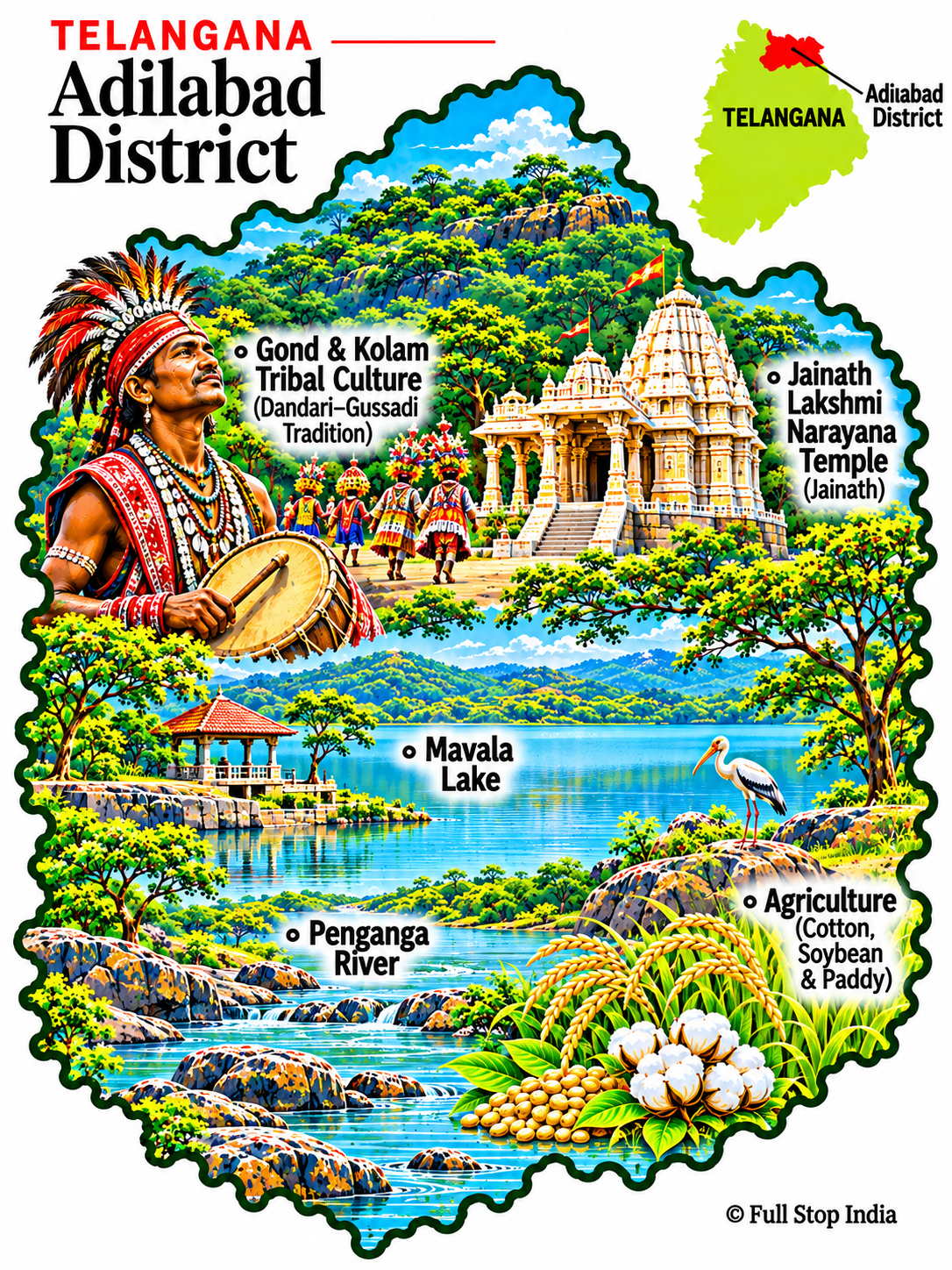
01 / Adilabad District
Forests, Jainath and the northern frontier
Jainath Temple and the Penganga frontier give Adilabad a character distinct from the cities farther south.
Cotton and soybean cultivation, market towns and Gond and Kolam cultural traditions shape local life. Weekly markets bring farm produce and household goods into district towns, while the landscape near the Maharashtra border has its own linguistic and cultural connections beyond Telangana.
The district’s weekly markets are also places where forest produce, grain and household goods move between villages and towns. The northern borderland has its own rhythms, distinct from the metropolitan south.
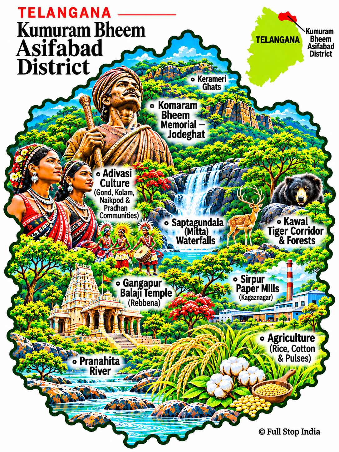
02 / Kumuram Bheem Asifabad District
Komaram Bheem country
Jodeghat recalls the resistance of Adivasi leader Komaram Bheem. The Kerameri hills and forested valleys are among the district’s defining landscapes.
Gond, Kolam and other communities sustain cultural traditions alongside farming; the paper industry around Kagaznagar is another important part of the district’s story.
The district takes its name from Komaram Bheem, whose resistance to the Nizam’s rule remains central to local Adivasi history. Forest livelihoods, village markets and seasonal agriculture are inseparable from that history.
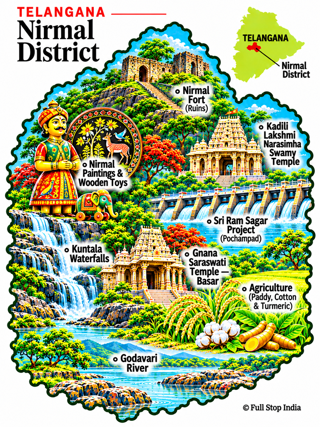
03 / Nirmal District
Painted crafts and waterfalls
Nirmal is known for its distinctive painted wooden crafts, while Kuntala waterfalls and the landscapes around Kadam attract visitors into the countryside.
Craft workshops, farming and the Sri Ram Sagar irrigation system link the district’s heritage to its working economy.
Nirmal’s painted wooden objects and lacquered craftwork remain among its most recognizable products. The district’s workshops are as much a part of its identity as the waterfalls and forested hills.
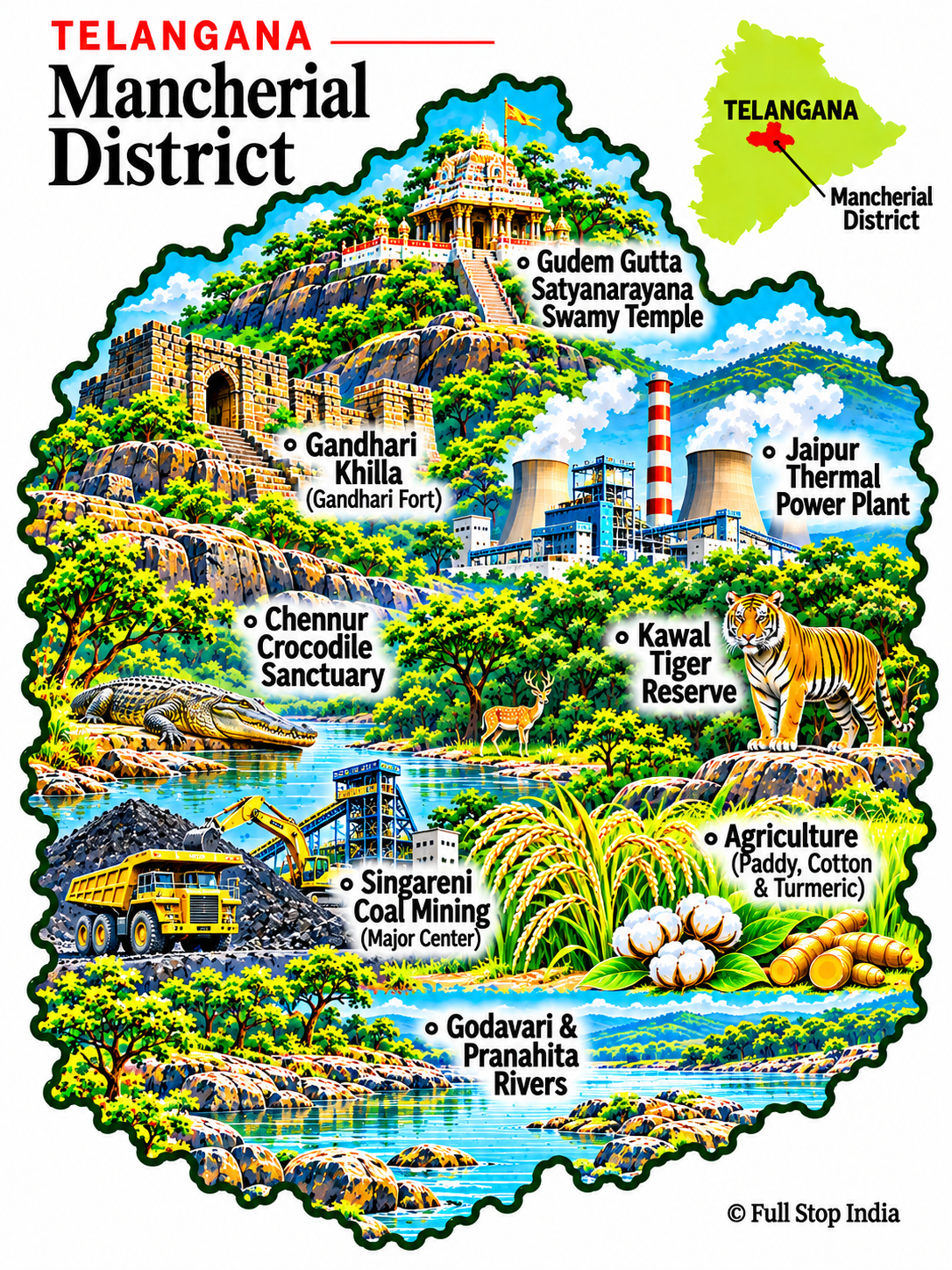
04 / Mancherial District
Coal, forests and the Godavari
Mancherial lies in a landscape of coalfields, the Godavari and the forest corridors associated with Kawal.
Singareni mining and associated industries support many households, while rural communities depend on farming and forest resources.
Mining has shaped employment, housing and transport around Bellampalli and Mandamarri. Beyond the industrial towns, the Godavari and forest-edge villages reveal a very different side of the district.
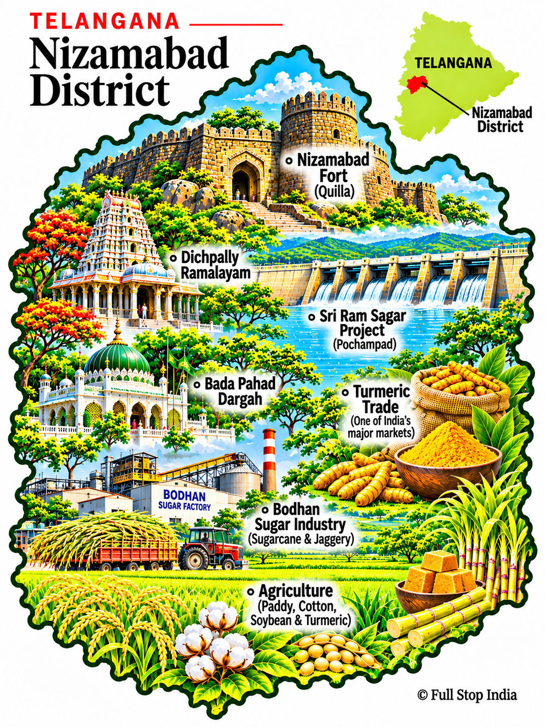
05 / Nizamabad District
A trading city in turmeric country
Nizamabad’s fort and old urban quarters recall a layered past; the Godavari basin shapes the countryside beyond.
Turmeric, rice and other crops support a substantial agricultural trade, with mills, markets and transport connections centered on Nizamabad town.
Turmeric trading connects local growers to buyers well beyond Telangana, while rice mills and agricultural services support the surrounding countryside. The city’s commercial streets offer a clearer picture of daily life than a monuments-only visit.
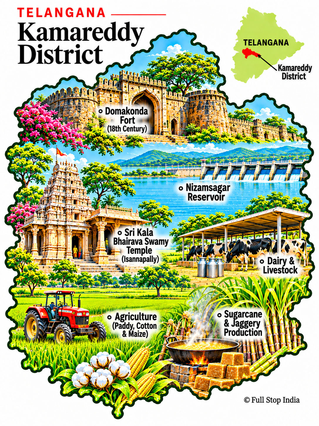
06 / Kamareddy District
Fields, markets and Nizam Sagar
Kamareddy’s towns sit among agricultural villages and reservoirs, including the historic Nizam Sagar project.
Rice, sugarcane and dairy farming contribute to the district’s economy; it is better understood through its markets and working countryside than a single monument.
The agricultural economy extends beyond the fields into grain markets, processing businesses and transport services. Banswada and other smaller towns have their own commercial life, rather than functioning simply as stops on the way to Hyderabad.
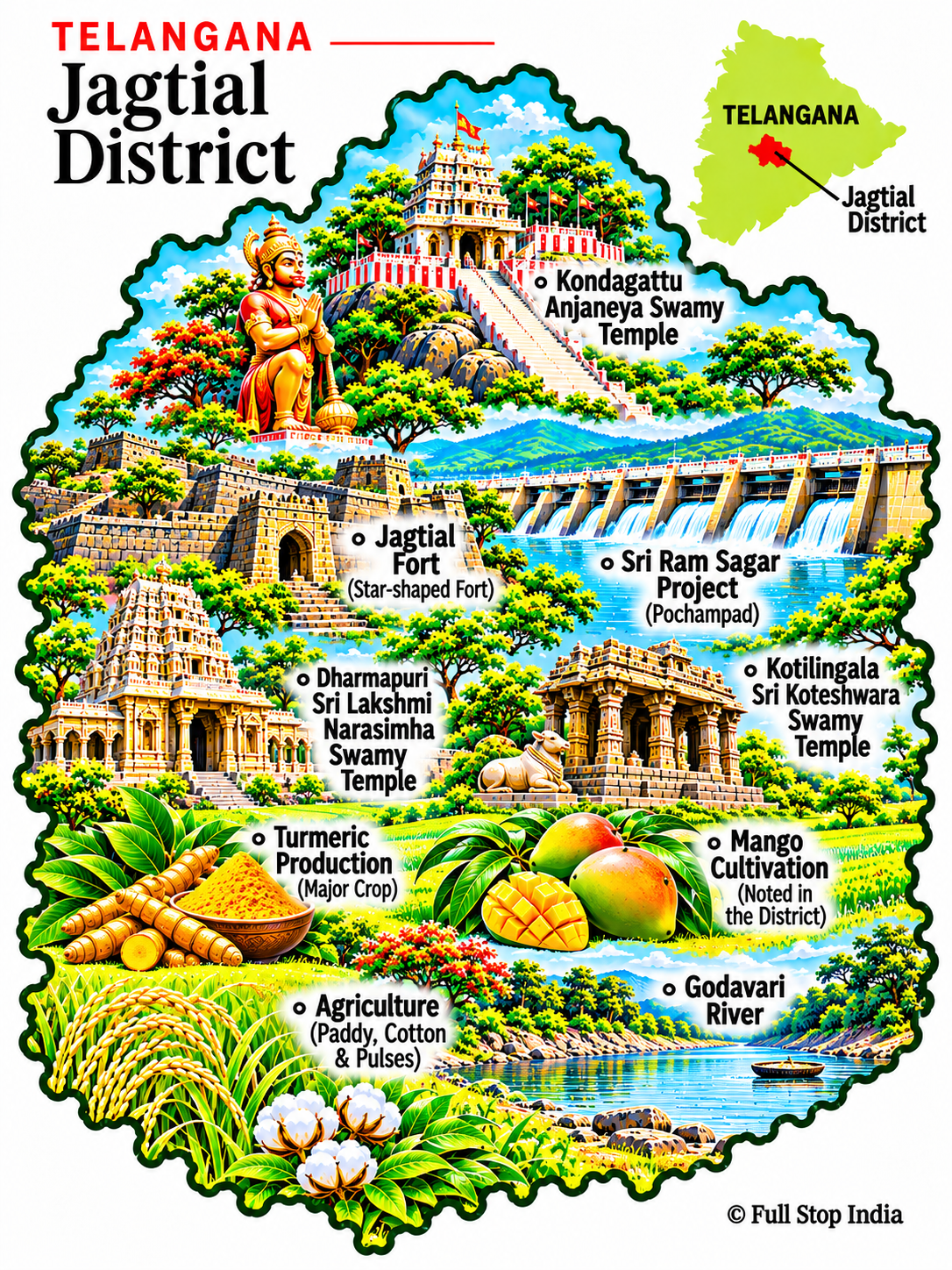
07 / Jagtial District
Temples and river country
Kondagattu’s Anjaneya temple and the towns around Jagtial offer a mix of pilgrimage and rural travel.
Farming and trading communities are closely tied to the Godavari basin; irrigation, grain markets and small businesses are part of everyday life.
The Godavari basin supports irrigated farming and a network of market towns. Temple visits can be combined with a look at the region’s produce markets and the everyday commerce serving nearby villages.
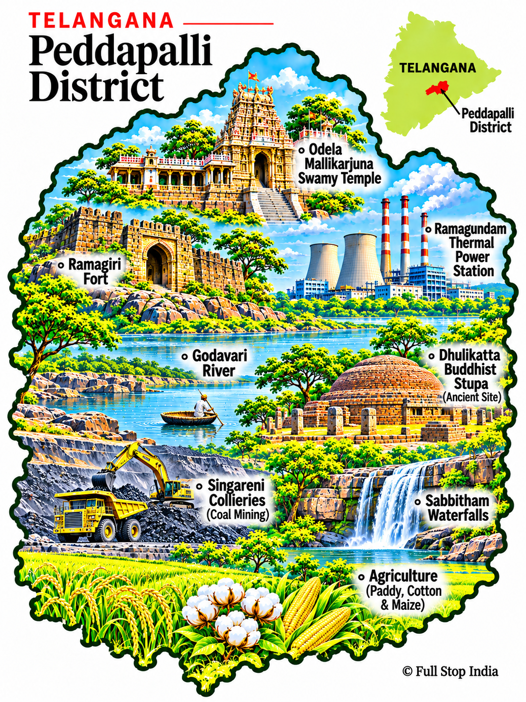
08 / Peddapalli District
Power stations and coal country
Ramagundam is one of Telangana’s major industrial centers, known for thermal power generation and its proximity to coalfields.
The district is not simply an industrial landscape: river settlements and agricultural communities coexist with large plants and transport corridors.
Ramagundam’s power generation and the wider coal economy have made this one of Telangana’s important industrial districts. Workers’ settlements, rail connections and energy infrastructure are a defining part of its modern landscape.
The districts · The Kakatiya heartland
Stone, temples and looms
Warangal and Hanumakonda anchor this region of Kakatiya architecture, temple towns and textile production; farther east, the forests and Godavari tributaries shape settlement and travel.
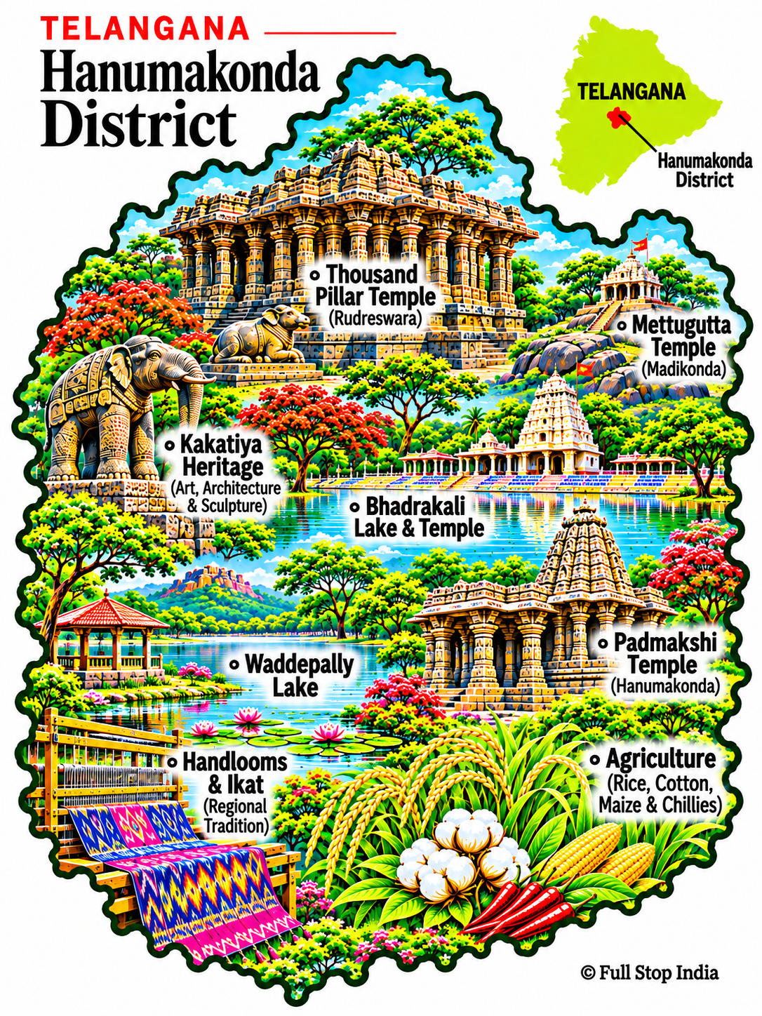
09 / Hanumakonda District
The stonework of Hanumakonda
The Thousand Pillar Temple, Padmakshi Temple and Bhadrakali Lake are essential to understanding the area’s Kakatiya heritage.
Hanumakonda is also an active center of education, healthcare, commerce and urban life.
The district is also a major center for education, healthcare and commerce serving the wider Warangal urban area. That everyday role sits alongside its exceptional Kakatiya stonework.
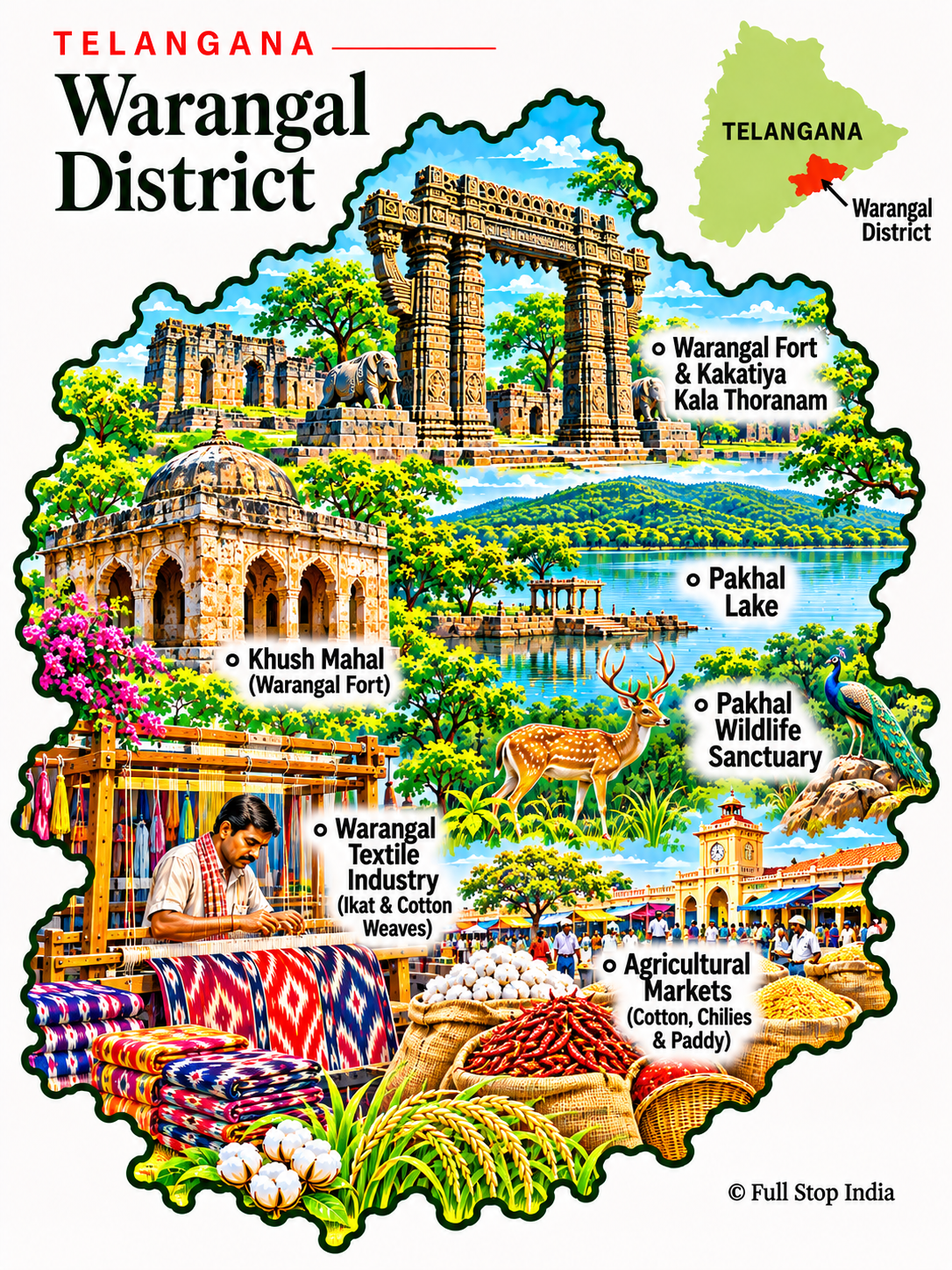
10 / Warangal District
The old Kakatiya capital
Warangal Fort and its celebrated gateways recall the Kakatiya dynasty’s architectural ambition.
Geese-gonda’s weaving traditions, trade and agriculture reveal the district beyond its archaeological sites.
Warangal’s importance extends beyond the surviving fort: the Kakatiya legacy remains visible in the region’s sculpture, temple design and public identity. Modern trading neighborhoods and educational institutions give the historic city a working life of its own.
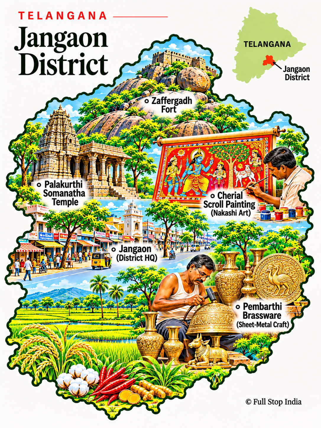
11 / Jangaon District
Villages, brasswork and Kakatiya memory
Jangaon sits in a region with deep Kakatiya connections and villages known for metalworking traditions.
Pembarthi’s decorative brasswork is a distinctive craft; farming and market towns remain important throughout the district.
Farming villages, local markets and road links tie Jangaon to both Hyderabad and the Warangal region. The district’s cultural landscape is best understood through these everyday connections as well as its historic sites.
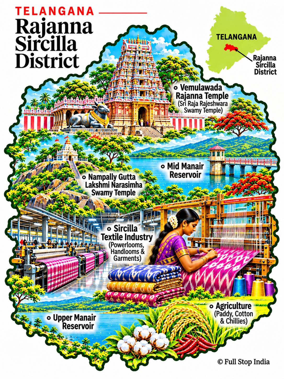
12 / Rajanna Sircilla District
The looms of Sircilla
Vemulawada’s Rajarajeshwara temple is a major pilgrimage destination, while Sircilla is synonymous with textile production.
Powerlooms, weaving families and garment businesses make this one of Telangana’s most distinctive manufacturing districts.
Sircilla’s powerloom economy supports thousands of families and a dense network of yarn traders, workshops and garment-related businesses. Its textile story is one of skilled labor and changing industrial conditions, not simply a picturesque handloom tradition.
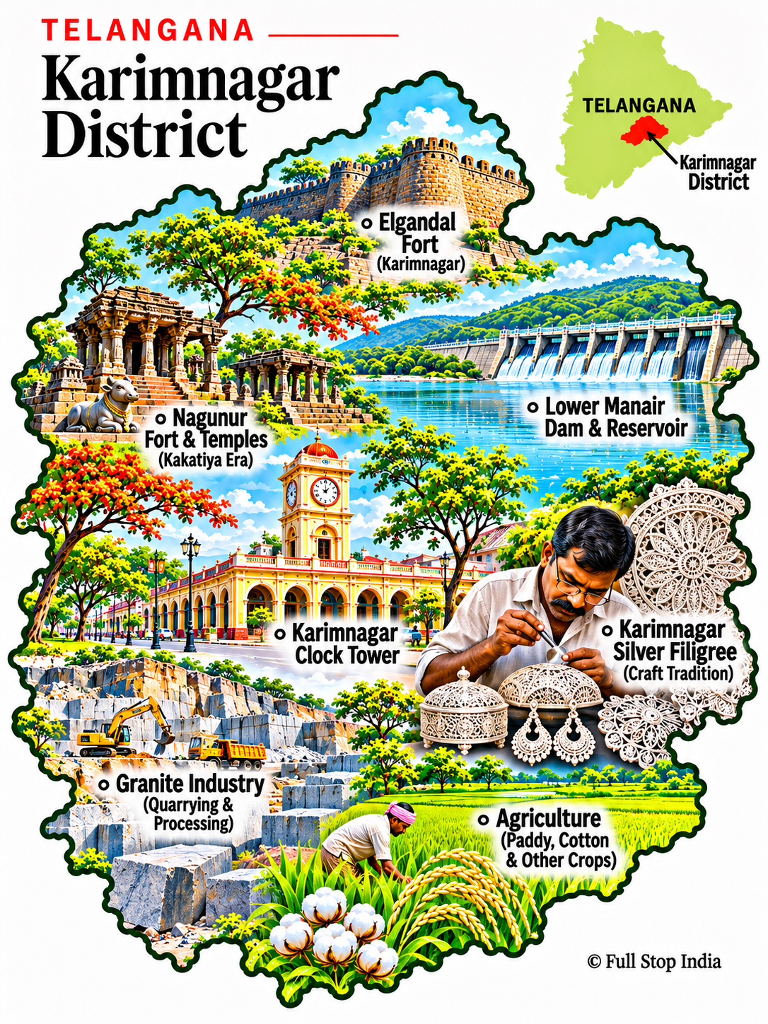
13 / Karimnagar District
Markets along the Lower Manair
Karimnagar is a regional commercial center, with the Lower Manair reservoir close to the city and Kakatiya-era sites in the wider region.
Granite, farming, education and trade support the economy; the city is a useful base for exploring north-central Telangana.
Karimnagar is a commercial and educational hub for surrounding towns, with grain, produce and small-business trade passing through its markets. Its silver filigree craft adds a distinctive artistic tradition to that regional role.
The districts · Hyderabad and central Telangana
A capital and its changing hinterland
Hyderabad’s historic trading quarters and expanding technology corridors sit amid satellite towns, manufacturing belts, farms and commuter settlements that are changing rapidly.
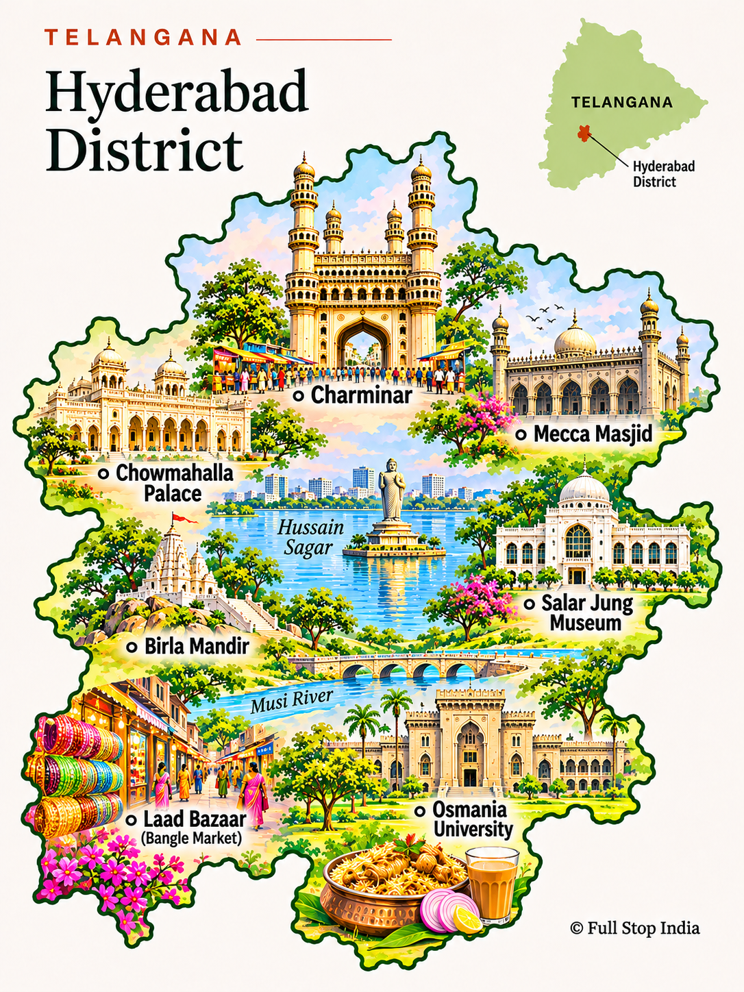
14 / Hyderabad District
A Deccan city of many layers
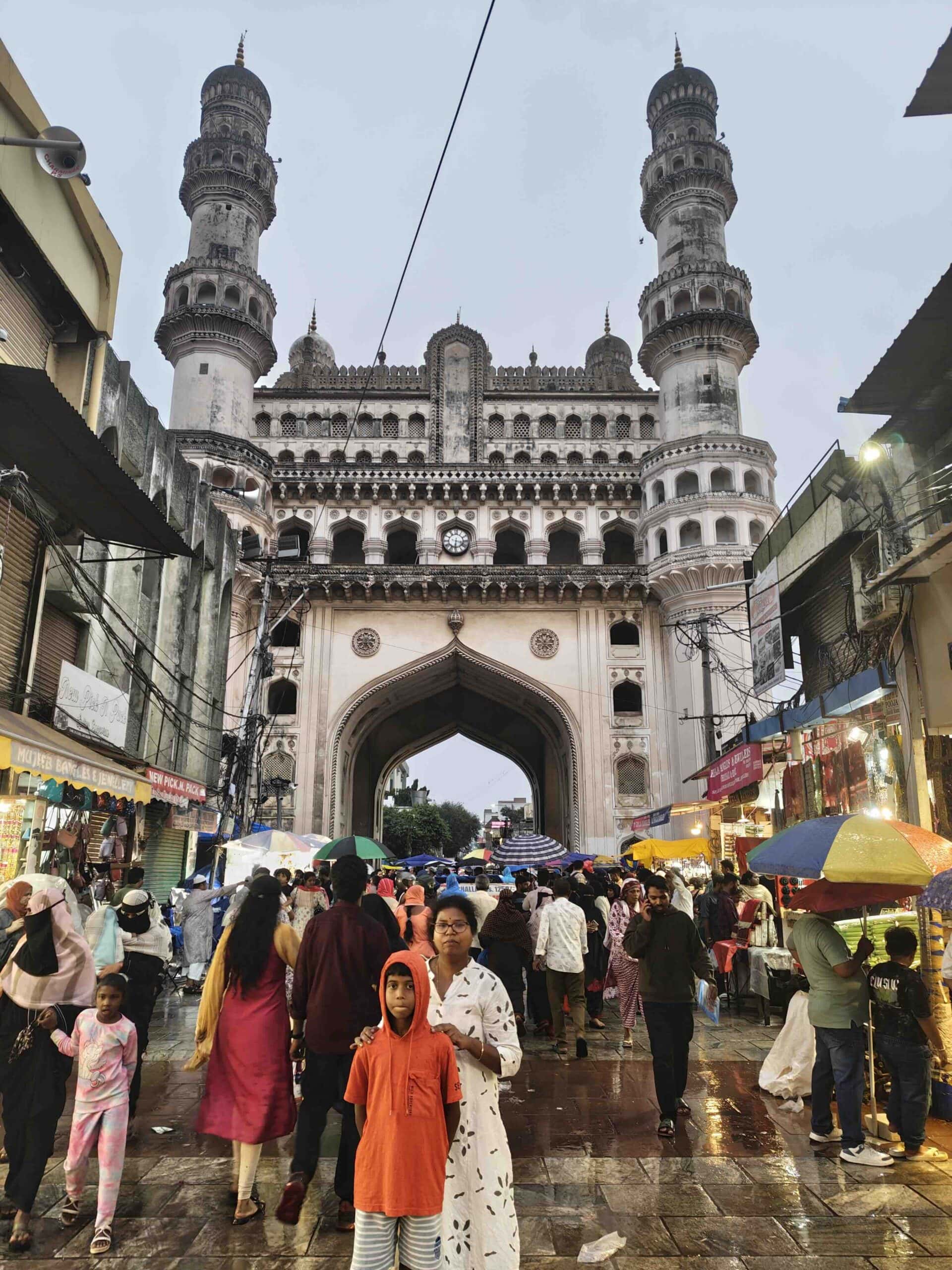
Old Hyderabad grew around the Charminar and its bazaars, with Qutb Shahi monuments, mosques, pearl and bangle traders, Irani cafés and busy market lanes. Telugu, Urdu and the local Deccani variety of Urdu are all part of the city’s everyday soundscape; its cooking draws on those overlapping histories.
West of the historic core, HITEC City and the Financial District speak to a very different Hyderabad of software firms, global offices and new apartment towers. Pharmaceuticals, biotechnology, universities and cinema are major parts of the metropolitan economy. The contrast between old-city commerce and modern industry is central to understanding the capital.
The city’s identity is not limited to Charminar and the old bazaars. Technology campuses, pharmaceutical research and manufacturing, universities and a vast service economy have transformed its outer neighborhoods, while Telugu, Urdu and Deccani speech remain part of daily life.
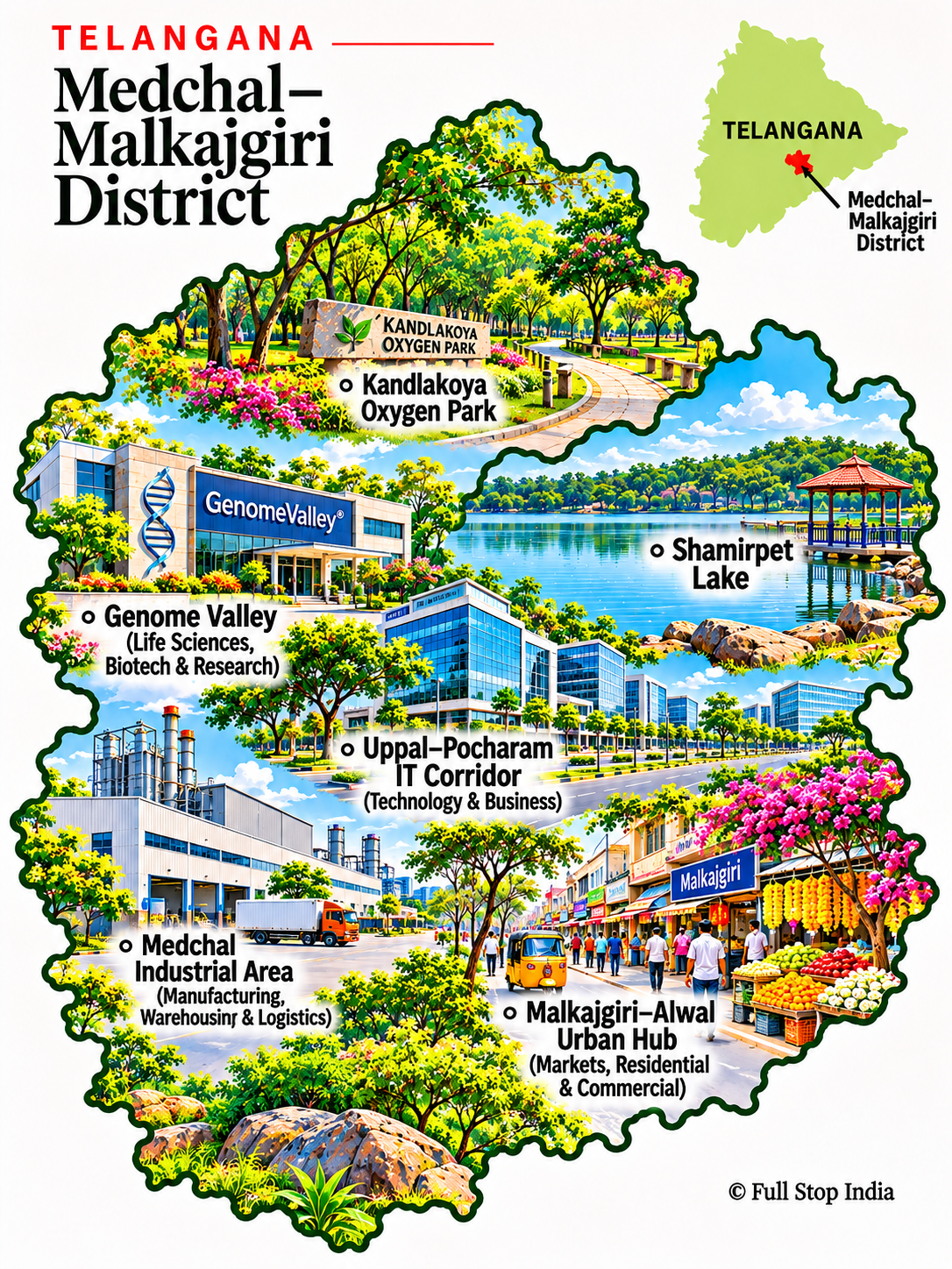
15 / Medchal Malkajgiri District
The northern metropolitan fringe
Medchal–Malkajgiri includes busy suburbs and commuter neighborhoods north and east of Hyderabad.
Life sciences, manufacturing, services and transport hubs make this a working part of the metropolitan region rather than a conventional sightseeing district.
This is metropolitan Telangana at close range: apartment developments, warehouses, industrial estates and commuter routes increasingly occupy land once dominated by villages and fields. Its growth illustrates how Hyderabad’s economy extends beyond the city’s administrative boundary.
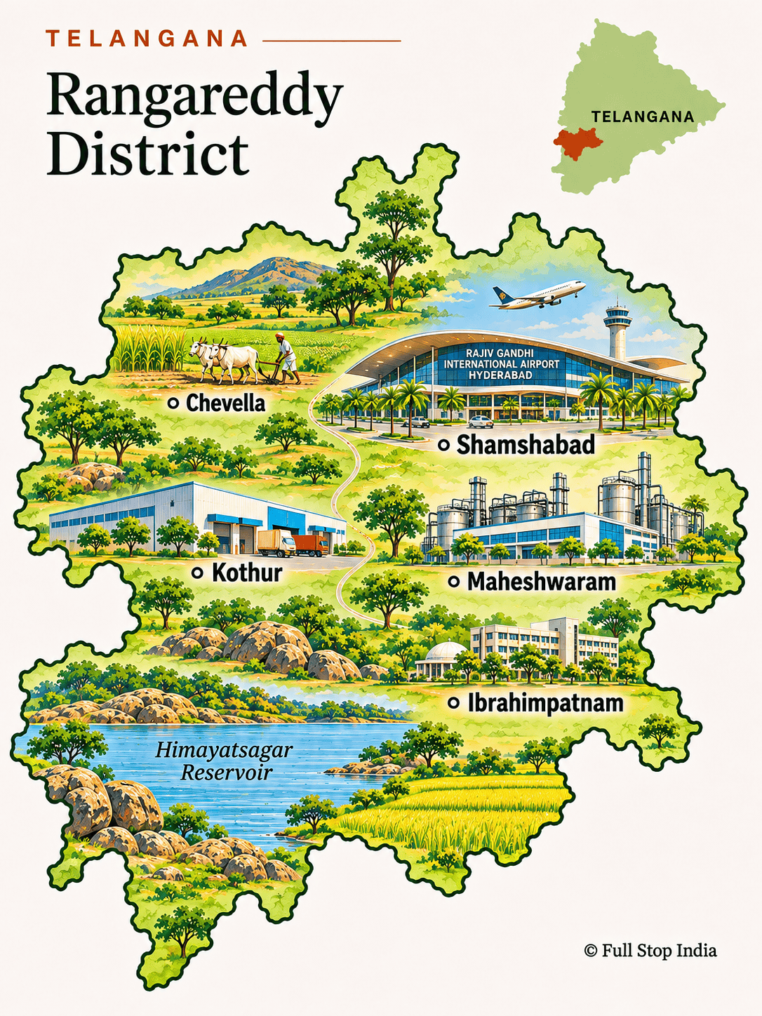
16 / Rangareddy District
The capital’s expanding edge
Rangareddy surrounds much of Hyderabad’s southern and western growth, from the airport corridor to towns and rocky landscapes.
IT campuses, logistics, real estate, farms and expanding suburbs reveal how the metropolis is changing the surrounding countryside.
Airport-linked development, technology offices, logistics and new residential districts have reshaped the area around Hyderabad. Yet older settlements and farming pockets remain, creating a sharp contrast between established village life and the capital’s expansion.
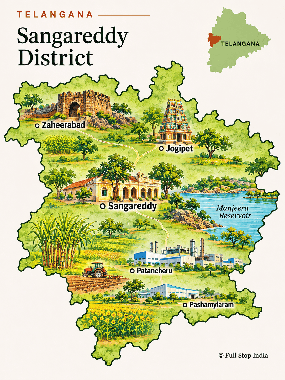
17 / Sangareddy District
Factories beyond the capital
Sangareddy is closely tied to Hyderabad’s western industrial corridor, but older settlements and countryside remain visible beyond the highways.
Manufacturing, pharmaceuticals, logistics and farming together explain the district’s modern character.
Industrial estates and manufacturing plants are important employers, while agriculture remains visible beyond the main corridors. The district shows how factories, commuting and older market towns now coexist west of Hyderabad.
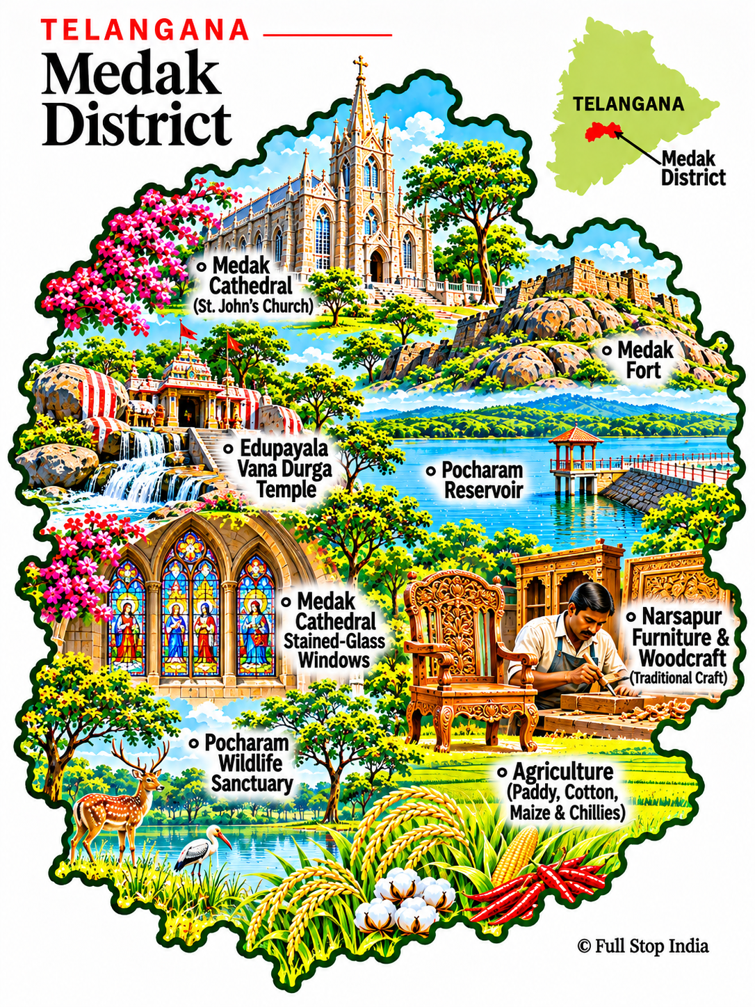
18 / Medak District
A cathedral and a fort
Medak Cathedral is an unexpected landmark in this part of Telangana, while Medak Fort recalls older regional powers.
Farming, small industries and towns connected to Hyderabad sustain the surrounding district.
Medak’s cathedral and fort are only part of its story. Farming, irrigation and trade through its district towns continue to shape the surrounding landscape, with religious and commercial activity often concentrated in the same local centers.
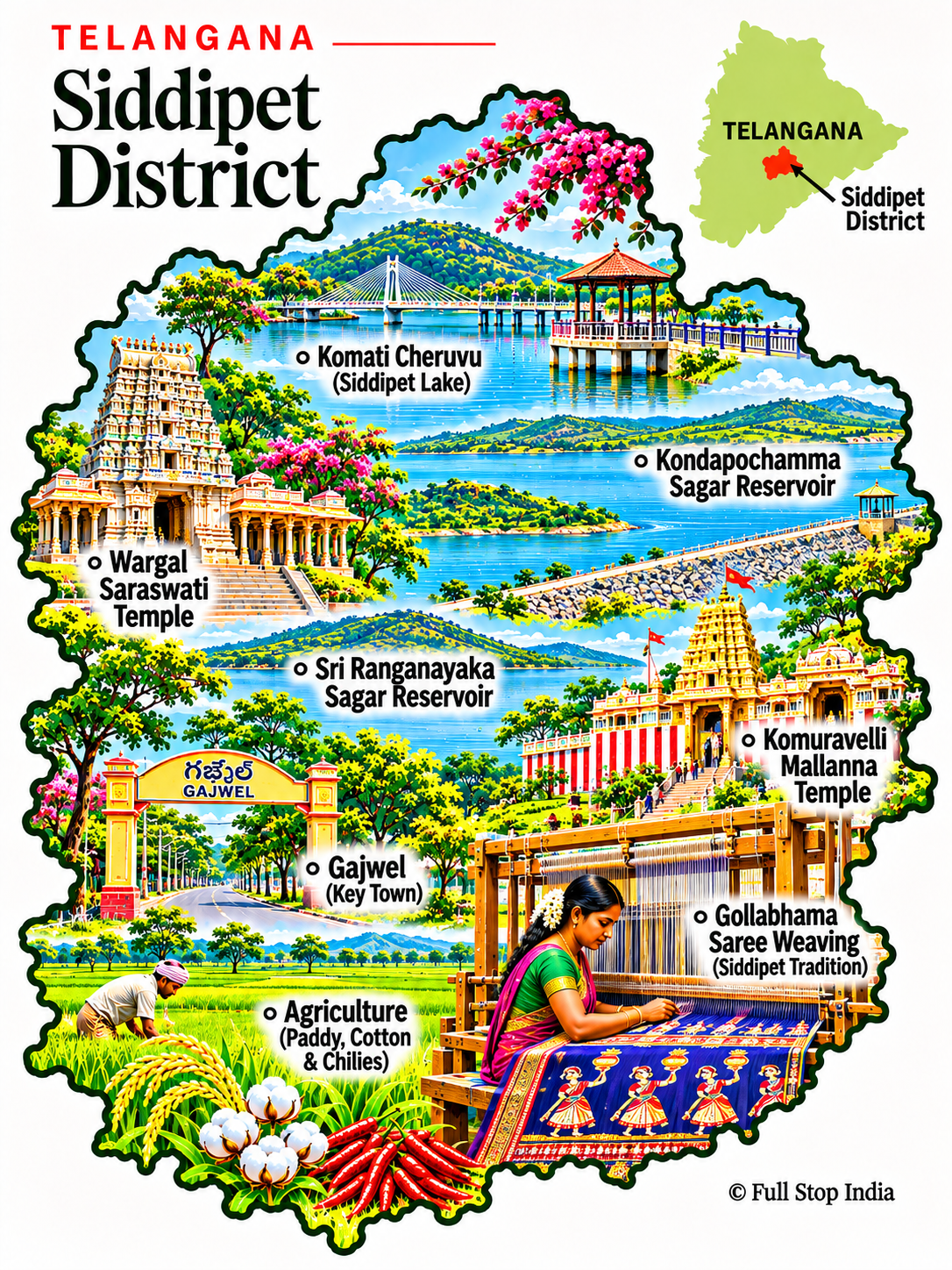
19 / Siddipet District
Reservoirs and pilgrimage towns
Siddipet combines temple towns, lakes and major irrigation infrastructure, including the Kondapochamma Sagar reservoir.
Agriculture, commerce and growing towns connect the district to the wider Hyderabad region.
The district’s reservoirs have altered the landscape and supported new irrigation patterns. Its market towns serve farmers and small businesses, while pilgrimage routes bring another stream of visitors through the region.
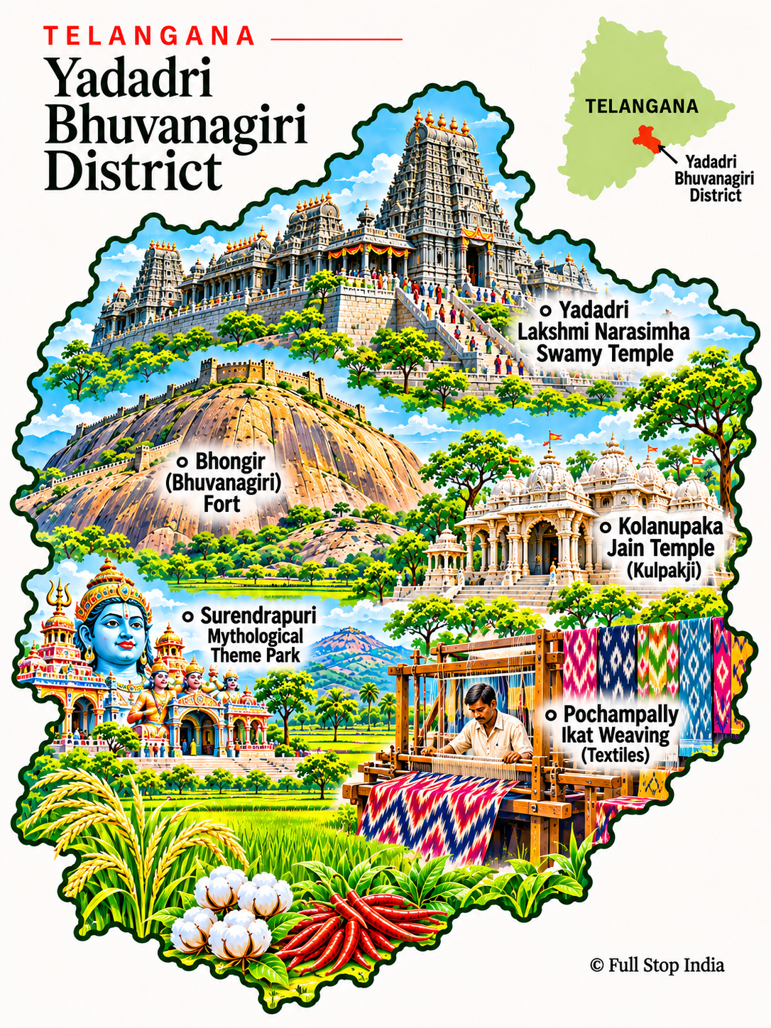
20 / Yadadri Bhuvanagiri District
A great temple on the hill
Yadadri’s Lakshmi Narasimha Swamy temple is a major pilgrimage site; Bhongir Fort rises dramatically from its granite hill.
Agriculture and the industrial influence of the Hyderabad–Warangal corridor shape the surrounding towns.
The redevelopment of the Yadadri temple has changed the scale of pilgrimage and associated services. Outside the shrine precinct, agriculture, small industries and commuter links connect the district to the wider Hyderabad region.
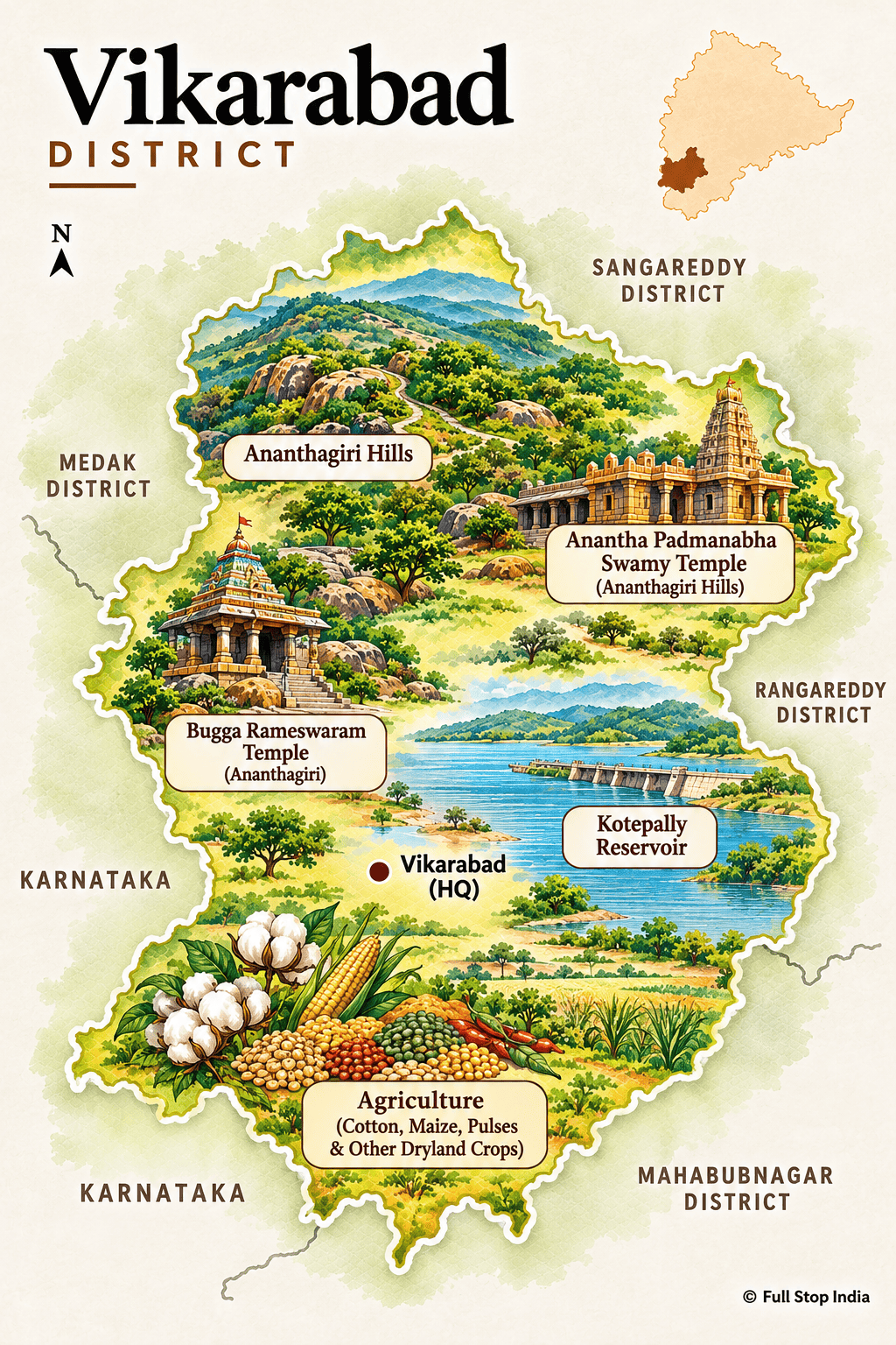
21 / Vikarabad District
The Ananthagiri hills
Vikarabad’s Ananthagiri hills offer a wooded escape from Hyderabad, with modest trails and small settlements.
Farming, local trade and the changing economy of the city’s outer fringe are equally part of the district’s story.
The Ananthagiri hills provide a cooler, greener contrast to Hyderabad’s built-up districts. Farming, local trading centers and weekend visitors all contribute to an economy that is not solely about hill scenery.
The districts · Eastern Telangana
Coalfields, forests and river towns
The east is shaped by coal and power generation, forest communities, irrigation and pilgrimage routes along the Godavari and its tributaries.
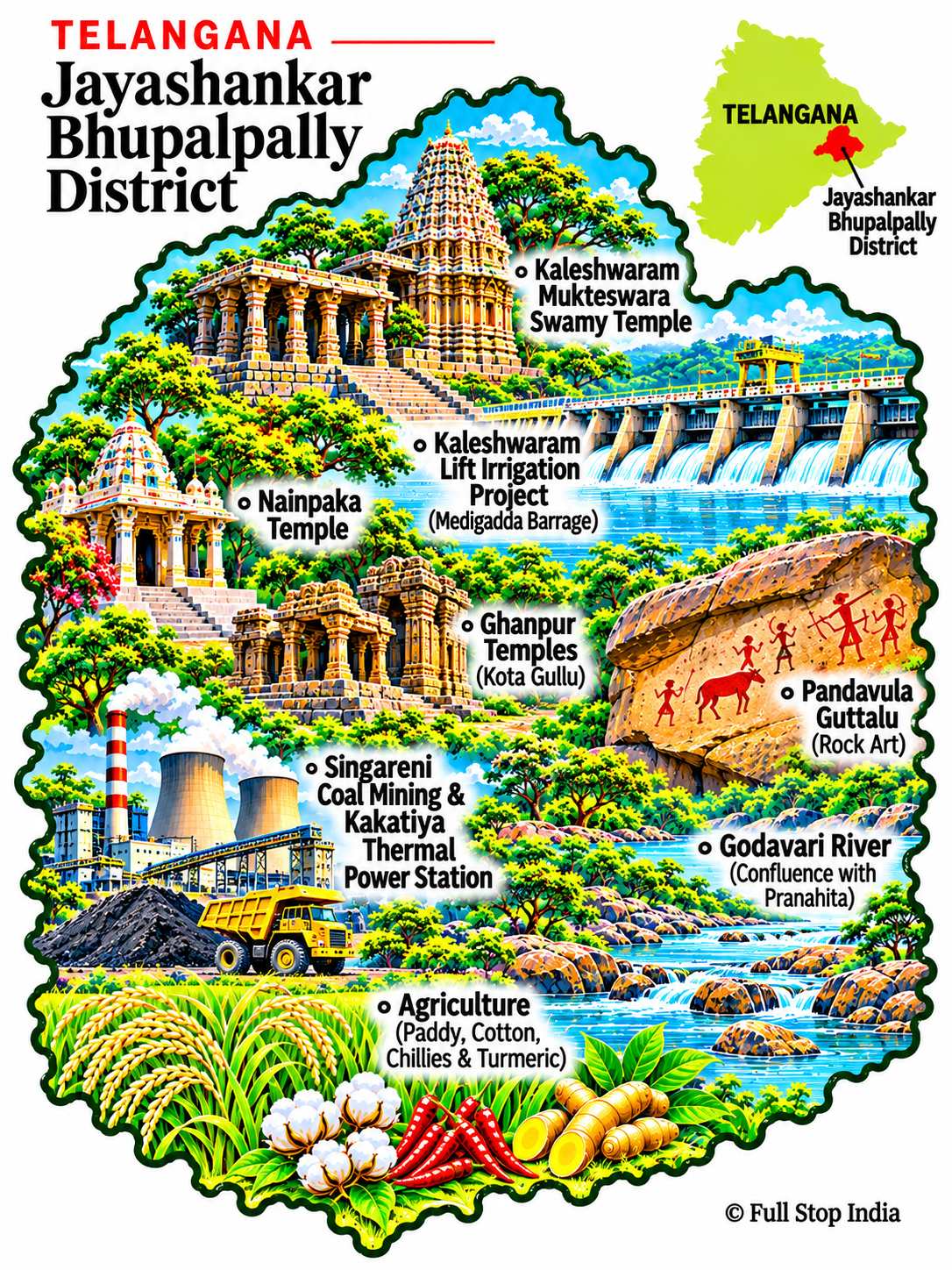
22 / Jayashankar Bhupalpally District
Kaleshwaram and the river confluence
The Kaleshwaram temple stands near the meeting of the Godavari and Pranahita rivers, giving the district a strong pilgrimage identity.
River settlements, forests, quarrying and agriculture are central to life beyond the main temple routes.
The meeting of major rivers at Kaleshwaram gives this district religious and geographic importance. Irrigation works, forest communities and agriculture also shape the places between its better-known pilgrimage sites.
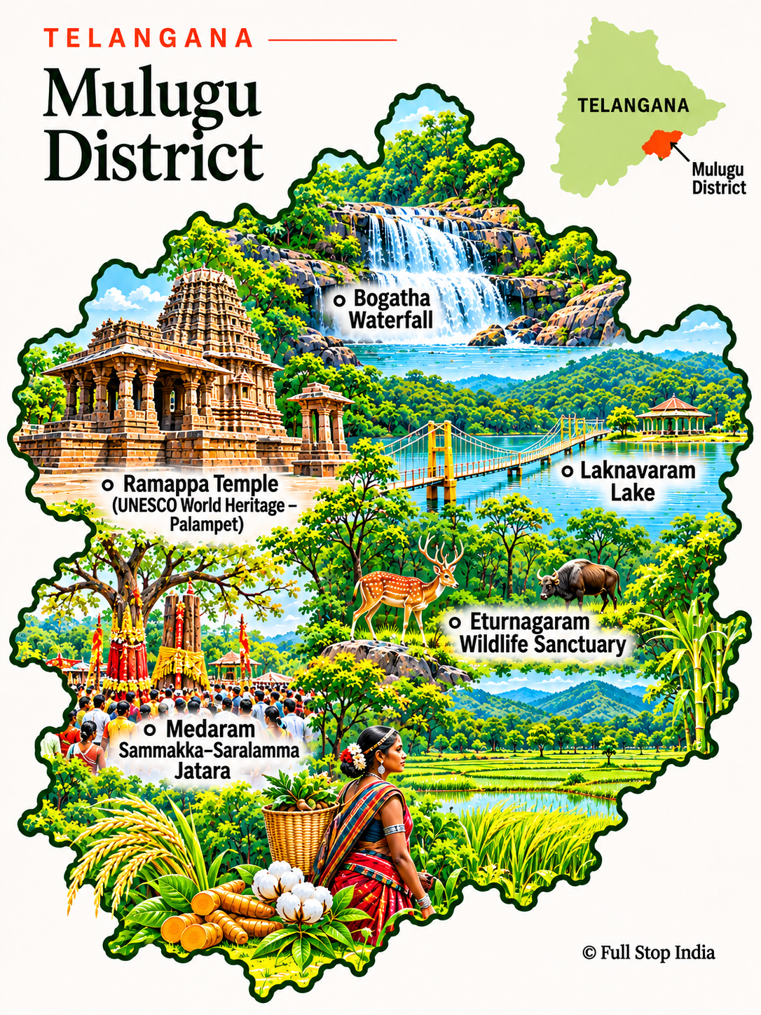
23 / Mulugu District
Ramappa and the forested east
Ramappa Temple at Palampet, a UNESCO World Heritage Site, is a remarkable example of Kakatiya architecture. Laknavaram Lake and the forested interior offer a different setting.
The district’s villages, Adivasi communities and agricultural lands deserve attention alongside its celebrated monument.
Much of the district’s identity is tied to forest landscapes and Adivasi communities, alongside the architectural achievement of Ramappa Temple. The Medaram gathering is a major expression of regional cultural life, not merely a visitor attraction.
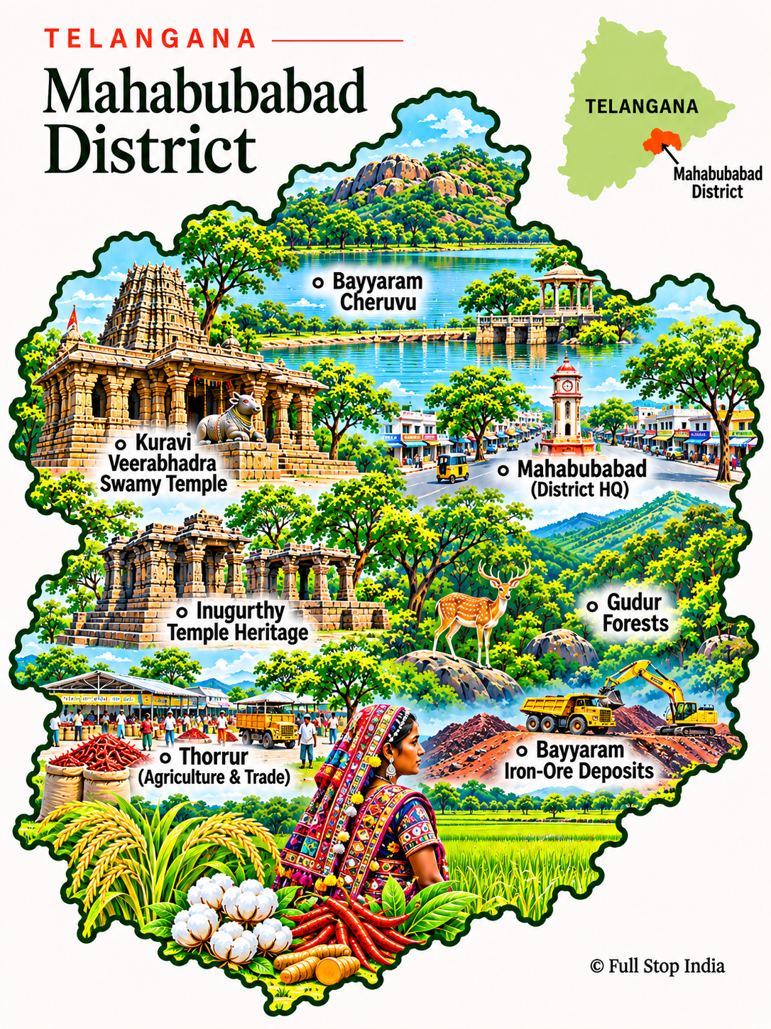
24 / Mahabubabad District
Hill forts and working villages
Kuravi’s Veerabhadra Swamy temple and the district’s rocky hills reflect a long local religious history.
Paddy cultivation, rural markets and small-scale enterprise define much of Mahabubabad’s daily life.
Rural markets, agriculture and Adivasi communities are central to the district’s character. The movement of produce and people through its smaller towns reveals more about local life than a quick stop at a historic site.
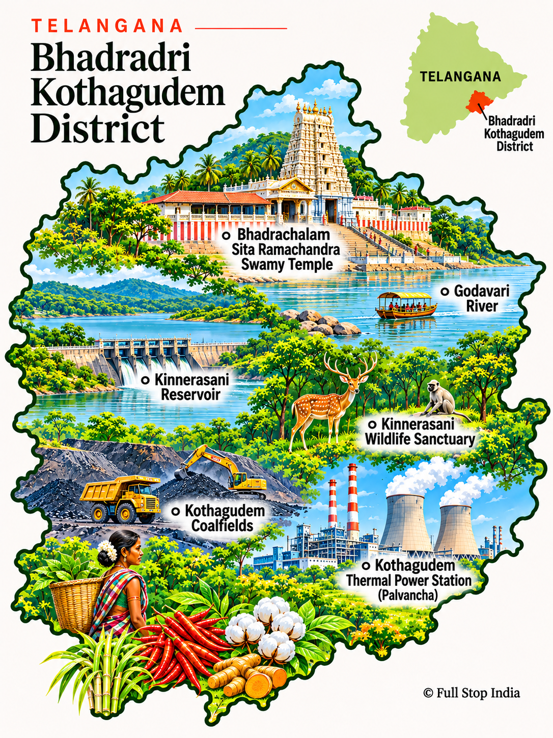
25 / Bhadradri Kothagudem District
Coalfields and the Godavari
Bhadrachalam’s riverside temple is one of the region’s major pilgrimage sites, while the wider district reaches into forest and industrial country.
Kothagudem’s coalfields, thermal power, forest communities and agriculture make this one of Telangana’s most varied districts.
Coal mining, power production and associated workers’ towns are central to the district’s modern economy. The pilgrimage traffic around Bhadrachalam and the forested stretches farther inland make it a particularly varied part of eastern Telangana.
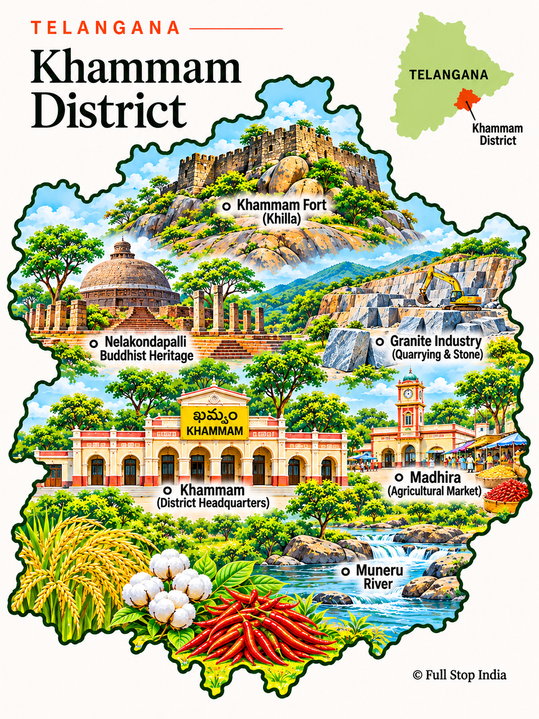
26 / Khammam District
A fort above the town
Khammam Fort stands over a busy commercial city, while the district’s countryside is shaped by irrigation and farming.
Rice, cotton, chillies and trading businesses connect Khammam to the wider eastern Deccan economy.
Khammam is a trading and transport center for surrounding agricultural areas, with commercial streets and produce markets that stay busy beyond festival periods. Its location also makes it an important link toward the eastern districts.
The districts · Southern Telangana
Dryland farming and the Krishna basin
South of the capital, market towns, pilgrimage centers and handloom communities sit amid dryland fields, rocky hills and the irrigation networks of the Krishna basin.

27 / Suryapet District
A corridor of towns and fields
Suryapet is a busy stop on the Hyderabad–Vijayawada route, with historic sites and irrigation landscapes beyond the highway.
Agriculture, transport services, rice mills and commerce sustain its towns.
Roadside commerce and agricultural trading are especially visible along the major routes crossing the district. Smaller towns and villages retain a different pace from the highway corridor.
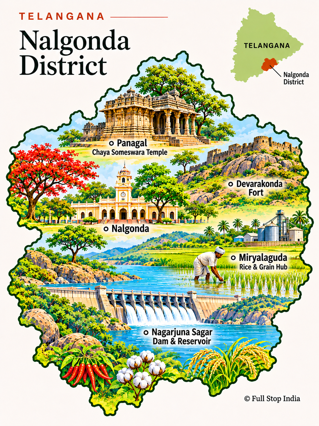
28 / Nalgonda District
Ancient sites and modern infrastructure
Nagarjuna Sagar and the Buddhist heritage associated with the Krishna valley make Nalgonda a significant historical landscape.
Cement, agriculture, irrigation and industry have also reshaped the district’s modern economy.
The district’s story includes irrigation, cement and other industries alongside older temple and archaeological sites. Its proximity to Hyderabad should not obscure the independent economy of its towns and farming areas.
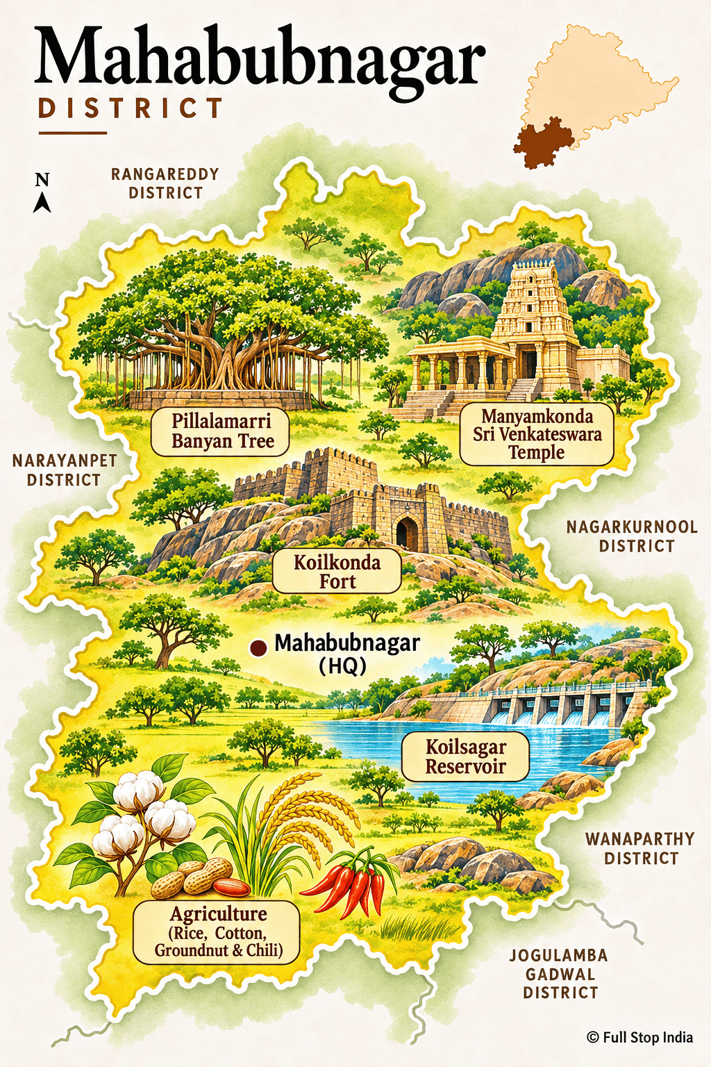
29 / Mahabubnagar District
A regional crossroads
Mahabubnagar, historically known as Palamuru, is a regional trading and transport center on the southern Deccan, with connections toward Hyderabad, Karnataka and the Krishna basin. Its markets serve surrounding farming villages, and the district’s rocky landscape gives way to fields dependent on seasonal rainfall and irrigation.
Dryland agriculture, livestock, small businesses and public services support local households. Palamuru also has a long history of workers leaving for construction and other jobs elsewhere, a pattern that has shaped family incomes and village life. New irrigation projects are changing parts of that agricultural economy.
Known historically as Palamuru, the district has long been associated with seasonal labor migration as well as farming. Local markets, changing irrigation access and connections to neighboring Karnataka help explain how households earn a living today.
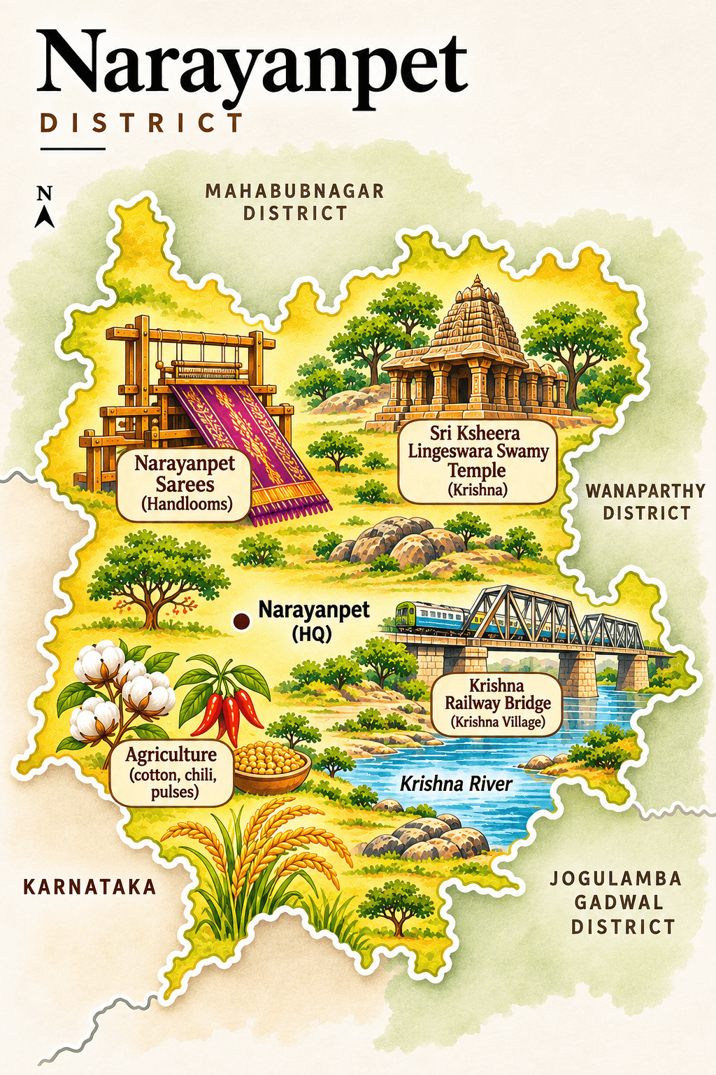
30 / Narayanpet District
Handlooms and borderland traditions
Narayanpet is especially known for its distinctive handloom saris and textiles.
Its markets and villages share cultural and commercial connections with neighboring Karnataka, while farming remains a mainstay.
Narayanpet’s handloom saris reflect a weaving economy connected to both Telangana and neighboring Karnataka. The town’s craft workshops and trading streets give this border district a distinct commercial and cultural identity.
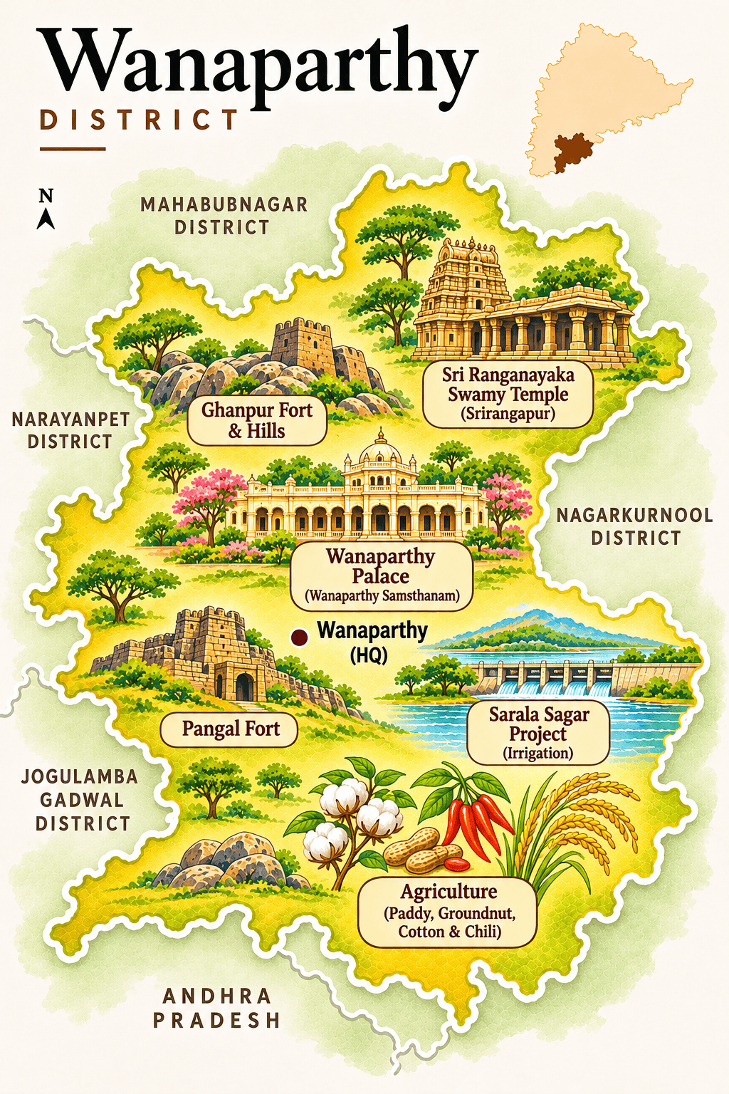
31 / Wanaparthy District
Palaces and agricultural towns
Wanaparthy’s former princely estate left a legacy of buildings and local history in the district headquarters.
Irrigation, farming and regional commerce continue to shape the countryside.
The former princely estate remains part of local memory, but the district’s present is closely tied to farming, irrigation and regional services. Markets in the smaller towns connect producers with the wider southern Telangana economy.
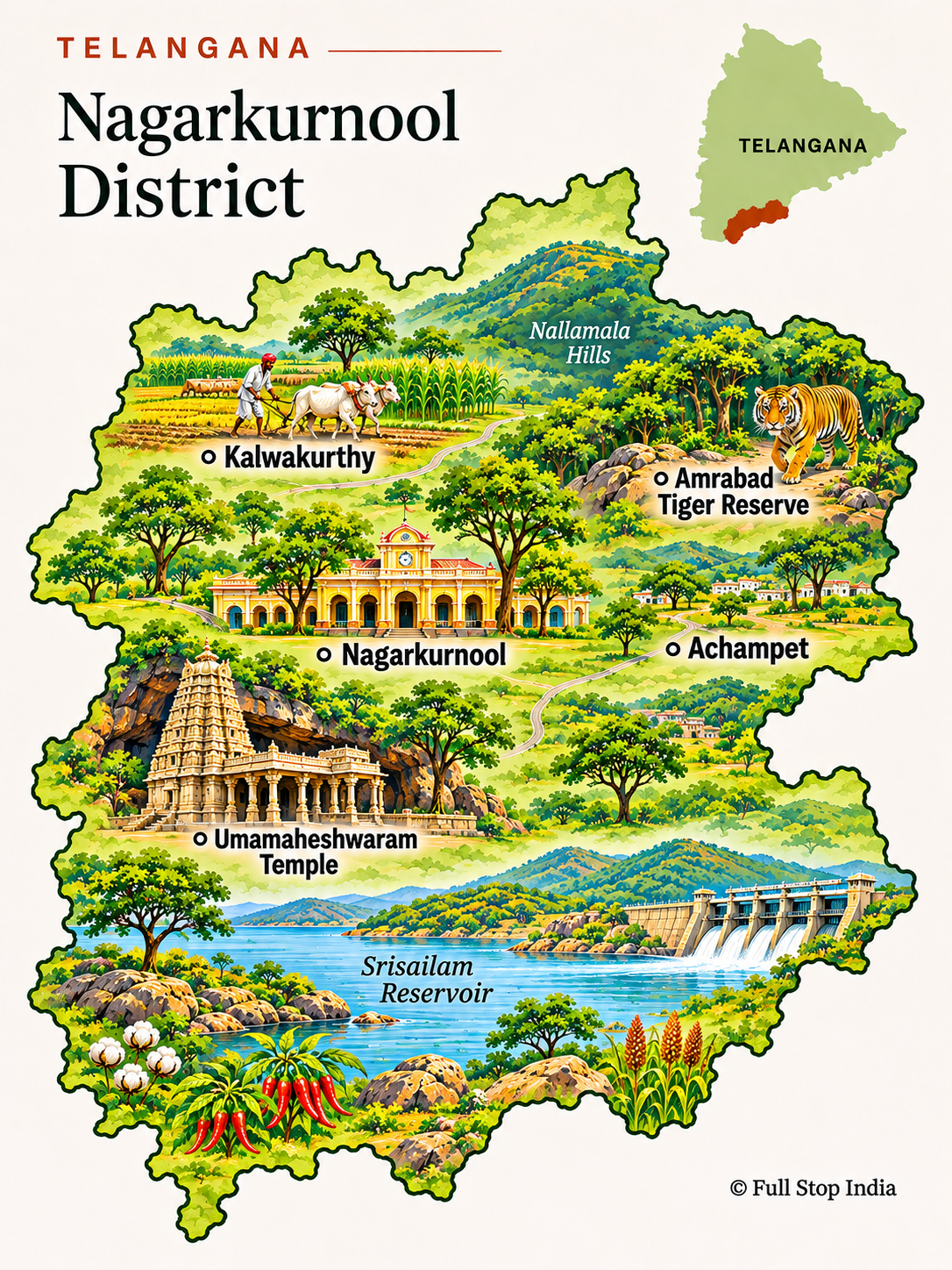
32 / Nagarkurnool District
The road to the Nallamala hills
Nagarkurnool opens toward the Nallamala forests and the Krishna River, with routes to Srisailam and other pilgrimage destinations.
Forestry, farming and settlements on the edge of protected landscapes give the district a different rhythm from metropolitan Telangana.
Travel here involves longer distances between small settlements and protected areas. Local livelihoods, forest conservation and pilgrimage traffic intersect along the roads into the Nallamala landscape.
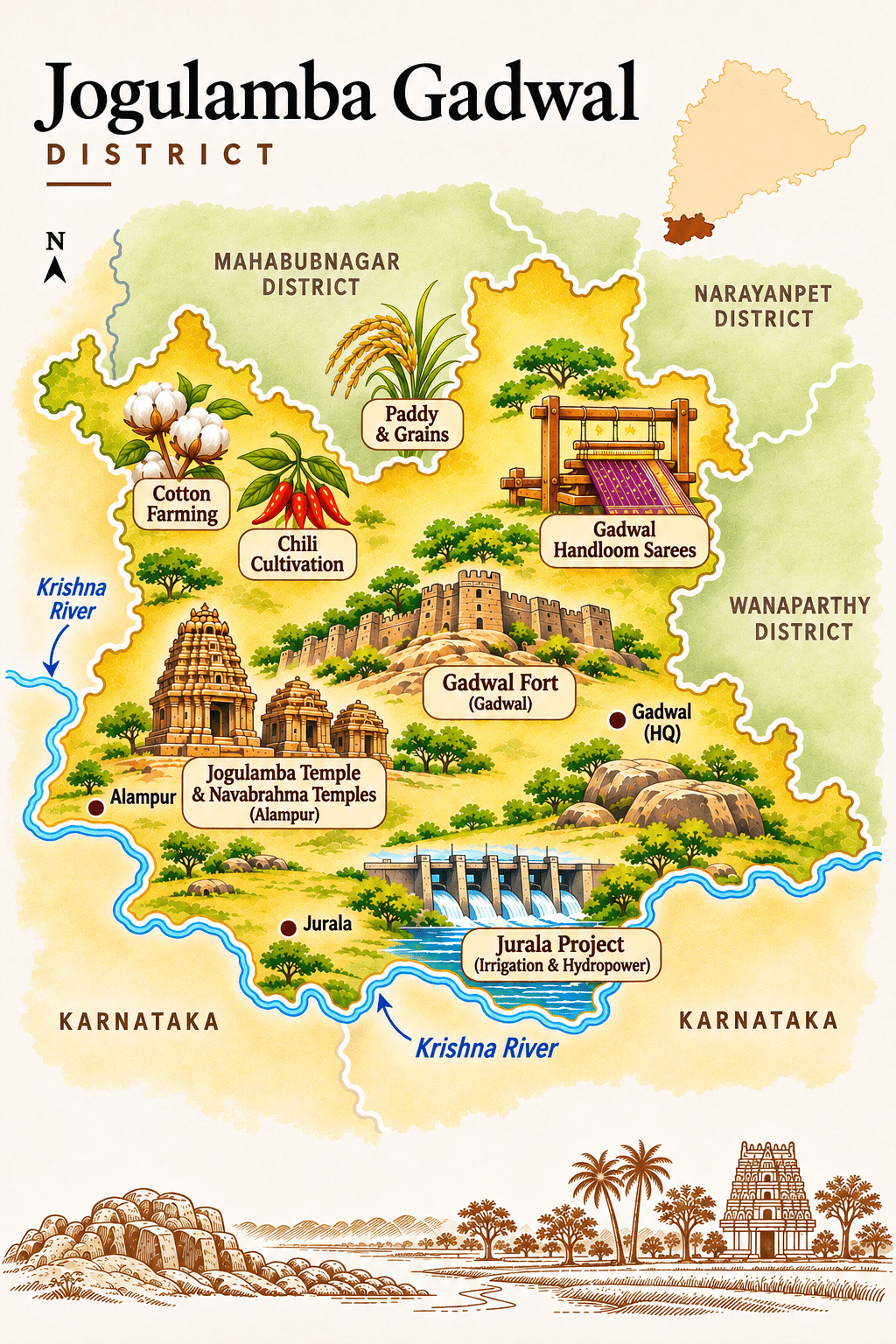
33 / Jogulamba Gadwal District
A shrine beside the Krishna
Alampur’s Jogulamba temple and ancient Nava Brahma temples are among the district’s defining monuments.
The Krishna–Tungabhadra river region, irrigation and agriculture shape everyday life across Jogulamba Gadwal.
Gadwal’s celebrated handloom saris, often recognized for their contrasting borders, connect the district to a wider textile trade. The river confluence and temple towns give the area a cultural identity distinct from Hyderabad.
Telangana beyond the map

Food & everyday life
Telangana’s food changes considerably beyond Hyderabad’s biryani houses and Irani cafés. In the countryside, jonna rotte (sorghum flatbread), sarva pindi, sakinalu and fiery chutneys speak to a cooking tradition built around millets, rice, lentils and seasonal produce. Markets in Nizamabad and Karimnagar reflect the crops grown nearby, while the capital draws flavors and cooks from across the Deccan.
Crafts & commerce
Telangana’s textiles tell different regional stories: Pochampally’s geometric ikat, the contrasting borders of Gadwal saris and Narayanpet’s striped cotton and silk weaving. Nirmal is known for painted wooden objects and decorative art. These traditions survive alongside the large-scale industries that employ people across the state: information technology and pharmaceuticals around Hyderabad, coal mining in the eastern districts and manufacturing around its expanding urban corridors.
Festivals & traditions
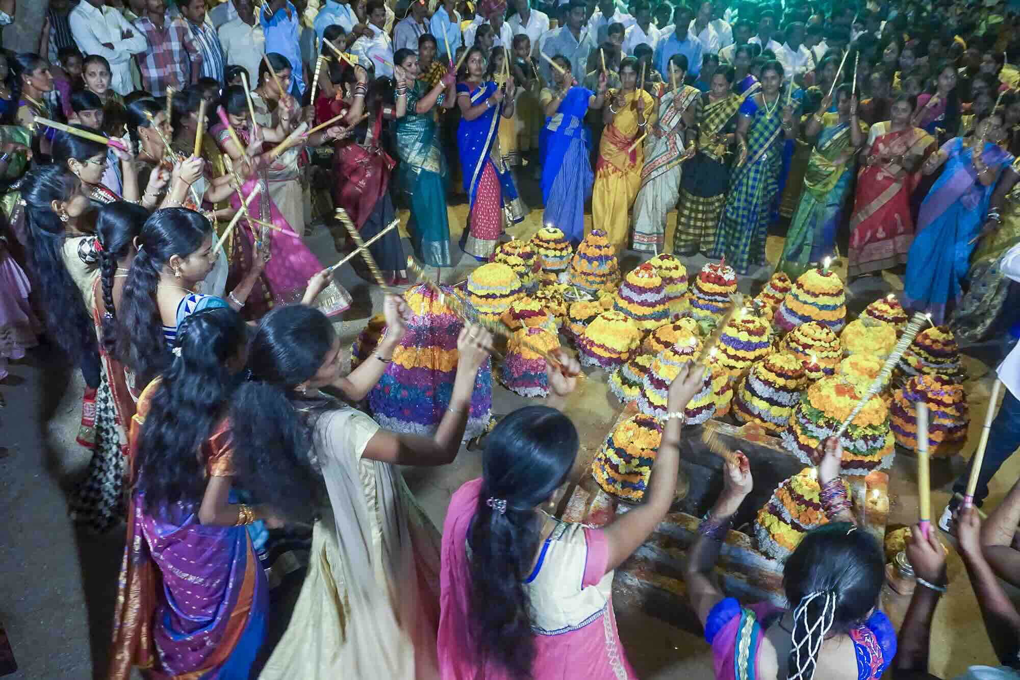
Festival traditions are just as varied. Bathukamma brings women together to arrange flowers in elaborate seasonal displays; Bonalu fills neighborhood temples with processions and offerings. Sammakka Saralamma Jatara at Medaram draws enormous crowds into the forests of Mulugu, while village fairs, temple celebrations and cultural performances follow their own local calendars.
Getting to Telangana
By air
Rajiv Gandhi International Airport (HYD), south of Hyderabad, is Telangana’s principal passenger gateway, with domestic and international flights. Allow time to reach central Hyderabad or other districts. Other regional airfields include Begumpet Airport (BPM) in Hyderabad, used for non-scheduled aviation; Warangal Airport (WGC) at Mamnoor, under redevelopment; and Ramagundam Airport (RMD), currently non-operational. None is a regular scheduled-flight alternative to HYD.
By train
Hyderabad Deccan / Nampally (HYB), Secunderabad Junction (SC) and Kacheguda (KCG) are major rail terminals. Kazipet Junction (KZJ), Warangal (WL) and Nizamabad (NZB) connect the state with the wider Indian Railways network. Search routes and book through IRCTC.
By bus and road
State buses and private operators link Hyderabad with district towns and neighboring states. For official Telangana services, see TGSRTC. Road travel is often the most practical way to reach temples, smaller towns and rural areas.
When to visit Telangana
November to February is generally the most comfortable period for city walks, temple visits and longer journeys across the state. Days are usually pleasant, although mornings can be cool in the northern districts. March to May brings intense heat, particularly inland, making midday sightseeing tiring. The June to September monsoon greens the countryside and can make waterfalls especially dramatic, but heavy rain can disrupt rural roads and forest access.
Festival dates offer another reason to plan carefully: Bathukamma and Bonalu follow their own seasonal calendars, while the Sammakka Saralamma Jatara at Medaram takes place biennially rather than every year.
Choosing where to stay
Do not treat Hyderabad as a base for the entire state. Warangal and Hanumakonda make more sense as an overnight stop for Kakatiya heritage; Nizamabad works for the northwest, and the eastern forest and Godavari districts are better approached as a separate journey. Driving back to Hyderabad every evening can consume much of the day.
Hyderabad makes sense for a first visit and offers the broadest hotel choice. Stay near the old city if markets, monuments and food are the priority; Banjara Hills and Jubilee Hills are convenient for restaurants and city life; the western technology corridor suits business travelers but is farther from historic Hyderabad.
Warangal and Hanumakonda are a practical base for Kakatiya architecture and nearby temples. Karimnagar works for a north-central Telangana itinerary, while Nizamabad provides access to the northwestern agricultural districts.
For the eastern forests, the Godavari and pilgrimage sites, consider Bhadrachalam or Kothagudem, depending on the route. Smaller towns have fewer accommodation choices, so plan overnight stops around realistic driving times rather than district boundaries.
Explore More of India
Local celebrations, cultural events and annual festivals.
The geography between the state and the village.
How India’s states and Union Territories differ.
India’s currency, its symbols and a few surprises.